Salty, green marsh air drifts up from a river while cicadas buzz in the pines behind, and that was the first thing noticed at this Georgia site. The highway promised a quiet historical marker.
A three-story cypress blockhouse standing over a moat appeared instead, with cannons aimed toward the water and a museum full of stories never heard in school.
Back in 1721, this little triangle of earth and timber marked the absolute edge of the British Empire in North America, the farthest south the Crown dared to plant a flag.
Soldiers lived here for six hard years, and many never left, which becomes clear walking past the cemetery. What surprised most was how peaceful it all is now, with butterflies drifting over the tabby ruins and shrimp boats easing by.
History that feels close enough to touch lives in this corner of coastal Georgia, and it deserves a spot on any map. The blockhouse stands tall, and the stories still linger.
The Blockhouse That Marked the Empire’s Edge
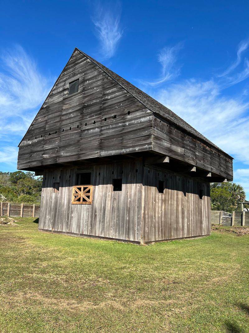
Nothing quite prepares you for the sight of that dark cypress tower rising out of the grass. Twenty-six feet square and three stories tall, the blockhouse is the centerpiece of the whole site.
I climbed the narrow interior stairs, which creak in a way that feels honest rather than worrying, and came out at the lookout level where sentries once scanned the river for approaching boats. From up there you understand the whole point of the place instantly.
The Altamaha River delta spreads out in shining ribbons, and anything moving on the water would have been spotted long before it arrived.
Inside, the lower floors hold cannon ports and a heavy, timbered gloom that makes the summer heat feel a little less fierce. Small details caught my attention, like the way the logs were notched and the gun loops cut at odd angles to cover the ground below.
Fun bit of history: the original blockhouse was built by scoutmen sent under British royal orders in 1721, making this the southernmost outpost of the British Empire in North America at the time.
Bring a phone or camera with a wide lens, because the view from the top is the shot everyone wants and the interior light is dim.
Moat, Palisades, and a Triangle Built for Trouble
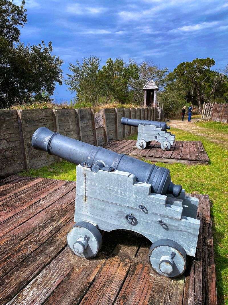
Walls made of dirt do not sound impressive until you walk the edge of one. The earthworks here form a triangle, with a shallow moat curving around the outside and sharpened palisade stakes standing shoulder to shoulder.
I followed the ditch most of the way around, half expecting it to feel small, and instead kept thinking about how much digging this took in humid Georgia heat with hand tools.
Engineers chose the triangle shape because it let defenders cover every approach with fewer men, which mattered a lot when your garrison kept shrinking from illness.
Cannons sit on carriages along the works, pointed toward the river channel where Spanish or French vessels might have appeared. Interpretive signs explain how the moat was never meant to hold deep water, more of an obstacle than a swimming hazard.
Standing between the stakes, the noise of the modern world drops away and you mostly hear wind moving through marsh grass.
A practical tip from my own mistake: the grass paths around the earthworks get soggy after rain, so closed shoes beat sandals here. Early morning light hits the palisade beautifully, and the mosquitoes are noticeably calmer before the afternoon stillness settles in.
Barracks, Guardhouse, and Life for His Majesty’s Company of Foot
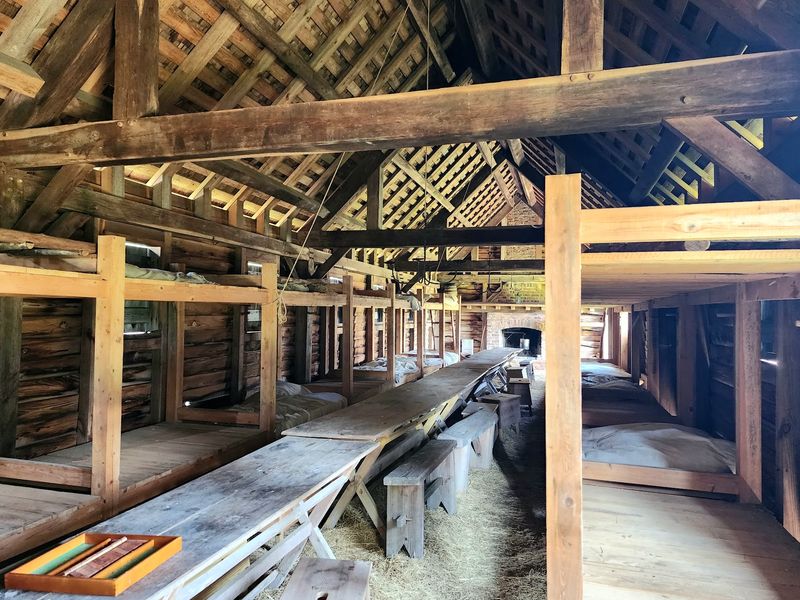
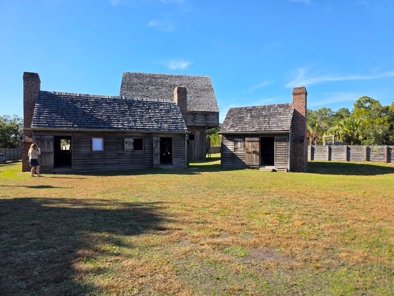
Six years of duty here was no adventure story. His Majesty’s Independent Company of Foot garrisoned Fort King George from 1721 to 1727, and the reconstructed barracks make their daily routine surprisingly easy to picture.
Rows of plain bunks, coarse blankets, wooden chests, and a few muskets on racks fill the space. I leaned in a doorway and tried to imagine sharing that room through a July night with no breeze and no screens.
Nearby sits the guardhouse and the officers’ quarters, which were only slightly more comfortable than the enlisted rooms.
What struck me was how the buildings were rebuilt from old records and drawings, so the proportions feel right rather than theatrical. Soldiers here dealt with fevers, short supplies, and the constant worry of attack, and disease claimed far more of them than any battle did.
A fire damaged the fort in 1726, it was rebuilt the following year, and then the whole garrison was pulled north to Port Royal, South Carolina.
Take your time reading the small placards inside these buildings. They carry the kind of specific details, rations, duties, illnesses, that turn a wooden room into somebody’s real life.
One of the Oldest British Military Cemeteries in the Southeast
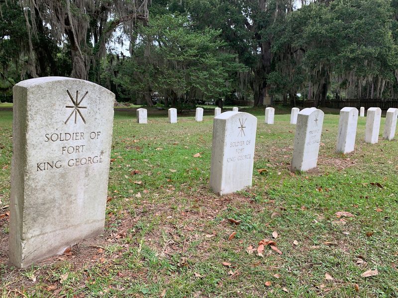
A hush settles over the far end of the grounds, where simple markers stand in rows beneath live oaks hung with Spanish moss. Roughly one hundred forty soldiers were buried here, most of them lost to disease rather than combat.
I walked slowly along the rows, and the contrast hit hard. Birds singing, warm light through the branches, and underneath it all the reality that this outpost cost an enormous number of young lives in just six years.
Historians consider it one of the oldest British military cemeteries in the Southeast, which makes the quiet feel earned.
Later burials from the Darien community share the ground too, so you get layers of coastal Georgia history in one shaded clearing. A few markers are worn nearly smooth, and reading the signage nearby helps fill in who these people were and why so many of them never made it home.
Spanish moss sways, the marsh smells faintly of salt, and the whole area invites you to slow your pace.
Visitors often save the cemetery for last, and I would recommend that order. Seeing the fort first, then the graves, gives the whole story a weight you carry back to the parking lot with you.
Museum Galleries and the Film That Ties It All Together
Start indoors if you can, because the museum does the heavy lifting of explaining everything outside. The exhibits move through several eras: the Guale people who lived along this coast, the Spanish mission of Santo Domingo de Talaje, the British fort years, the Scottish Highlanders, and the sawmill boom of the 1800s.
A short film plays in the theater area, and I found it genuinely useful for sorting out who arrived when and why three European powers cared so much about one riverbank.
The answer, mostly, is land and timber along the Altamaha and Savannah rivers, plus the strategic value of controlling the river mouths.
Artifact cases hold tools, pottery pieces, and military items recovered from the site, displayed without fuss. Staff at the desk are happy to point you toward the trail and answer questions, which made my visit smoother than wandering blind.
Fort King George State Historic Site joined the National Register of Historic Places in 1971.
Plan around thirty to forty minutes inside before heading out to the fort. Restrooms are here as well, which matters if you are traveling with kids or planning to linger on the grounds for a couple of hours.
Tabby Ruins and the Ghosts of Darien’s Sawmill Boom
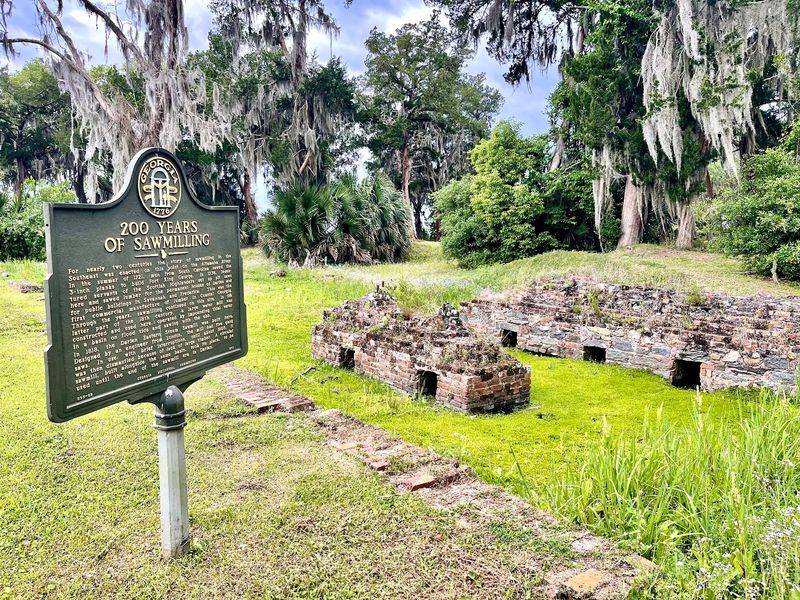
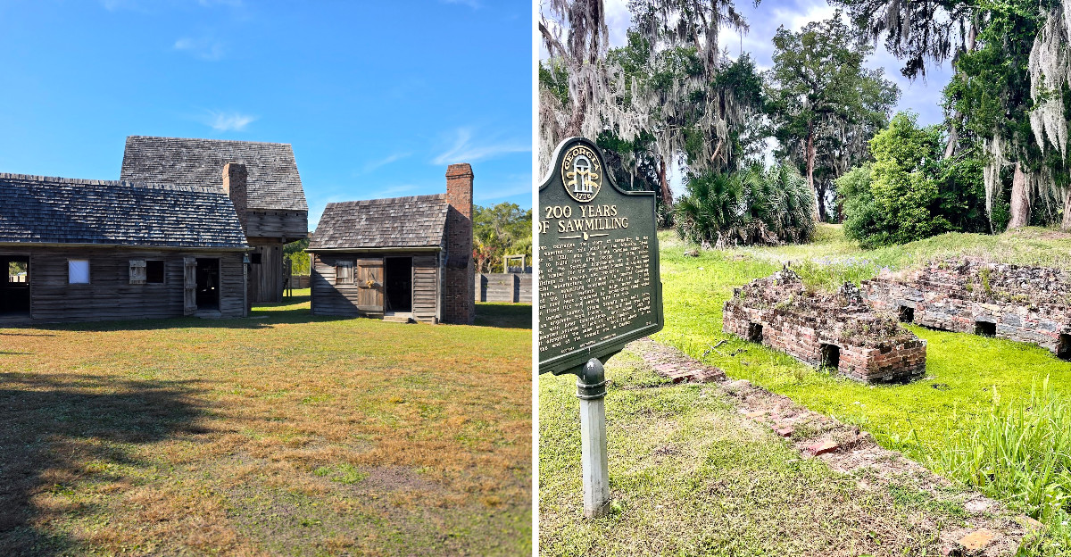
Crumbling gray walls near the water surprised me more than the fort itself did. They are tabby, an old coastal building material made from lime, sand, water, and crushed oyster shells, and you can still see individual shell fragments poking out of the surface.
These ruins belong to a completely different chapter of the site’s story. After the British left, Darien grew into one of the busiest lumber export towns on the Atlantic coast, and sawmills lined this stretch of riverfront.
Remains of three sawmills sit on the grounds, along with foundations and scattered brickwork slowly disappearing into the grass.
Scottish Highlanders brought here by General James Oglethorpe in 1736 founded Darien, and their descendants helped build the timber trade that made the port famous. Rafts of pine logs once floated down the Altamaha to be cut here and shipped worldwide.
Standing among the ruins with shrimp boats passing, that industrial past feels almost impossible.
Watch your footing around the broken tabby, since edges are uneven and partly hidden by vegetation. Photographers will like the late afternoon light here, when the walls warm up and the marsh behind them turns gold.
The Nature Trail, the Marsh Views, and How to Plan Your Visit
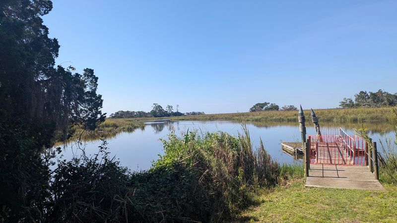
My favorite twenty minutes at the site had nothing to do with cannons. A nature trail loops away from the fort into shady woods and along the edge of the salt marsh, and it is flat, short, and easy to follow.
Fiddler crabs scuttled across the mud, egrets stood frozen in the shallows, and the tide made small sucking sounds in the reeds. Benches along the way give you a reason to sit and just watch the river move.
Bring bug spray in warm months, plus water and a hat, because shade comes and goes.
The grounds work well for families, with plenty of open space for kids to burn energy after the museum. Allow two hours for a relaxed visit, more if you enjoy reading every panel like I do.
Darien itself sits minutes away, so pairing the fort with lunch downtown or a look at the working waterfront makes an easy half day.
Check current hours before driving out, since seasonal schedules and holidays can shift. Parking is simple and close to the entrance, which is a small mercy in Georgia summer heat.
Address: 302 McIntosh Road SE, Darien, Georgia
