This drive deserves to be taken slowly, at a pace that leaves room for old neon, cracked concrete, and the stories tucked between Chicago and the Mississippi.
The route begins in the city, eases through the early suburbs, and keeps drifting southwest until the river signals the final chapter.
Some stops feel forgotten, others strangely familiar, like they have been waiting for someone to notice again.
The tone of the road shifts every few miles, subtle at first, then unmistakable, like radio stations changing without a hand ever touching the dial.
Illinois reveals itself best this way, not all at once, but in layers that only show up when attention stays steady and unhurried.
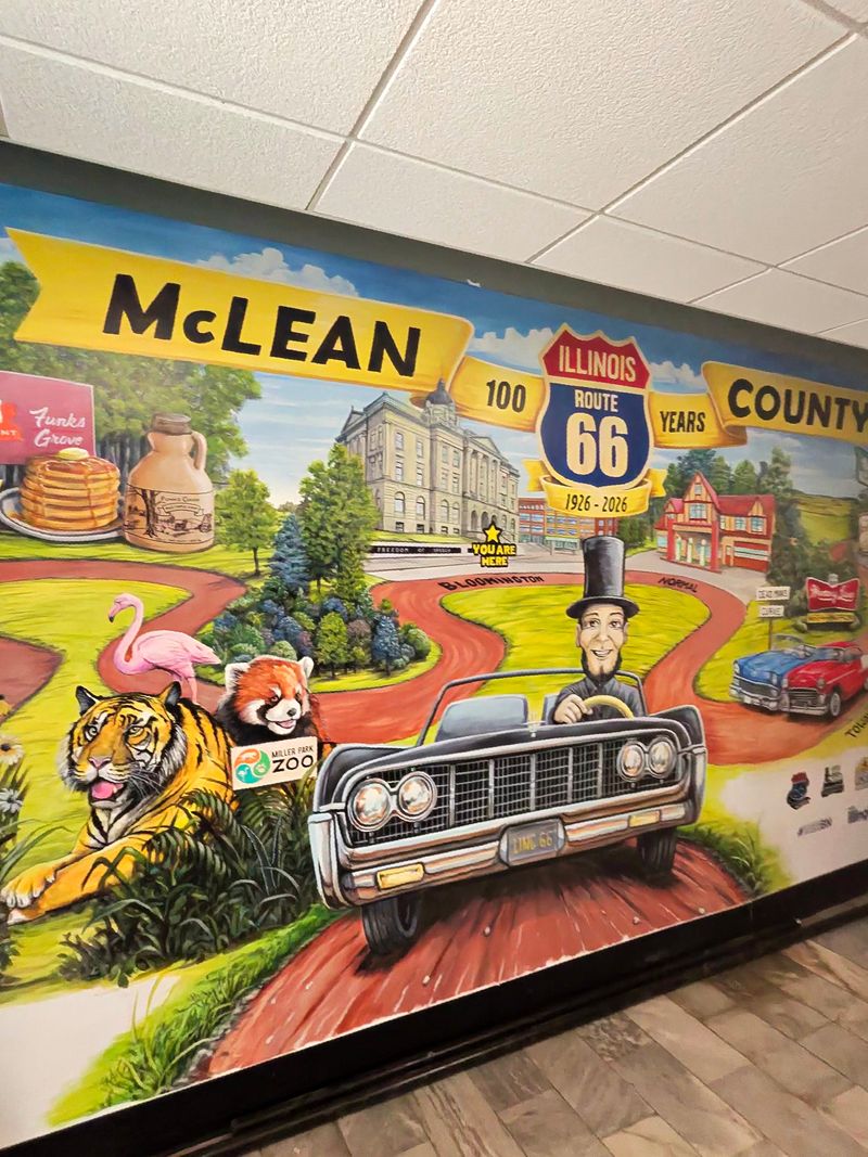
Chicago Marks The Beginning Of The Route 66 Story
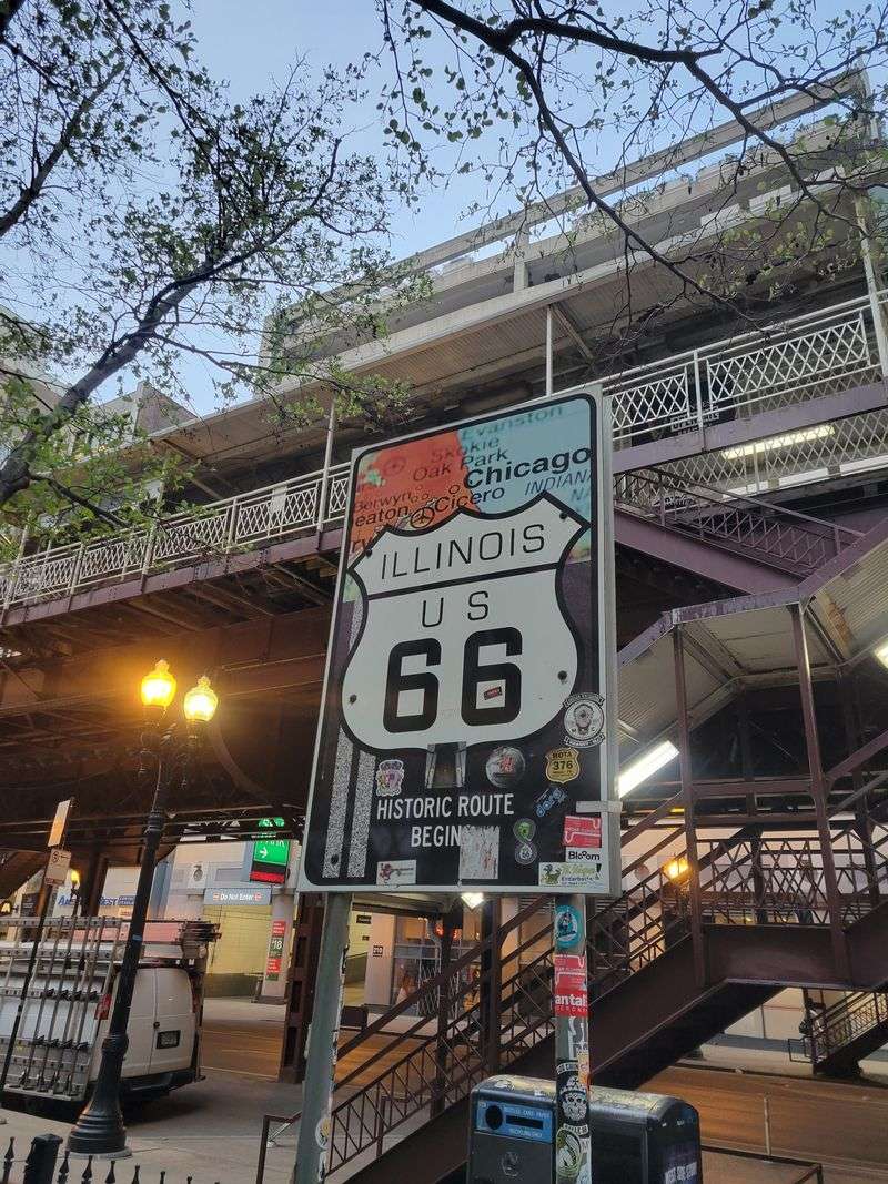
Set your compass at the eastern trailhead by the brown Begin Historic Route 66 sign near 78 E Adams St, Chicago, Illinois.
You can stand on the sidewalk, look up at the old facades, and feel that hum that says yes, this is where people push off.
Walk a block or two and you’ll see the street grid lining you up like a runway toward the southwest. The downtown buildings crowd in, but the sign feels like a quiet handshake with the road ahead.
Before you roll, eye the curb and picture the cars that have left from here in every decade.
You can almost hear a soft clatter from the elevated tracks, like a metronome for departures.
Point the hood toward Ogden Avenue and make peace with the city traffic. It’s a reminder that Route 66 begins in the thick of it and only slowly thins out.
If you want a quick mental snapshot, frame the sign against the old theaters. It locks the start line to something human and local.
Ready to go, let the stoplights pace you through the Loop and into the neighborhoods. The beginning is less about speed and more about deciding to follow a story all the way to the river.
Early Suburbs Reveal The Road’s Original Purpose
Once you slip past the Loop, the road starts telling its working story through neighborhoods and early suburbs along Ogden Avenue.
You feel how Route 66 connected city errands with farm deliveries and everything in between.
I like passing through Cicero near 4801 W Ogden Ave. The buildings sit close to the curb like they still expect deliveries and handshakes at the door.
Stick with the old alignment as best you can and watch the storefronts flip by like pages.
You’ll get those angled intersections that make you breathe and check mirrors twice.
You can pause near Berwyn around 7131 W Ogden Ave.
The old signs are honest about their years, which is exactly what makes them welcoming.
Do you notice how the speed feels different here than inside Chicago proper? It’s not slower so much as steadier, like a sustained note.
As you roll onward, the suburban grid stretches out and gives the sky more room. This is where Route 66 becomes a habit, not just a headline.
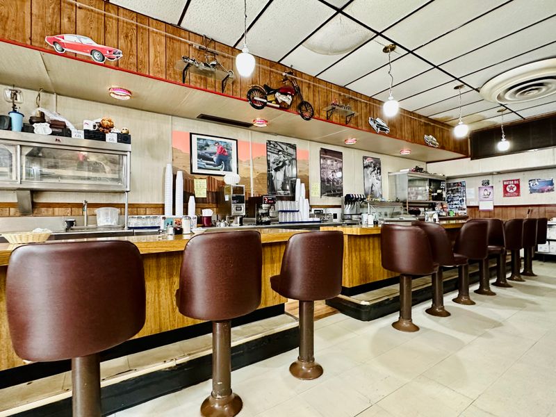
Classic Diners Preserve Midcentury Road Culture
Aim for the iconic White Fence Farm look on Joliet Road, Romeoville. Even from the lot, the architecture nods to road culture that kept travelers moving and smiling.
Keep cruising to Joliet and you’ll find the Route 66 vibe baked into places along 169 N Chicago St, Joliet.
The signage and seating always seem ready for a car full of stories.
You notice how the booths and counter stools are arranged for conversation. It’s designed for people to pause without fully stopping their day.
You’re not chasing a museum here, just real working rooms that still accept road dust as part of the decor.
Even the light through the windows feels like a map.
Do you want to linger or keep it rolling? Either way, the midcentury spirit rubs off on your mood.
Back in the car, I always feel like I’ve picked up an invisible co-pilot from another decade. The dashboard rattles a tiny bit, and somehow the miles get friendlier.
Small Town Main Streets Keep The Route Visible
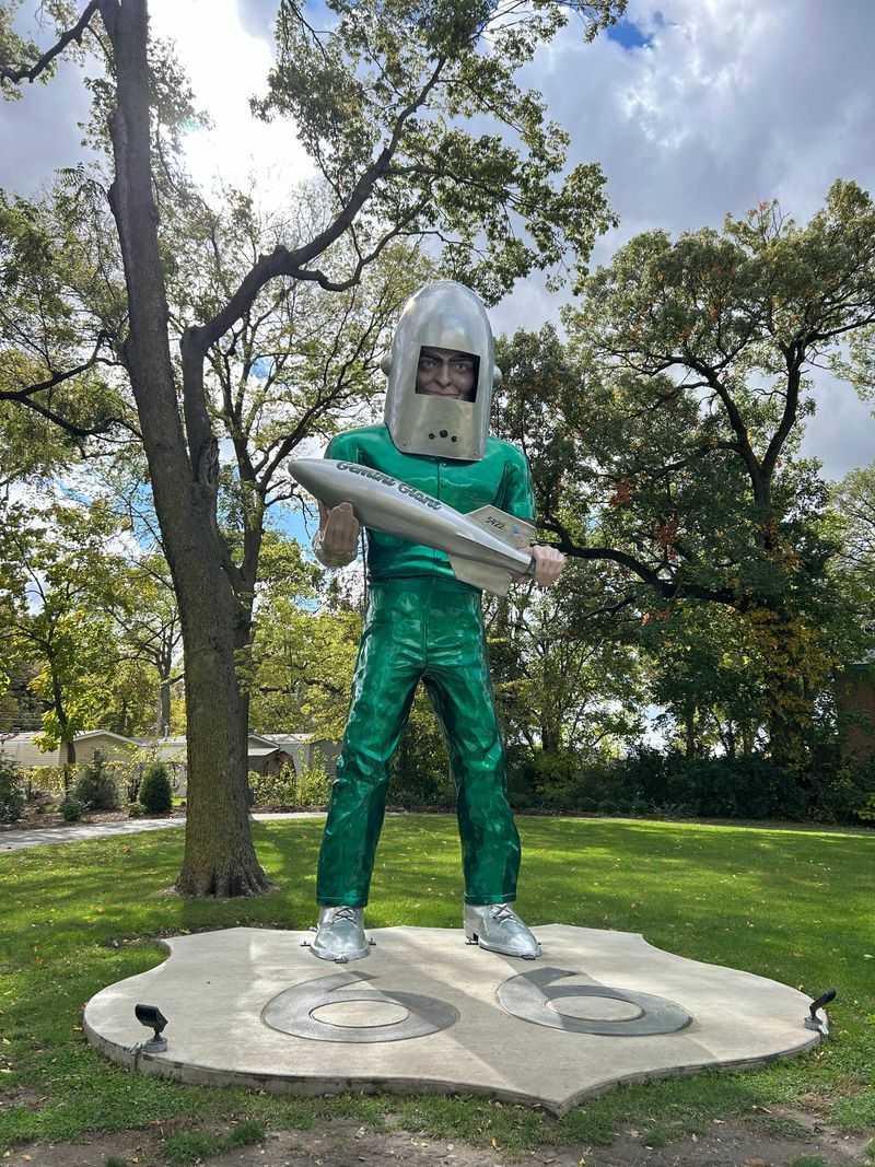
Roll into Wilmington and visit the Gemini Giant at 810 E Baltimore St, Wilmington. That fiberglass astronaut keeps watch over cars like a friendly lighthouse for drivers.
Main Street here feels honest about its age.
Storefront windows show reflections of trucks and clouds sliding by in equal measure.
When you park and walk a block, the sidewalks remind you this road was always personal. People still wave from doorways, which changes your breathing a bit.
On the way toward Braidwood and Braceville, the alignment flickers between old and newer lanes.
Follow the older strip when you can because it has better conversation.
Do you want a quick photo with the giant before the light shifts? The afternoon glow makes the helmet look almost theatrical.
Back in the car, the town shrinks in the rearview but stays loud in your head. That’s what small streets do along Route 66 in Illinois.
Historic Motels Reflect The Golden Age Of Driving
Joliet’s Starved Rock Motor Inn style is echoed by places down the line, but I always think of the Riviera Motel site vibes near 574 Rte 66, Gardner.
The simple low-slung buildings were built for car doors and easy nights.
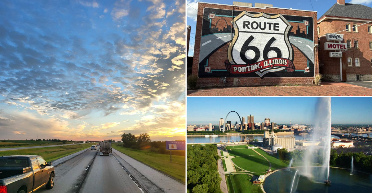
Farther south, Pontiac draws you in with restored neon near 217 N Mill St, Pontiac. The glow feels like a handshake you can pocket for later.
When you pause at the museum blocks, the motel imagery sneaks into the present. It’s like seeing your grandparents’ living room lamp still turned on for you.
I like walking the lot lines and tracing where the ice machine probably hummed.
The spaces between doors tell you how families spaced their dreams.
Do you miss that slower check-in rhythm sometimes? A key, a smile, and a parking spot right outside the room still sounds right.
As you head out, the road carries that soft neon memory on the windshield. It makes the next mile feel like a gentle nod from the past.
Roadside Landmarks Add Personality To The Drive
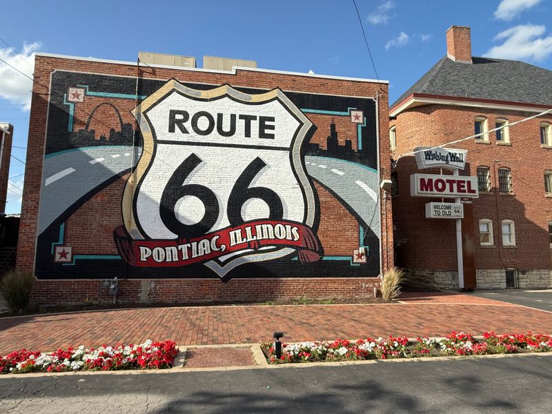
Pontiac’s Route 66 shield mural at 200 W Howard St, Pontiac, is basically a handshake from the entire road. The mural fills a brick wall like a friendly compass.
Just down the way, the swinging two-celled jail at 100 Depot St, Gardner, feels quirky without trying.
It’s a tiny building that refuses to be quiet.
These are the spots that break up the drive and reset the mood. You park, nod, maybe smile, then carry that grin to the next town.
You could also stop by the Ambler’s Texaco Station at 200 W Waupansie St, Dwight.
The service bay windows still look ready for a tune and a story.
Want a quick photo with the big shield or the small jail? Either choice works because the point is to remember the stop happened.
When the road picks up again, those images hang on the edge of your thoughts. Illinois does a nice job of keeping the personality pieces standing.
Rural Stretches Slow The Pace And Reset Expectations
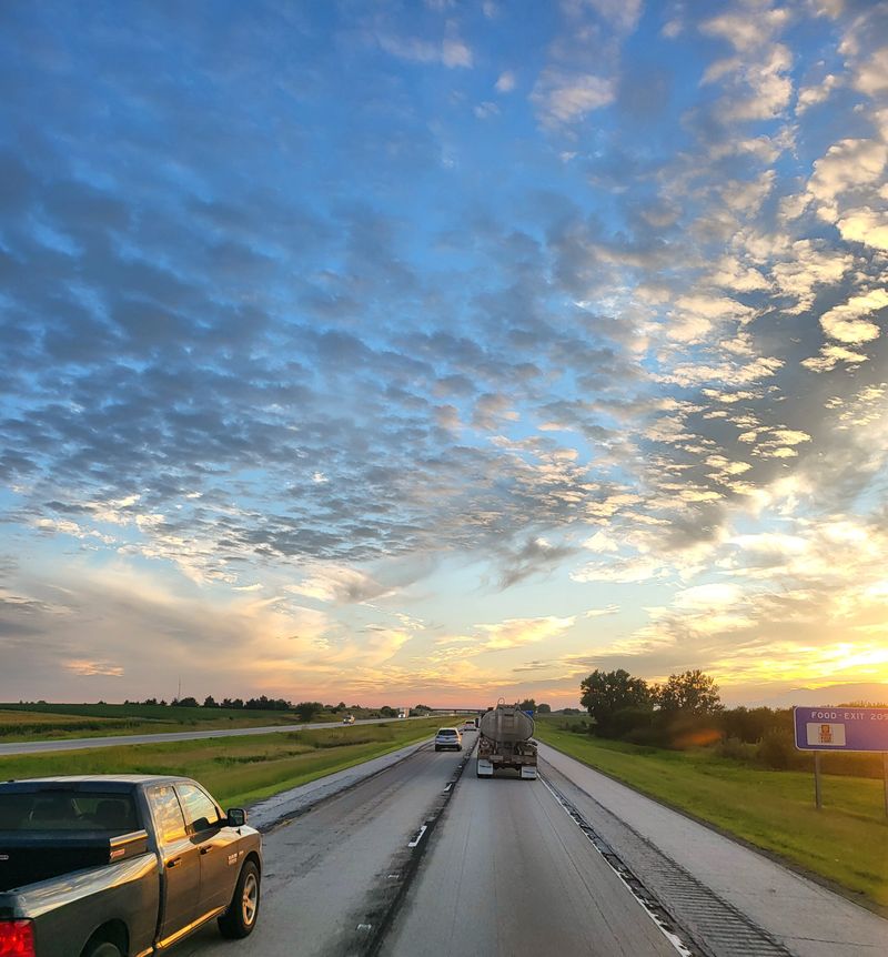
South of Pontiac, the land flattens out and the conversations get slower in the best way. Two-lane stretches near 18000 N 2300 East Rd, Odell, carry us between fields that keep their own calendar.
You pass the Odell Station at 400 S West St, Odell.
Its canopy and pumps feel like punctuation for the road’s longer sentences.
When the sky opens, the car becomes a small moving room where thoughts get taller. It’s quiet enough to hear the turn signal like a metronome.
If the wind leans on the car a bit, just let it. The line of the horizon will hold steady while you float between mile markers.
Do you notice how the radio sounds warmer out here? Maybe it’s the fields acting like a soft amplifier.
By the time you reach the next town, the visual noise has washed away. That’s the rural gift Route 66 keeps giving in Illinois.
Preservation Efforts Keep The Route From Disappearing
Bloomington and Normal take care of their pieces, and it really shows around 200 N Main St, Bloomington. Buildings are kept upright with pride rather than polish.
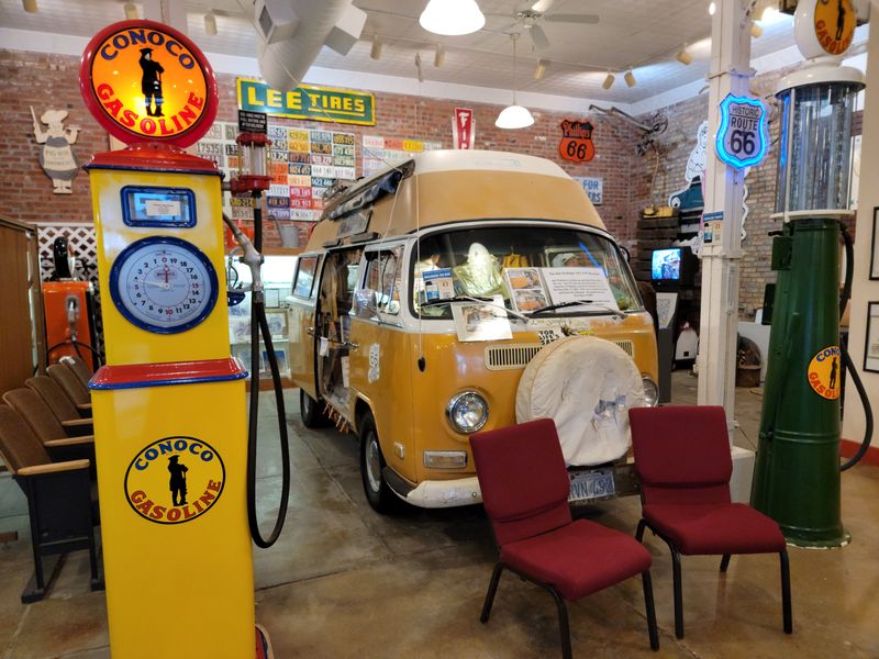
The Route 66 Experience in Normal near 100 E Beaufort St, Normal, lays out the story like a conversation you can walk through.
It’s calm, clear, and generous with details.
When you meet locals, they talk about signs and sidewalks like they are neighbors. That energy protects the little things you might otherwise blow past.
I like snapping a quick photo of a restored shield painted on the pavement. It’s a reminder that the route lives on in layers, not just landmarks.
Have you noticed how volunteers always seem to appear exactly when needed?
Someone’s holding a paintbrush or a folder and pointing you gently in the right direction.
You drive away with fresh respect for the people who keep the lights on. Without them, the map would lose half its voice in Illinois.
The Landscape Changes As The Road Moves South
By the time you angle toward Lincoln and Atlanta, the fields change texture and the towns sit farther apart.
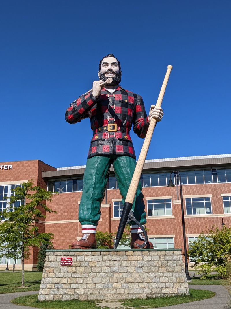
I like rolling by the Paul Bunyon hotdog giant at 112 SW Arch St, Atlanta, just for the cheerful weirdness.
In Lincoln near 101 N Chicago St, Lincoln, the courthouse square lines up the past and present in a tidy grid. It looks like it was designed to host conversations from parked cars.
You keep finding murals and small museums that color in the map. The southern half of Illinois feels like the road is loosening its collar.
Southbound miles glide easier, and the sky seems wider by a notch.
The car breathes with you and shrugs off the city’s pace.
Want to pull over for a quick stretch by the square? Ten minutes outside the car stretches the rest of the day.
Now swing back onto the alignment and let the next county line arrive whenever it wants. No one’s rushing you, least of all the highway.
The Mississippi River Signals The End Of Illinois’ Chapter
Alton feels like a soft landing before the water, with the old brick and river air meeting us near 200 Piasa St, Alton. The road’s voice drops to a hush you can almost hear.
Glide the final stretch into East St Louis around 700 E Broadway, East St Louis.
The bridges ahead look like instructions written across the sky.
At the riverfront near Malcolm W Martin Memorial Park at 185 W Trendley Ave, East St Louis, you can face the water and breathe. Every mile behind you seems to settle at once.
You do not need a speech here. Just a moment to understand that Illinois carried us with care all the way to the edge.
Do you feel the tug to cross and keep going? The river makes a gentle case for more road.
For now, call it good and let the current sign our logbook.
The story continues on the other bank whenever you’re ready.
Dear Reader: This page may contain affiliate links which may earn a commission if you click through and make a purchase. Our independent journalism is not influenced by any advertiser or commercial initiative unless it is clearly marked as sponsored content. As travel products change, please be sure to reconfirm all details and stay up to date with current events to ensure a safe and successful trip.