The trail winds through the woods, past trees and moss-covered stones. At first, you might not notice them.
Then you see the outline of a foundation, a wall, the ghost of a building that once stood here. This lost Virginia canal town has been forgotten by time, its stone foundations scattered through the forest like a puzzle waiting to be solved.
I hiked the trail on a cool morning, stepping over roots and rocks, and found myself walking through the ruins of what was once a thriving community. The canal brought trade, the town grew, and then it faded away.
Now all that remains are the stones, quiet and patient, telling a story that few people stop to hear. Virginia has plenty of history, but this hike is different.
It is a walk through a ghost town.
The Forgotten Town That George Washington Built a Dream Around
Few places in Virginia carry the kind of backstory that stops you mid-trail and makes you want to sit down on a rock and just absorb it all. Matildaville did not appear by accident.
It grew directly from George Washington’s grand ambition to connect the Potomac and Ohio rivers through a working canal system, creating a trade route that would bind the young nation together.
Washington served as the first president of the Patowmack Company, chartered to make this bold vision a reality. Workers flooded the area, structures went up fast, and suddenly this patch of Virginia wilderness became a functioning company town complete with a market, a gristmill, a foundry, and an inn.
At its peak, Matildaville was genuinely alive. Canal boats navigated the locks while curious onlookers watched from the banks.
The Patowmack Company ran its headquarters right here, making this small clearing one of the most strategically important spots in early American commerce.
Standing among the ruins today, knowing Washington himself championed this place, gives the hike an electric historical charge that no museum exhibit could ever fully replicate. Virginia holds a lot of history, but this particular pocket of it feels raw and real.
Henry Light Horse Harry Lee and the Naming of a Town
Revolutionary War hero Henry “Light Horse Harry” Lee is most famous for being the father of Robert E. Lee, but his own chapter of history is just as fascinating.
In 1793, Lee leased the land near the Patowmack Canal and gave the settlement a name that was entirely personal. He called it Matildaville, after his beloved first wife, Matilda Lee.
It is a quietly romantic detail tucked inside a story that is mostly about commerce and ambition. The Virginia General Assembly had formally chartered the town back in 1790, but Lee’s involvement gave it both a name and a human heartbeat.
He was not just a landlord. He was a celebrated military figure lending his prestige to a place he believed had a future.
That future, of course, did not last. But the name did.
Even now, trail signs and park maps across Great Falls Park carry the word Matildaville, a small tribute to a woman most history books barely mention.
Walking the Matildaville Trail and knowing its name honors a real person, not a corporation or a geographical feature, adds a surprisingly tender layer to what might otherwise feel like a purely industrial ruin.
What the Town Actually Looked Like at Its Peak
Picturing Matildaville in its prime takes a bit of imagination, but the historical record gives us plenty to work with.
At its busiest, the town included a superintendent’s house, a market, a gristmill, a sawmill, a foundry, an inn, an ice house, workers’ barracks, boarding houses, and small private homes scattered through the trees.
The Patowmack Company’s headquarters operated here, meaning paperwork, payroll, and planning all happened on this now-quiet patch of Virginia land. Workers from various trades lived side by side, and the constant movement of canal boats through the locks gave the waterfront an almost industrial rhythm.
Tourists even showed up to watch the boats navigate the canal, which tells you something about how impressive the engineering must have appeared to people at the time. This was not a sleepy backwater.
It was a working, breathing, commercially active community with real economic stakes tied to national ambition.
Today, only stone foundations remain, but they are arranged in a way that still suggests the original layout of the town. Wandering between them, you can almost map out where the inn stood, where workers slept, and where the superintendent surveyed his domain each morning.
The Patowmack Canal and Why It All Fell Apart
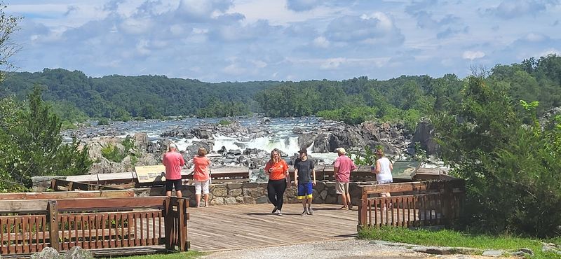
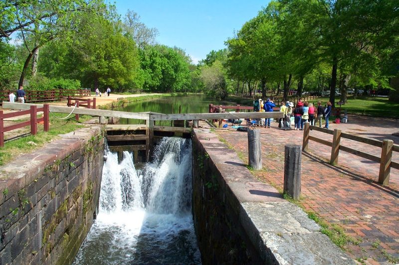
The Patowmack Canal was an engineering marvel for its era, cut directly into rock cliffs along the Potomac River to allow boats to bypass the roaring falls. Getting it built at all was a massive achievement.
Keeping it financially viable turned out to be a completely different problem.
Construction costs ran high, and the canal could only operate for one or two months per year because of fluctuating water levels in the Potomac. Revenue never came close to matching expenses, and the Patowmack Company slowly bled money until it formally went bankrupt.
By 1828, the company was finished. Two years later, the newly formed Chesapeake and Ohio Canal Company took one look at the situation and abandoned the whole operation.
Matildaville, already struggling without its main employer, effectively lost its reason to exist.
The ruins of the canal locks are still visible today, carved dramatically into the rock face along the trail. Seeing them up close, you feel both the ambition of the original builders and the quiet sadness of a project that simply could not sustain itself.
Great Falls Park preserves these locks as a testament to what early American infrastructure actually looked like in practice.
The Short-Lived Second Act as South Lowell
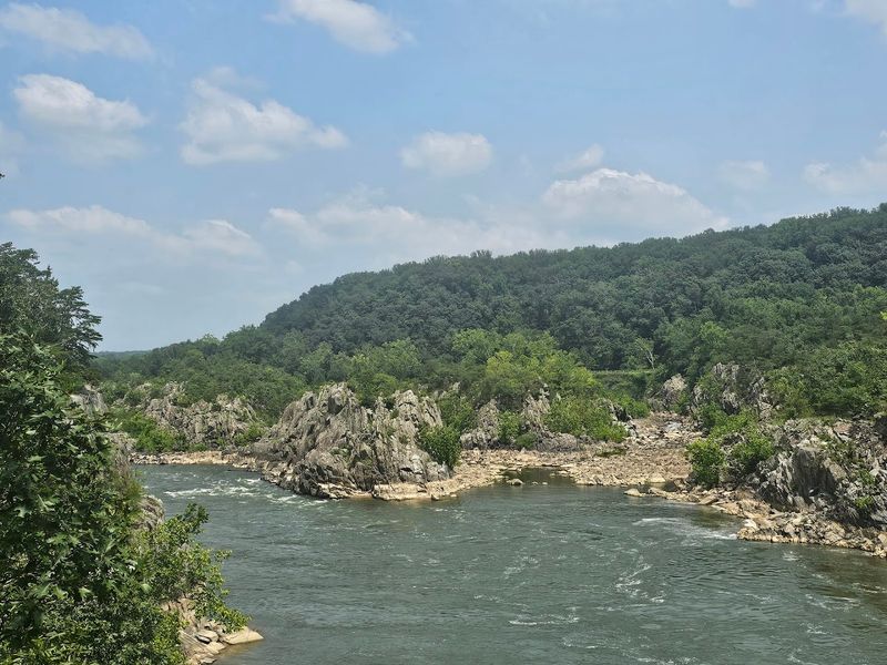
Just when you think Matildaville’s story could not get more interesting, along comes a second act. In the mid-1830s, the Great Falls Manufacturing Company purchased the land with a very different vision.
Instead of canals and commerce, they wanted to build a water-powered textile factory and transform the area into an industrial hub.
The Virginia legislature chartered this new version of the settlement as South Lowell in 1839. A name was clearly inspired by Lowell, Massachusetts, the booming textile city that had become a symbol of American industrial ambition.
The dream was big, the location was strategic, and the water power from the Potomac was genuinely impressive.
Legal troubles derailed the whole enterprise before it ever hit its stride. Disputes, financial complications, and failed negotiations left the project stranded, and one by one the remaining structures were abandoned.
South Lowell faded even faster than Matildaville had.
Most hikers passing through Great Falls Park today have never heard of South Lowell, which makes this layer of history feel like a genuine discovery. The ruins you see on the trail carry two separate stories of ambition and failure, layered on top of each other in the Virginia forest like geological strata.
The Matildaville Trail and How to Hike It
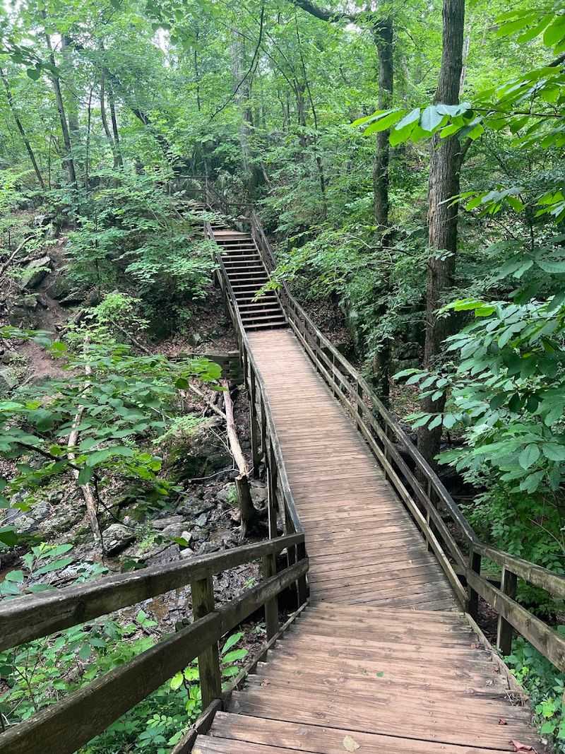
The Matildaville Trail itself is a genuinely pleasant hike, especially if you appreciate a route that rewards curiosity rather than just cardiovascular effort.
The path is mostly flat and wooded, cutting through a quiet section of Great Falls Park that feels surprisingly remote given how close it sits to the Washington D.C. metro area.
A straightforward out-and-back option covers around 1.7 miles and takes you directly past the main ruins. For something with more variety, connecting the Matildaville Trail with the River Trail creates a moderate loop of about 3.8 miles starting from the park’s visitor center.
The terrain stays manageable for most fitness levels, though it can get muddy after rain, and things get noticeably hillier near the Ridge Trail intersection.
Dogs are welcome on the trails as long as they stay on a leash, which makes this a popular weekend outing for pet owners in northern Virginia. The trail is well-marked, and the ruins appear gradually as you move deeper into the forest, creating a satisfying sense of discovery rather than a single dramatic reveal.
Starting from the visitor center also means you can grab a trail map and get oriented before heading out, which is always a smart move at a park this size.
Standing Inside the Superintendent’s House Ruins
Among all the ruins scattered along the trail, the superintendent’s house foundations carry a particular presence. This was not a worker’s bunk or a storage shed.
It was the home of the man who ran the Patowmack Company’s day-to-day operations, and its stone walls were built to reflect that status.
The foundation is one of the more substantial remnants visible at Matildaville Ruins, with enough wall height remaining in places to give you a genuine sense of the building’s original scale.
Standing inside the footprint of the structure, surrounded by Virginia forest on all sides, creates a strange and memorable sensation, part history lesson, part meditation on impermanence.
Interpretive signs along the trail help identify what you are looking at, which is genuinely useful because stone foundations without context can feel abstract. Knowing this specific rectangle of rocks once enclosed a man who reported directly to George Washington’s canal company makes the whole thing click into focus.
Park guidelines ask visitors not to climb on the ruins, and it is worth respecting that request. The Archeological Resources Protection Act of 1979 legally protects these structures, meaning the ruins are not just historically significant.
They are federally safeguarded artifacts sitting right there on the forest floor.
The Springhouse and Other Scattered Stone Mysteries
Not every ruin at Matildaville Ruins is as immediately obvious as the superintendent’s house. Tucked along the trail, the springhouse foundations offer a quieter, more intimate kind of discovery.
Springhouses were practical structures used to keep food and water cool before refrigeration existed, and finding one here reminds you that Matildaville was not just a commercial operation. It was a place where people actually lived.
The springhouse ruins are compact and easy to overlook if you are moving too quickly, which is exactly the wrong approach to take on this trail. Slow down, look sideways into the trees, and you will start noticing stone arrangements that the forest has been slowly reclaiming for nearly two centuries.
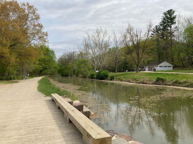
Other traces of the canal cut directly into the rock cliffs are visible along the route, a dramatic reminder that the Patowmack Canal was not a gentle earthwork project. Workers literally carved channels into solid stone to make the boats pass through.
Each of these remnants tells a slightly different piece of the Matildaville story. Together, they build a picture of a community that was far more complex and layered than the word “ruins” might initially suggest.
Virginia rarely runs short of surprises, and this trail is full of them.
Great Falls Park Beyond the Ruins
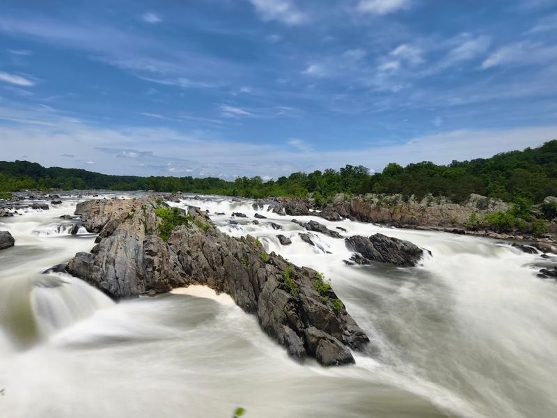
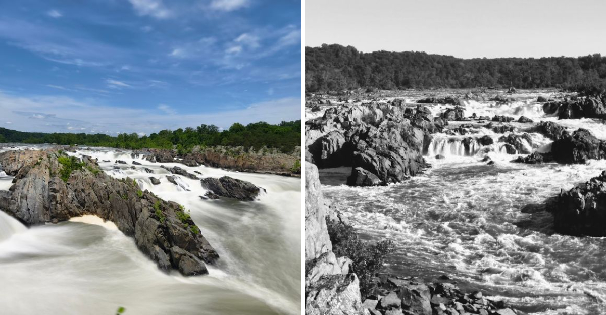
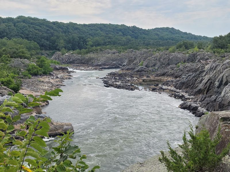
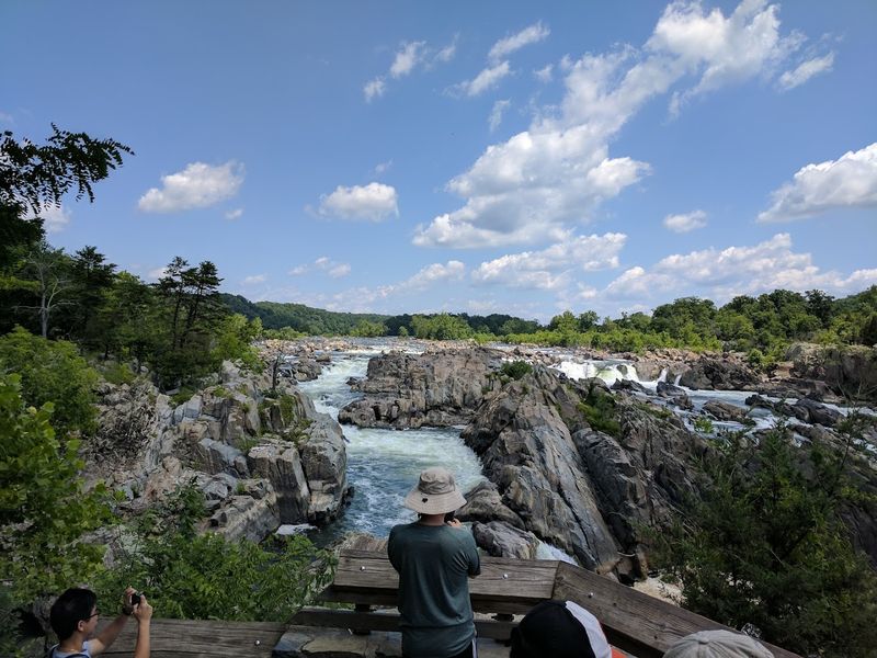
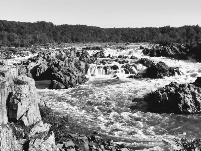
Matildaville Ruins are the historical centerpiece of the park, but Great Falls Park itself is a destination worth an entire day of exploration. The Potomac River crashing through the narrow rocky gorge at the falls is one of the most visually dramatic natural spectacles in the entire mid-Atlantic region, and the overlooks deliver views that genuinely stop you in your tracks.
Three main overlooks are spaced along an easy walking path near the visitor center, each offering a different angle on the falls. The roar of the water is audible long before you reach the edge, building anticipation with every step.
On sunny days, the light bouncing off the churning white water creates a scene that photographers absolutely love.
Beyond the overlooks, the park’s trail network fans out through forested terrain, rocky riverbanks, and quieter wooded corridors where wildlife sightings are common. Deer, birds, and the occasional turtle make regular appearances along the paths.
The visitor center itself is worth a stop for its exhibits on both the natural history of the falls and the story of the Patowmack Canal. Great Falls Park opens daily from early morning, giving you plenty of daylight hours to cover both the ruins trail and the waterfall overlooks in a single satisfying visit.
Planning Your Visit to Matildaville Ruins at Great Falls Park
Getting to Great Falls Park is straightforward from the Washington D.C. area, and the park’s address is 9200 Old Dominion Drive, McLean, VA 22102. The park opens daily at 7 AM and stays open until 9 PM, giving you a generous window to explore without feeling rushed.
An admission fee applies per vehicle, so come prepared.
Starting the Matildaville Trail from the visitor center is the recommended approach.
This is for navigation ease and because the center provides trail maps and historical context that genuinely enrich the experience. Rangers are on-site and happy to point you toward the ruins if you are unsure which direction to head first.
Wear sturdy shoes because the trail can turn muddy after rainfall, and bring water especially during warmer months. Virginia summers can be genuinely intense, and there is no shade-free shortcut on the wooded trail.
Morning visits tend to be cooler and less crowded, particularly on weekends when the falls overlooks draw large numbers of day-trippers.
Leashed dogs are welcome on the Matildaville Trail, the park’s phone number is (703) 757-3101, and the official website at nps.gov/grfa has current trail conditions and any seasonal updates worth checking before you head out.
