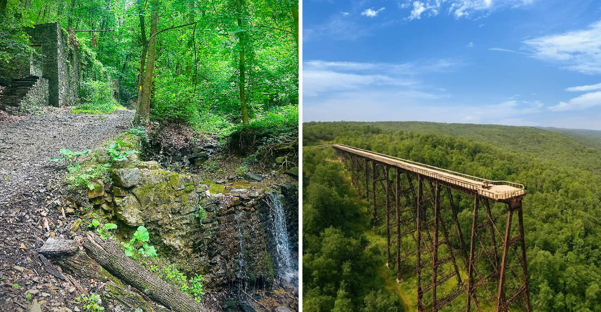
Mossy stone walls in the middle of a Pennsylvania forest keep secrets, and tripping over one is the fastest way to learn that. Old chimneys, quarry sheds, twisted steel, and foundations of buildings that vanished decades ago sit quietly under the hemlocks, waiting for someone curious enough to walk a little farther.
A hike here feels like two trips at once, one through nature and one through history. Trails across the state wander straight into forgotten factories, prison camps, and broken dams, each stop carrying its own mood.
Several of them genuinely gave me goosebumps. The ruins do not announce themselves.
They wait for you to notice a line of stone where no stone should be, or a rusted bolt half swallowed by roots. Nature has been slowly reclaiming what industry left behind, and the result is a landscape that feels both wild and haunted.
Nine of these trails are worth marking on your map, and each one rewards the kind of traveler who slows down to look.
1. Flat Rock Trail, Linn Run State Park
Half a mile does not sound like much, and yet this little path in the Laurel Highlands packs in more atmosphere than trails five times its length. Water does most of the talking here, since the route runs alongside Linn Run the entire way.
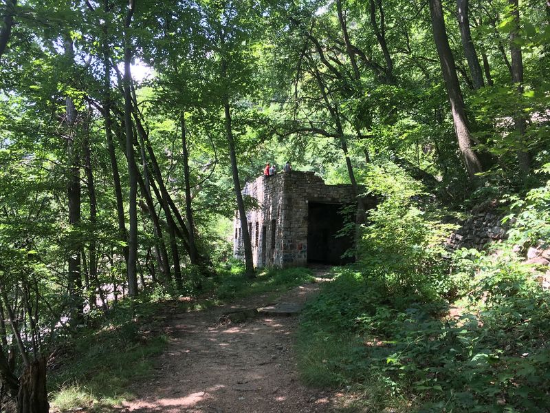
What caught my eye was the stonework tucked into the trees. The outer rock walls and chimney of the old McGinnis Rod and Gun Club still stand, quietly holding their shape long after the camp closed in the early 1940s.
Hemlocks lean over the water, and the light comes through in patches, which makes the ruins feel almost staged. They are not.
The building simply gave up and the forest moved in around it.
The trail ends at Flat Rock itself, a wide slab of smooth stone in the stream where the current spreads out and slows. Kids love it, and honestly so did I.
Bring shoes you do not mind getting damp, because the rocks near the water stay slick. Spring runoff makes the stream loud and full, while autumn turns the whole hollow gold.
Address: 770 Linn Run Road, Rector, PA 15677
2. Thousand Steps on the Standing Stone Trail
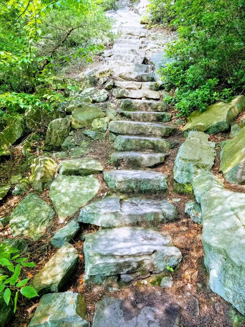
My calves still remember this one. Over a thousand uneven stone steps climb straight up Jack’s Mountain, and every hundred or so you find a painted number on the rock that either encourages you or taunts you, depending on how much water you brought.
Quarry workers built these steps in the 1950s so they could reach the operations high in Jack’s Narrows. Knowing that men made this climb daily, carrying tools and lunch in rain and snow, changes how you complain about it.
Along the way, look for the old dinkey grades, flat cuts in the slope where small trains hauled stone down the mountain. Near the top sits the concrete dinkey house, a squat little ruin that has become the unofficial trophy of the hike.
Views from the quarry ledge above are the payoff, a long sweep of river and ridgeline that genuinely surprised me. The higher you climb, the more the industrial past starts revealing itself in small details scattered across the wooded mountainside.
Plan on an hour or more up and nearly as long down, since tired legs make the descent trickier than the climb. Hiking poles help.
Parking sits right off the highway, so arrive early on weekends.
3. Kinzua Creek Trail and the Fallen Viaduct
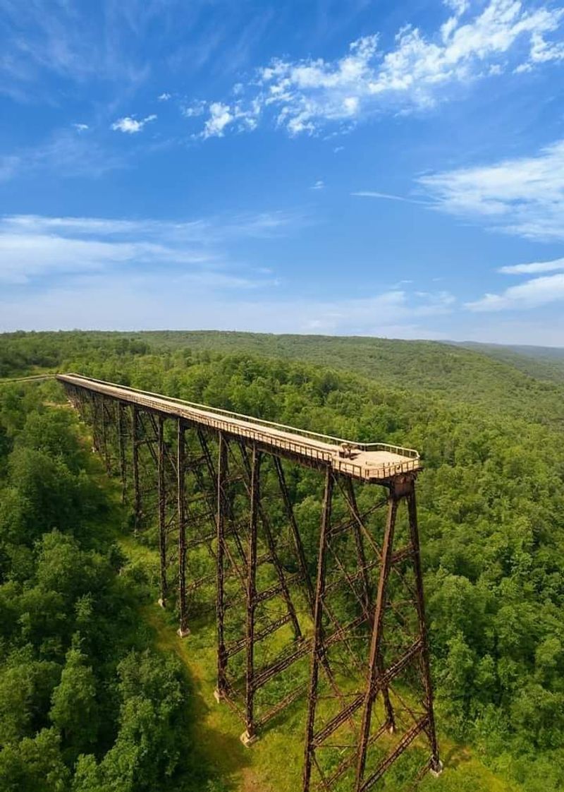
Few ruins in Pennsylvania hit as hard as this one. From the overlook you see a bridge cut in half, and then you walk down into the gorge and find the missing pieces lying in the grass like fallen giants.
The Kinzua Bridge once stretched 2,053 feet across the valley and stood 301 feet tall, making it the longest and tallest railroad structure in the world when it was built. A tornado tore out a huge section in 2003.
Steel towers now rest where they landed, rivets the size of fists still holding plates together. Standing beside one, I could not stop staring at how thick the metal is.
Seeing the wreckage from above is impressive, but standing at ground level beside those twisted towers makes the scale of the destruction much harder to process. Nature reclaimed the surrounding slopes, while the steel stayed exactly where the storm dropped it.
Getting there is the hard part. The trail drops roughly 280 feet over less than a mile, using stone steps and steep pitches that demand real boots and steady knees.
Coming back up is a genuine workout, so pace yourself and carry water. The Skywalk above gives the aerial view, but the valley floor gives the perspective.
Fall color here turns the gorge into something unforgettable.
Address: 296 Viaduct Road, Mount Jewett, PA 16740
4. Ruins Trail in Dead Man’s Hollow
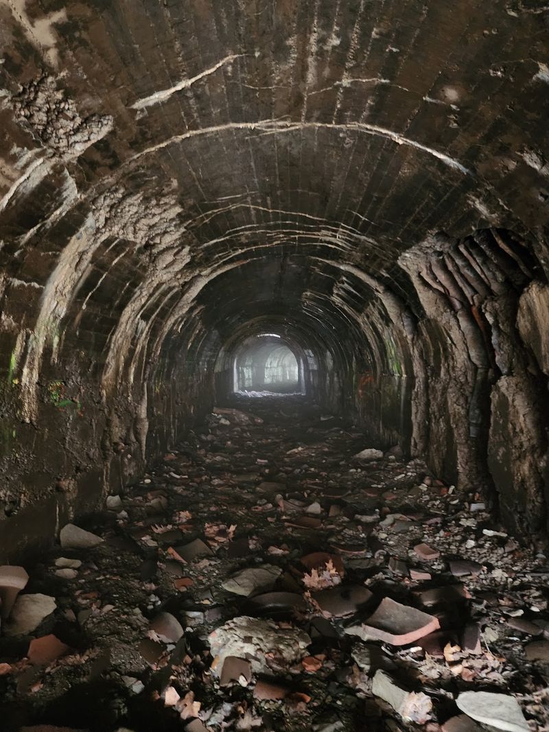
The name alone makes people curious, and the hollow lives up to it. Four hundred fifty acres of thick woods near McKeesport hide a place that once hummed with industry and now belongs entirely to the trees.
Following the Ruins Trail, you come across the remains of the Union Sewer Pipe Company, which operated here until the late 1920s. The factory turned out clay sewer pipes that ended up under streets in Pennsylvania, New York, and across New England.
There was a 19th century quarry here too, and pieces of that story still surface along the slopes.
Vines have wrapped the brickwork, saplings push through old floors, and the whole scene has that quiet industrial ghost feeling that western Pennsylvania does so well. I found myself whispering without meaning to.
Footing can be uneven and muddy after rain, and poison ivy likes the edges of the ruins, so long pants are smart.
Go on a weekday morning if you want the place mostly to yourself. Birdsong bouncing off old walls is a strange and lovely combination.
Address: 600 Scene Ridge Road, McKeesport, PA 15133
5. Camp Michaux Trails in Michaux State Forest
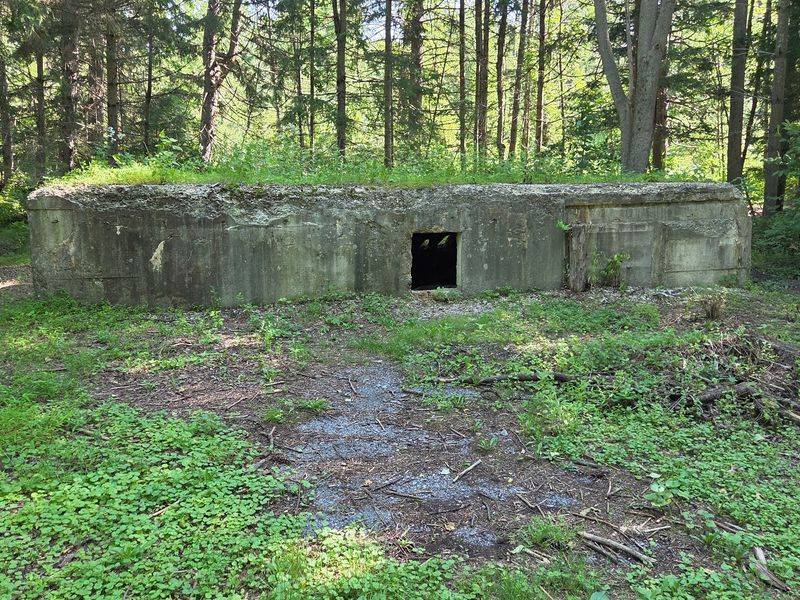
Layer after layer of history sits in this one clearing, and that is what makes it linger in your mind. What started as Bunker Hill Farm in the late 1700s became a Civilian Conservation Corps camp during the Great Depression, where young men built roads, trails, and sturdy stone structures.
Then came the strangest chapter. During World War II the site operated as a secret interrogation camp for German and Japanese prisoners, hidden away in the forest where almost nobody knew it existed.
Afterward it served as a church camp from 1946 until 1972, and the buildings were demolished in 1975.
Walking the loop today, you find barn and farmhouse foundations, stone steps that lead to nothing, two small dams on Toms Run, and a CCC fountain that somehow survived intact.
Pieces of concrete and old foundations appear between the trees, making the forest feel almost like an unfinished archaeological site. Each surviving fragment belongs to a different chapter, and figuring out which era it came from becomes part of the walk.
Interpretive signs explain what stood where, and I recommend reading every one. Without them, the stones are just stones.
Terrain is gentle and shaded, which makes it a good choice for a slower, more thoughtful walk. Bring bug spray in summer, and give yourself extra time to poke around.
Address: 1861 Michaux Road, Gardners, PA 17324
6. Ironton Rail Trail Through Cement Country
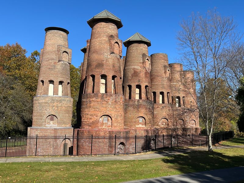
Easy walking, big history. This 9.2 mile path follows the old Ironton Railroad through Whitehall Township, Coplay, and North Whitehall, an area that once fed iron and cement operations across the Lehigh Valley.
My favorite oddity here is the concrete block phone booth standing beside the trail. Crews used these squat little structures to call dispatchers about track conditions, and they doubled as mile markers.
One of them wears the number 99.6, counting the distance all the way back to the Lehigh Valley Railroad’s Liberty Street Ferry Terminal in New York City. The railroad started installing them around 1903 and was dispatching by telephone by 1910.
Because the surface is mostly smooth and the grade is gentle, families with strollers and casual cyclists do well here. I liked how the route slips between neighborhoods, woods, and reminders of the cement industry that built this valley.
Old railroad traces appear quietly along the way, turning an otherwise relaxed walk into a small history hunt.
Interpretive markers fill in the story as you go.
Bring a hat, since some stretches sit wide open to the sun. Late afternoon light on the old concrete is worth a photo or two.
Address: 3853 Chestnut Street, Whitehall, PA 18052
7. Horse-Shoe Trail Segment at Valley Forge
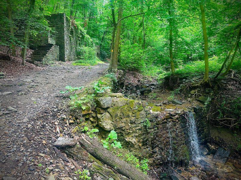
Most people come to Valley Forge for the encampment story, then never realize a rugged footpath climbs away from the open fields into rocky woods. The Horse-Shoe Trail runs 140 miles in total, and roughly a mile and a half of it threads through this park.
Roots, loose stone, and steady uphill grades make the short stretch feel more serious than expected. Good traction matters here.
The reward is the Colonial Springs Bottling Plant, built in the late 1800s over a natural spring. Benjamin Franklin Fisher started the operation in 1886, adding a dam and retaining wall that you can still trace through the leaves.
Water was bottled and sold commercially for decades before the state park acquired the property in the 1930s and let the buildings slide into ruin.
In 2017 the National Park Service stabilized the crumbling stonework, so the walls are safer to view without wrecking their weathered character.
I found the contrast striking, a forgotten little business sitting inside one of the most visited historic sites in the country. Go midweek and it feels almost private.
Address: 1400 North Outer Line Drive, King of Prussia, PA 19406
8. Austin Dam Memorial Park Trails
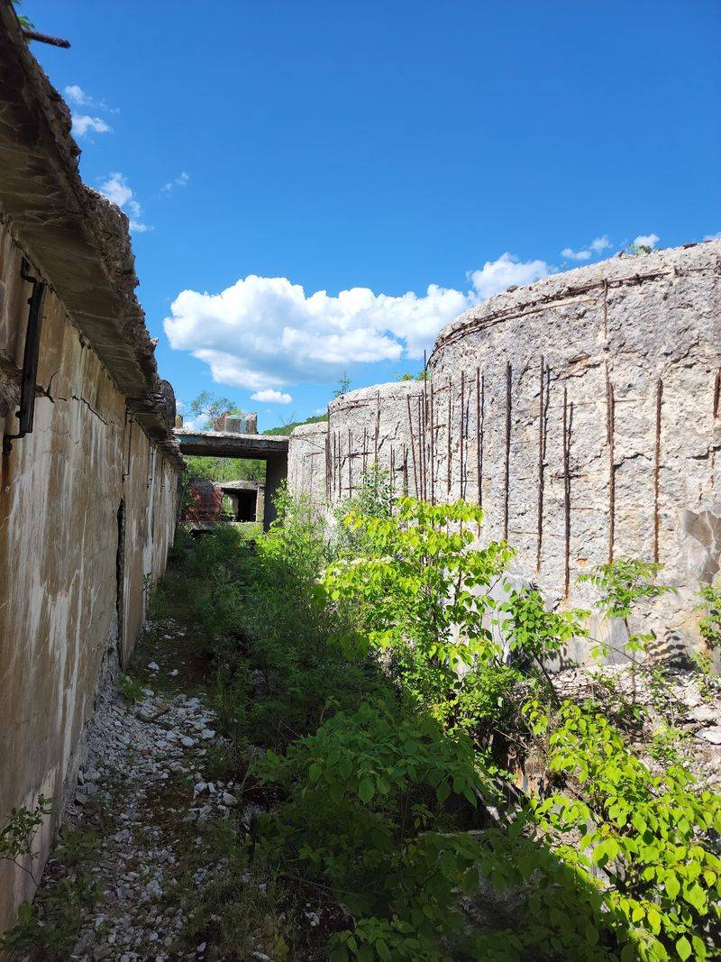
Nothing prepares you for the scale of the broken concrete here. Huge slabs of the Austin Dam lie tilted and cracked across the valley, and the gaps between them are big enough to walk through.
Built in 1909 to power the Bayless Pulp and Paper Company mill, the dam was advertised as the one that could not break. Poor construction and heavy rain proved otherwise on September 30, 1911.
Roughly 400 million gallons of water tore downstream, destroying the town and claiming at least 78 lives, making it the second worst flood disaster in Pennsylvania history.
Today a 76 acre park surrounds the wreckage. The Joseph Dumohoski Interpretive Hiking Trail leads past remains of three dams, concrete, coffer, and earthen, while the Bayless Paper Mill Ruins Trail heads toward the old mill structures.
A tall concrete tower, likely used for sulfuric acid, still rises above the brush beside a large abandoned building.
Signs throughout explain the engineering failures and the flood itself. The ruins joined the National Register of Historic Places in 1987, and walking among them feels appropriately sobering.
Address: 5384 State Route 872 North, Austin, PA 16720
9. Blue Trail at Rolling Hill Park
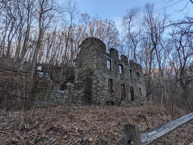
Suburban Philadelphia hides this one well. A 103 acre patchwork of woods, meadows, and streams sits above Mill Creek, and the Blue Trail drops down the slope into a valley that used to be full of working families.
The stone foundations you pass belonged to millworkers’ housing from the 19th century. One group traces back to homes built by mill owner Samuel Lehman Smith between 1837 and 1840, with a root cellar still visible nearby.
Head farther downstream toward the old Barker Mill site and you meet two more structures, a single unit and a double unit, both showing solid stonework and thick fireplace lintels that have refused to fall.
Elsewhere in the park you can make out the footprint of the Walter C. Pew estate house, lost to fire in 1958.
Sections of the trail get properly steep, and steps have been added where the grade demands them. I was grateful for them coming back up.
Winter, with the leaves down, is the best season for spotting stonework through the trees.
Address: 1301 Rose Glen Road, Gladwyne, PA 19035
