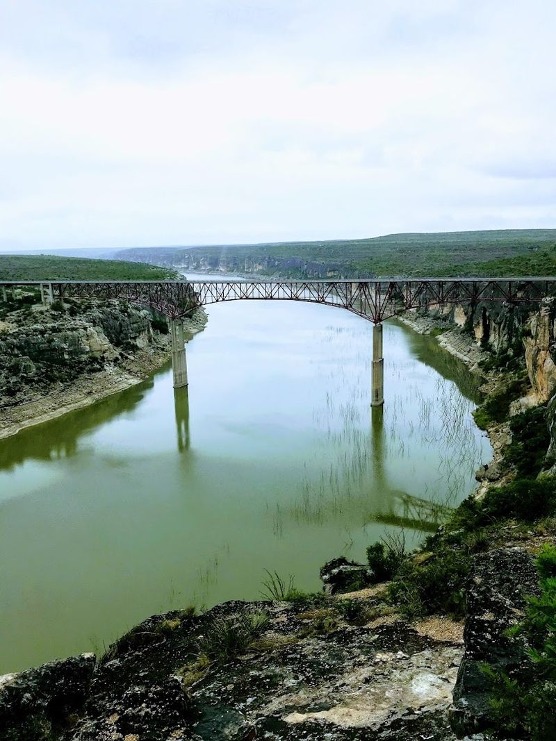
You do not realize how high 300 feet really is until you are standing on a bridge looking down. This one holds the title for the highest highway bridge in the state, and it earns every single foot.
The canyon opens up beneath you in a way that makes your stomach do a little flip. Rock walls, winding river, and a view that stretches for miles in every direction.
You will want to pull over at the lookout point and just stand there for a minute. Cameras do not quite capture it, but you will try anyway.
Drive across it, then turn around and do it again just to make sure it was real.
How High Is It Really? Understanding the Staggering Scale
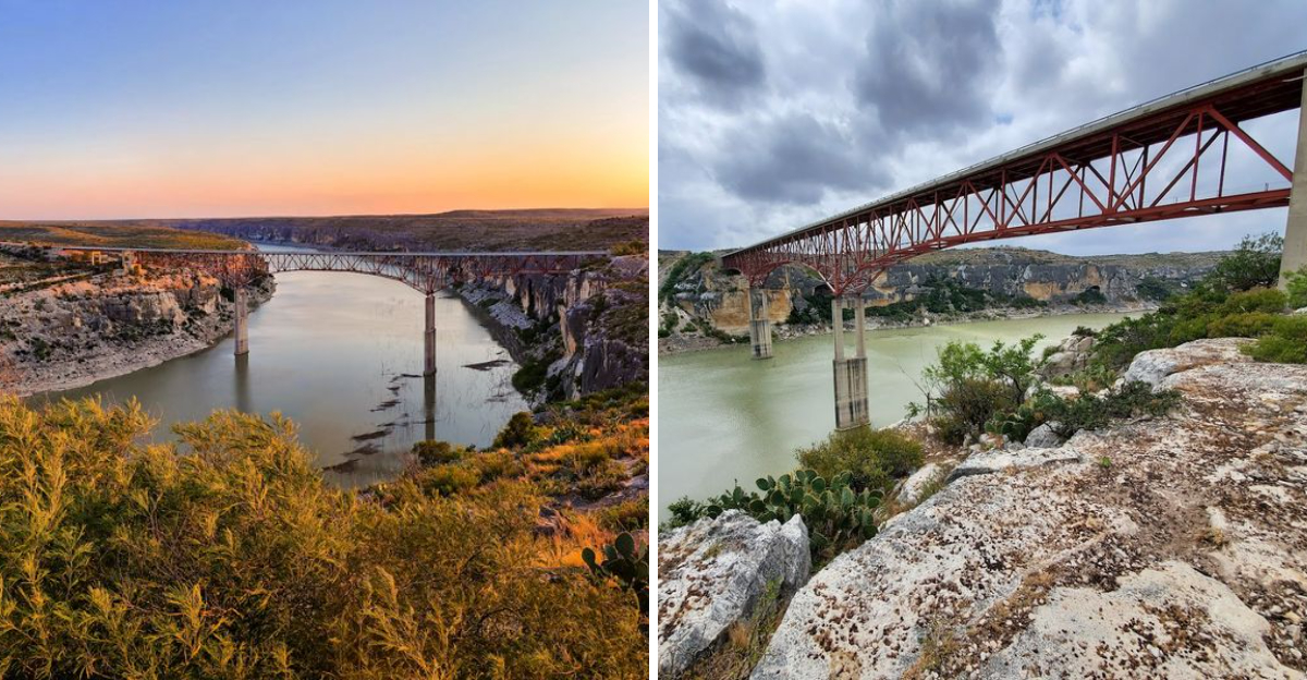
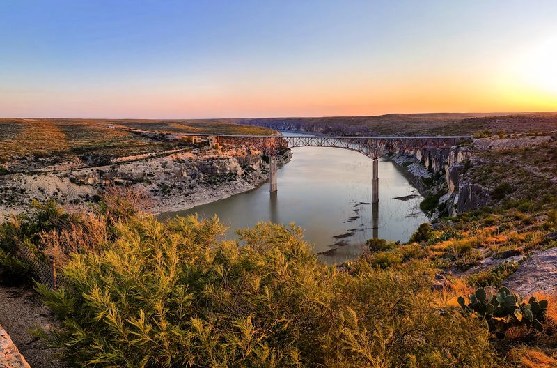
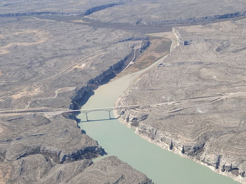
Numbers can feel abstract until you are actually standing on something. The Pecos River Highway Bridge rises approximately 273 feet above the river, which puts it firmly at the top of the list for highway bridges in Texas.
To put that in perspective, that is taller than a 25-story building. Most people do not fully register the height until they walk out toward the railing and peer down into the canyon.
The rocky walls drop sharply, and the river far below looks almost impossibly small.
One thing worth knowing is that the height above water can actually shift depending on the water level of the nearby Amistad Reservoir. When reservoir levels are high, the visual drop appears slightly less dramatic.
When levels are lower, the full jaw-dropping depth of the canyon becomes even more visible.
The bridge sits at the junction of U.S. Highway 90 and the Pecos River in Val Verde County.
That location alone makes it a natural stopping point for anyone driving through this part of Southwest Texas. The scale of the place hits differently when you experience it in person rather than just reading about it.
A Bridge Built to Last: The History Behind the Structure
There is something deeply satisfying about knowing a place earned its spot on the map the hard way. The Pecos River Highway Bridge was completed in April 1957, but the story behind it goes back much further than that.
Earlier bridges at this crossing were destroyed by massive floods in 1923, 1954, and 1955. Three times the river rose and took the crossing with it, and three times the region had to find a way forward.
That kind of persistence shaped the decision to build something truly permanent.
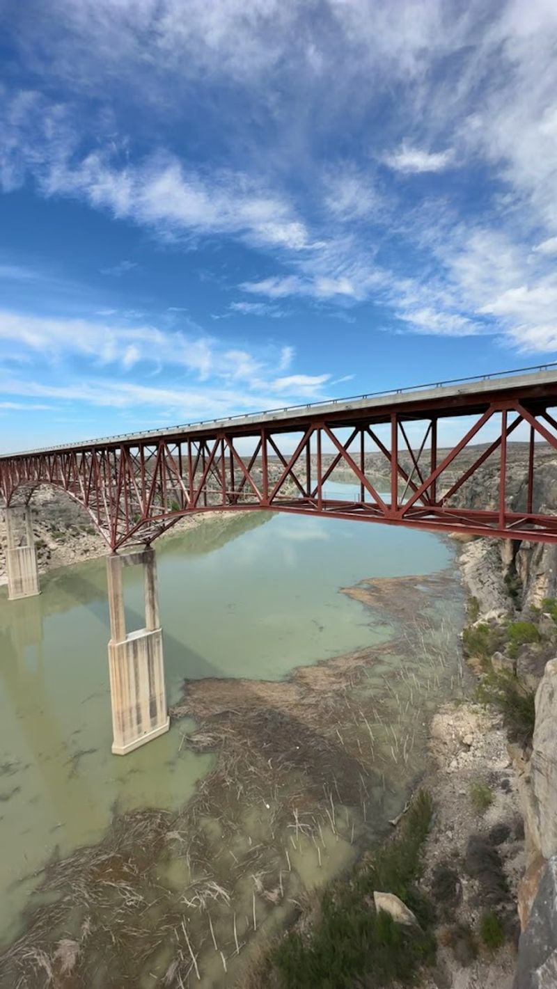
The final design features two central piers anchoring a 1,310-foot-long span. Engineers incorporated a 1,040-foot deck truss unit, a concrete slab section, and a 240-foot continuous plate girder span into the overall structure.
Each element was chosen deliberately to handle the unpredictable power of the Pecos River below.
Val Verde County, where the bridge sits, is remote and rugged. Getting a structure of this scale built in such an isolated location was no small feat.
The bridge stands today as proof that good engineering and stubborn determination can outlast even the most relentless natural forces.
The Canyon Views That Make Your Jaw Actually Drop
The canyon itself is the real showstopper here. Long before you even get to the bridge, the landscape starts shifting into something wilder and more ancient-feeling, with dry scrub giving way to dramatic cliff faces and open sky.
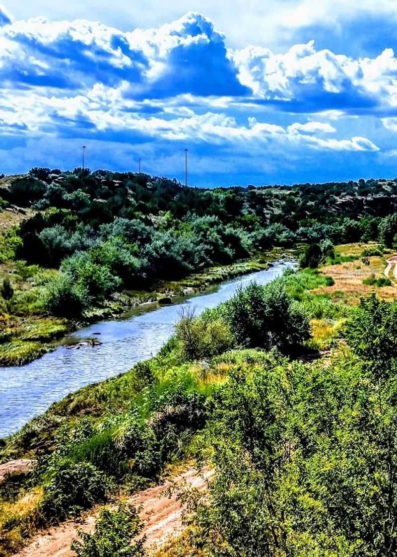
From the bridge deck, you can see the canyon walls stretching out in both directions, layered in shades of tan, rust, and pale gold. The Pecos River threads through the bottom like a thin blue ribbon, framed by rocky ledges and desert vegetation.
On a clear day, the visibility extends far enough to feel almost cinematic.
What makes the view extra special is the confluence point nearby, where the Pecos River meets the Rio Grande. That meeting of two iconic rivers adds a geographic significance to what is already a visually stunning location.
Not many bridges in the country can claim a backdrop like that.
Photographers tend to linger here longer than planned. The light changes throughout the day, and the canyon catches golden hour in a way that makes even a casual snapshot look like a professional travel photo.
Bring a camera with a wide lens if you have one, because no single frame captures the full scope of what you are seeing.
The Picnic Area: A Surprisingly Perfect Spot to Pause
Not every great road trip moment happens at the main attraction. Sometimes it is the quiet little side spot that ends up being your favorite part of the stop.
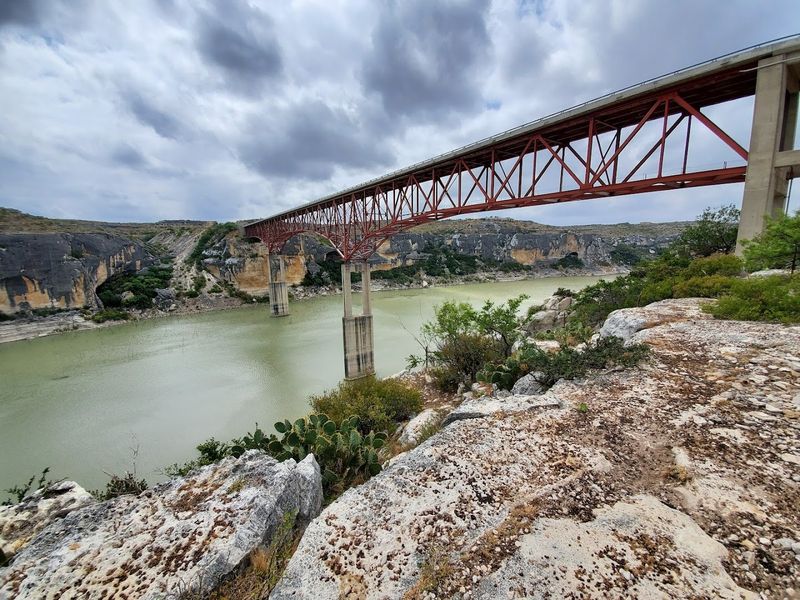
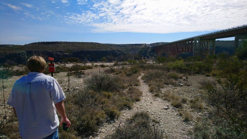
On the east side of the river, there is a small picnic area that offers a genuinely lovely place to sit and take everything in. The views from this spot are actually excellent for seeing the full bridge structure from a distance, which gives you a better sense of its scale than standing on the deck itself.
It is also one of the best vantage points for spotting the confluence of the Pecos River and the Rio Grande.
The area is simple and unpretentious, which honestly makes it more charming. There are no crowds, no admission fees, and no pressure to rush.
You can spread out a lunch, watch the canyon light shift, and just breathe for a while.
If you are doing a long stretch of Highway 90 through West Texas, this picnic area is a genuinely restorative rest stop. The combination of fresh air, dramatic scenery, and total quiet is hard to beat.
Pack something easy to eat and give yourself at least 30 minutes here. You will not regret it.
Engineering Marvel: What Makes This Bridge So Impressive
Most people drive across bridges without giving a second thought to what holds them up. The Pecos River Highway Bridge is the kind of structure that makes you stop and actually think about it.
The design includes two central piers that anchor the entire span above the canyon. Those piers had to be constructed deep within the canyon walls, which required significant engineering creativity given the remote location and the difficult terrain.
The 1,040-foot deck truss unit is the heart of the structure, flanked by a concrete slab section and a 240-foot continuous plate girder span on the approaches.
What stands out is how seamlessly the bridge fits into the landscape despite its enormous size. From a distance, it almost looks delicate against the wide canyon sky, like a fine line drawn across the horizon.
Up close, the sheer mass of the steel and concrete becomes impossible to ignore.
The bridge has been carrying traffic reliably for nearly seven decades now. That kind of longevity in a region prone to extreme weather, flash floods, and dramatic temperature swings is a real testament to the quality of its original construction.
Engineers from that era built things meant to endure, and this bridge is living proof of that commitment.
Wildlife and Nature: What the Canyon Ecosystem Offers
The canyon around the Pecos River Highway Bridge is not just a geological spectacle. It is a living ecosystem with a surprising amount of wildlife activity for such a dry and rugged environment.
Raptors are a common sight here, particularly hawks and golden eagles that ride the thermal currents rising from the canyon walls. Watching one of those birds glide effortlessly above the river far below is one of those small, unexpected moments that makes a road trip feel genuinely special.
Keep your eyes on the sky as much as the canyon floor.
The scrubland surrounding the bridge also supports deer, javelinas, and a wide variety of reptiles. Early mornings and late afternoons are the best times to spot wildlife moving along the canyon edges.
Binoculars are worth packing if you have them.
The plant life in this part of Val Verde County is equally interesting. Desert succulents, native grasses, and thorny shrubs cling to the canyon walls in ways that seem almost impossible given how little rain falls here.
The whole ecosystem feels finely tuned to survive harsh conditions. Spending even a short time observing it gives you a new appreciation for just how resilient the natural world can be in extreme environments.
Tips for Visiting: Making the Most of Your Trip to the Bridge
A little preparation goes a long way when visiting somewhere this remote. The Pecos River Highway Bridge is not hard to reach, but it rewards visitors who show up ready for the conditions.
Early morning is genuinely the best time to visit. The light is softer, the temperatures are cooler, and there is almost no traffic on the bridge.
Sunrise over the canyon turns the rock walls shades of orange and pink that feel almost unreal. If you can manage the early wake-up, it is absolutely worth it.
Wear comfortable shoes with good grip if you plan to explore the picnic area or walk along the roadside viewing spots. The ground can be uneven and rocky.
Sun protection is non-negotiable here, since shade is scarce and the West Texas sun is relentless for most of the year.
Bring more water than you think you need. Seriously, double your estimate.
The combination of heat, altitude, and dry air can dehydrate you faster than expected, especially in summer months.
The bridge itself is an active roadway, so always stay aware of traffic when stopping to look around. Use the designated pullouts and picnic areas for your viewing stops.
Respecting the site ensures it stays accessible and enjoyable for everyone who comes after you.
Getting There: Navigating the Remote Roads of West Texas
Part of what makes the Pecos River Highway Bridge feel so rewarding is the drive to get there. West Texas has a particular kind of beauty that rewards patience, and the roads leading to this bridge are a prime example of that.
The bridge sits along U.S. Highway 90, which runs through some of the most remote and visually striking terrain in the state.
Towns are sparse, gas stations are far apart, and cell service can be spotty. That is not a warning so much as a reminder to plan ahead and enjoy the solitude.
From the town of Comstock, the bridge is just a short drive west. Comstock itself is small, but it serves as a useful waypoint for travelers heading toward the canyon.
Fill up on gas before you leave town, and make sure your water supply is solid, especially in summer when temperatures can climb fast.
The address to navigate to is River Rd, Texas 79772, which will bring you right to the crossing. Some GPS apps handle this stretch of Highway 90 better than others, so downloading an offline map before you head out is a smart move.
The remoteness is part of the experience, not a drawback.
Dear Reader: This page may contain affiliate links which may earn a commission if you click through and make a purchase. Our independent journalism is not influenced by any advertiser or commercial initiative unless it is clearly marked as sponsored content. As travel products change, please be sure to reconfirm all details and stay up to date with current events to ensure a safe and successful trip.