The first thing I noticed when the boat engine cut off was how loud the quiet felt. Portsmouth Village sits on the northern tip of Portsmouth Island, just across Ocracoke Inlet, and the only way in is by water.
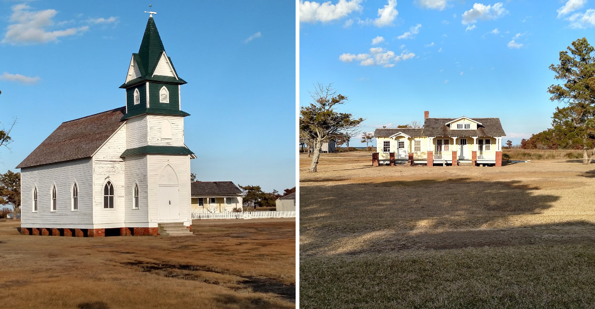
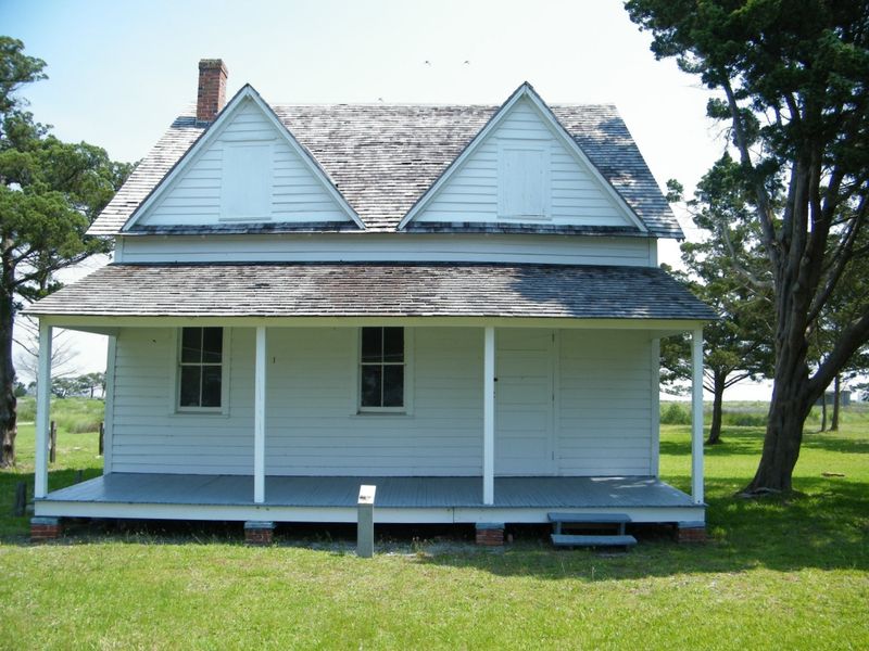
I walked up a sandy path lined with white clapboard houses, a church with a working bell, and a general store that hasn’t sold anything in decades. Nobody has lived here since 1971, yet the buildings are still standing in neat rows, painted and cared for, waiting for people who are not coming back.
There are no shops, no streetlights, and no traffic sounds, just marsh grass, mosquitoes, and the wind moving through open windows. I came for a couple of hours and left thinking about it for weeks.
A Shipping Powerhouse That Time Forgot
Hard to believe now, but this hushed strip of sand was once the busiest settlement on the entire Outer Banks. Portsmouth was created in 1753 by an act of the North Carolina colonial assembly, and by 1770 it had grown bigger than any other village along the banks.
The reason was geography. Ocracoke Inlet was the main doorway for trade through the Outer Banks, and big deep-draft ships couldn’t clear the shallow water inside.
So Portsmouth became a lightering port. Cargo was moved off large vessels onto smaller shallow boats, which then carried goods to mainland ports deeper inside the state.
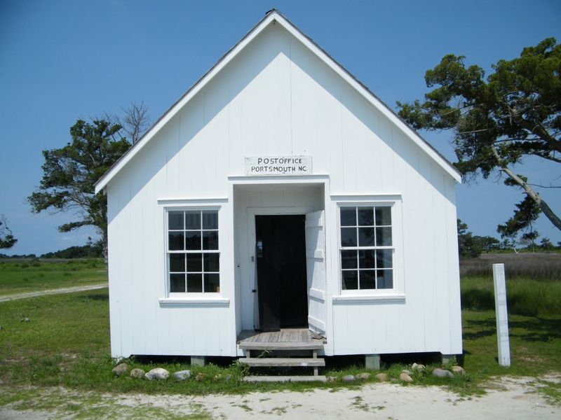
That work meant jobs, warehouses, docks, and steady traffic for close to a century. Standing beside the old store, I tried to picture sails stacked up in the inlet and men hauling barrels through this same sand.
Population peaked at 685 people in 1860. Many residents were African American, and some stayed on in the village even after the Civil War ended.
Knowing all of that changes how the place reads. The emptiness isn’t an accident of nature, it’s the leftover shape of a working town.
Why Everyone Eventually Packed Up
Nothing dramatic wiped Portsmouth off the map. It faded, slowly, for a whole list of reasons stacked on top of each other.
The trouble started underwater. Ocracoke Inlet began shoaling, meaning it grew shallower, even before the Civil War, which made navigation harder for the ships the village depended on.
Then a hurricane in 1846 opened a new and deeper inlet near Hatteras. Shipping traffic shifted north almost immediately, and Portsmouth lost the advantage that had built it.
The Civil War pushed many families off the island, and plenty of them never came home. Railroads took over freight hauling, so the old lightering trade lost its purpose entirely.
Add economic hard times, real isolation, and storms that kept arriving, and the math stopped working for anyone trying to stay. By 1956 there were only 17 residents left.
I find that part genuinely moving. These weren’t people who gave up easily, they held on for generations after the reason for the village had disappeared.
Walking the paths now, the decline feels less like failure and more like a long, stubborn goodbye.
1971 and the Final Three Names
The last chapter here comes down to three people. Henry Pigott was the final permanent male resident of the village, and after he passed, staying became nearly impossible for the two women who remained.
Elma Dixon and Marian Babb, sometimes listed as Marian Gray Babb, left the island in 1971. They did not go happily, and by every account the departure was reluctant.
That detail sticks with me more than any date or population figure. A village doesn’t really end when the boats stop coming, it ends when the last person closes a door behind them.
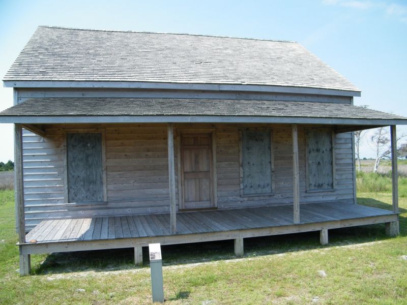
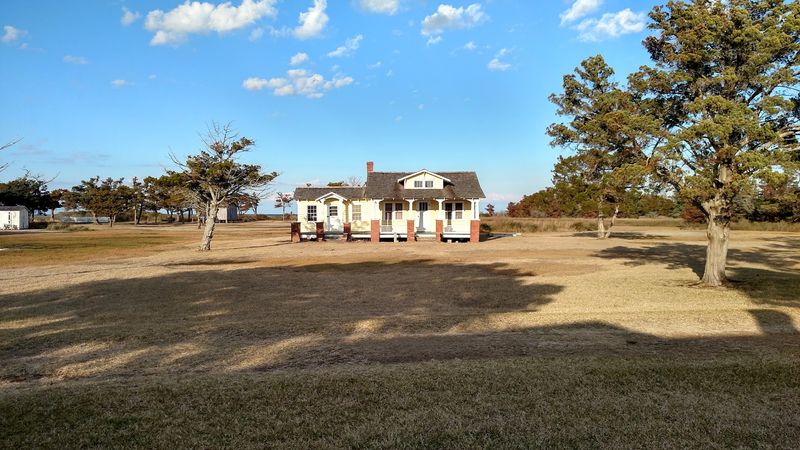
Nothing here shouts about it either. There’s no big monument, just houses with their furniture gone and porches facing an empty lane.
Reading the interpretive signs while standing in the actual yards makes the timeline feel personal instead of academic. 1971 isn’t ancient history, and that nearness is part of what makes the silence land so hard.
If you visit, take a minute somewhere shady and just let it sit. The village rewards patience far more than a quick loop with a camera.
The Church, the Bell, and Permission to Ring It
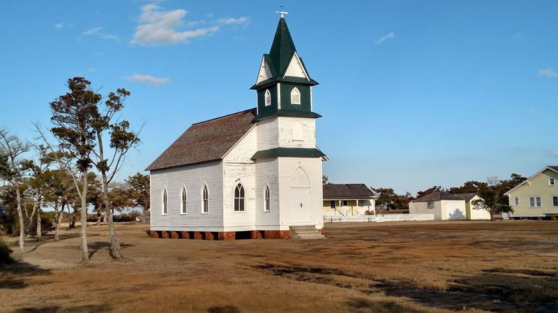
My favorite moment of the whole trip involved a rope. The Portsmouth United Methodist Church still stands, still bright white, and visitors are allowed to ring its bell.
The sound carries farther than you expect. With no cars, no music, and no chatter to compete with, one clang rolls out across the marsh and comes back thinner a second later.
Inside, the church is simple and plain, with wooden pews and windows that let the light do all the decorating. It doesn’t feel staged or museum-like, more like a room that was tidied and left alone.
Something about ringing that bell in an empty village feels respectful rather than touristy. For a few seconds the place has a voice again.
Bring a little patience for the mosquitoes if the wind drops, because the shaded areas near the church can get busy with them. Long sleeves and repellent make a real difference.
Of everything I photographed, the church is the image that stayed clearest in my head, and honestly the bell is the part I’d go back for.
Life-Saving Station With a Real Job to Do
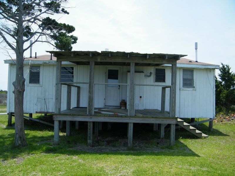
Long before helicopters and radios, rescue on this coast meant men, oars, and nerve. A U.S.
Life-Saving Station opened at Portsmouth in 1894 and operated for nearly five decades before being decommissioned in 1937.
The building is one of the most impressive structures still standing, and visitors can tour it. Wide porches, a lookout tower, and utilitarian rooms all hint at the drills and long night watches that filled the crew’s days.
Crews here mattered enormously to the community, not just to shipwrecked sailors. Steady work and a federal presence helped hold the village together during years when almost everything else was slipping away.
I spent longer inside than I planned, mostly reading and looking out the windows toward the water. Picturing a rescue launch from that beach in a storm is a sobering exercise.
The 1937 closure reads like another warning sign for the village’s future. One by one, the reasons to stay were being switched off.
Wear shoes you can walk sandy paths in, since the station sits a stretch from the landing area and the ground is soft.
The Salter House Is Now Your Welcome Desk
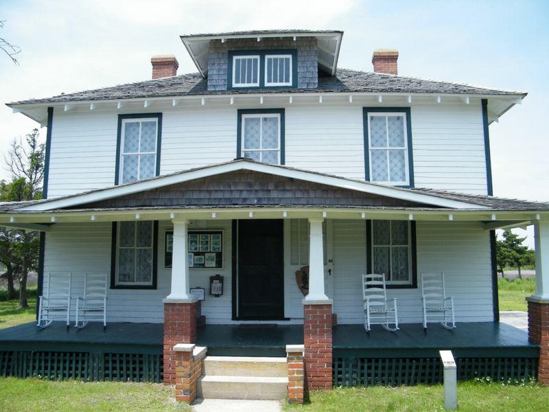
There’s exactly one building on the island where you’ll find modern comforts, and it used to be somebody’s home. The Theodore and Annie Salter House now serves as the Portsmouth Visitor Center.
Inside are exhibits, restrooms, and first aid supplies. That’s the extent of the amenities on the entire island, which is worth understanding before you step off the boat.
No electricity, no food service, and no drinking water exist beyond that building. Planning around that limitation is the single biggest factor in whether your visit feels great or miserable.
I stopped there first and I’d suggest the same. The exhibits gave me names, dates, and context that made the rest of the walk far more meaningful.
Repurposing a family house as the front door of a ghost village is a clever touch. You get information while standing in a room where people once cooked dinner and rode out storms.
Pack water, snacks, sunscreen, a hat, insect repellent, and comfortable walking shoes. Bring a bit more water than you think you need, especially in summer heat.
Getting Here Means Getting on a Boat
No bridge, no causeway, no shortcut. Boats are the only way in, which is exactly why Portsmouth stayed as intact as it did.
You can arrive by private vessel, a boat tour, or a passenger and vehicular ferry running from Ocracoke Island or from Davis on the North Carolina mainland. From Ocracoke the crossing usually takes 20 to 30 minutes.
Watching the village appear across the inlet is a proper arrival, not a parking lot experience. The water is shallow and bright, and the low island barely rises above it.
Timing matters more than usual here. Your return boat sets your schedule, so I’d build in extra minutes rather than sprinting back down the path.
Overnight rentals and hotels don’t exist on the island. Most people treat it as a day trip, though camping is possible for those who show up fully self-sufficient.
Talk to your boat operator about tides and conditions before you go, since crossings can be weather dependent. Flexibility is part of the deal with places this remote.
Beaches, Shells, and a Protected Future
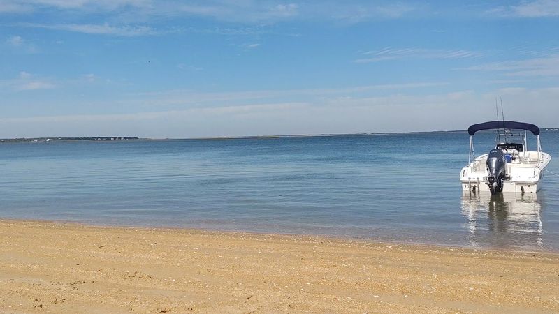
Past the buildings, the island opens into something completely different. Portsmouth Island is known for undeveloped beaches, excellent shelling, and surf fishing that draws people out here on its own merit.
Preservation is the reason all of it survives. The village became part of Cape Lookout National Seashore, established in 1976, and its 250-acre historic district joined the National Register of Historic Places in 1978.
Driving on the beaches and along marked interior roads is allowed with a proper 4WD vehicle. Without one, plan on walking, and plan on sand that pulls at your shoes.
Shelling here felt genuinely productive rather than picked over. That’s the payoff of a shoreline nobody strolls on every single morning.
I paired the history walk with an hour at the water, and the combination worked well. Empty houses behind you, open ocean in front, and almost nothing man-made in either direction.
Graveyards tucked among the shrubs are worth finding too, quietly marking the families who stayed longest. Treat them gently, and leave everything exactly where you found it.
Address: Portsmouth Village, Portsmouth Island, Carteret County, North Carolina
