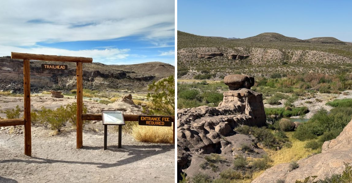
A hike that is only a mile long but delivers more scenery than trails twice its length is a true treasure. This Texas hike leads to a landscape filled with hoodoos and balanced rocks, unique geological formations that seem to defy gravity.
The views from the top are breathtaking and well worth the short walk. The trail is accessible for most fitness levels, making it a great option for families or those short on time.
It is a perfect example of how a small amount of effort can yield a big reward. This is a place to stop and appreciate the natural beauty of Texas.
A person can get a lot of value from this short adventure.
It is a reminder that some of the best experiences come in small packages
The Hoodoos That Make You Stop and Stare
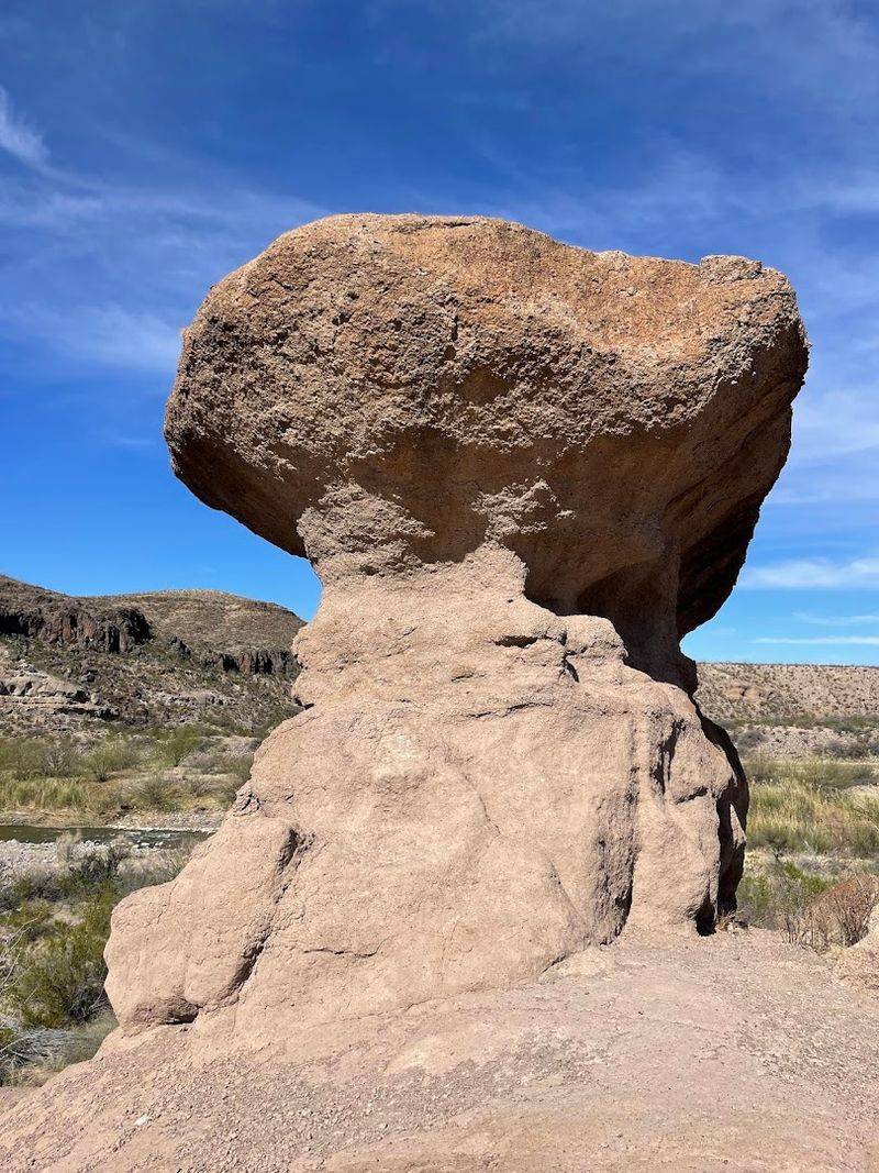
There is something almost theatrical about the hoodoos on this trail. They rise from the desert floor like ancient monuments nobody bothered to name, each one carved into its own strange personality by centuries of wind and rain erosion working on softer volcanic rock beneath a harder capstone.
Some look like hooded figures frozen mid-stride. Others resemble melted towers or creatures from a story you half-remember from childhood.
The variety is genuinely surprising for such a short stretch of trail, and you find yourself slowing down not because the path is difficult, but because you keep stopping to look.
Geologically speaking, these formations are the result of the region’s volcanic past colliding with the relentless forces of erosion. The hardened capstone on top protects the softer mudstone or tuff below, creating that signature tall, narrow silhouette.
It is a slow process measured in millions of years, which makes standing next to one feel quietly humbling.
Photographers tend to linger here longer than anywhere else on the loop. The morning light hits the formations at an angle that turns the rock surfaces golden and warm.
Even on an overcast day, the textures pop in a way that makes every shot feel effortless.
What I found most striking was how different each hoodoo looked depending on where I stood. A few steps to the left and the shape completely changed.
That kind of visual depth is rare on a trail this short, and it makes the hoodoos the undeniable centerpiece of the entire experience.
Balanced Rocks That Seem to Defy Every Law of Physics
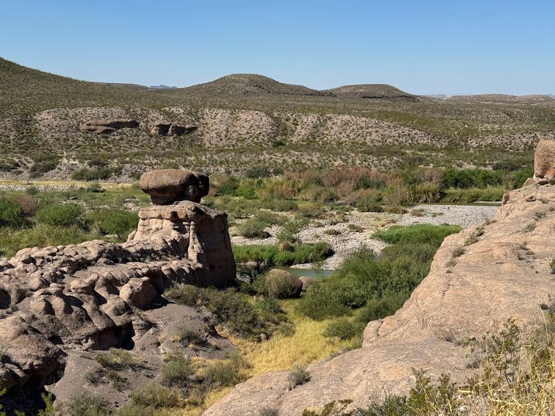
Honestly, the balanced rocks on this trail look like someone placed them there as a joke. Massive boulders sit perched on narrow columns of softer rock, tilted at angles that make your brain quietly insist they should have fallen over a long time ago.
They have not, and that is part of what makes them so mesmerizing.
These formations are the product of the same erosion processes that shaped the hoodoos nearby. The surrounding material erodes faster than the dense caprock on top, leaving behind these gravity-defying pedestals.
It is a perfectly logical geological explanation that somehow does nothing to reduce the visual shock of seeing one up close.
I stood under one for a moment and had a brief, completely irrational thought about whether today was the day it would finally tip. It was not, of course.
These rocks have been balancing for longer than humans have been walking this trail, and they will likely keep balancing long after we are gone.
The contrast between the heavy, angular boulders and the thin columns holding them up creates a kind of visual tension that keeps drawing your eye back. It is one of those sights that photographs well but still somehow looks more dramatic in person.
Kids especially love these formations. There is an instinctive fascination with things that look like they should not work, and balanced rocks tap right into that curiosity.
Bring younger hikers here and watch their faces when they first spot one peeking between the desert brush.
The Rio Grande Views That Sneak Up on You
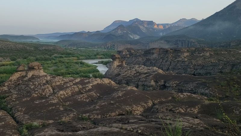
The Rio Grande does not announce itself dramatically on this trail. One moment you are weaving between hoodoos and sandy rock, and then suddenly the river appears through a gap in the brush, wide and calm and impossibly green against the surrounding desert.
It genuinely caught me off guard the first time.
The riverbank section of the loop brings you right to the water’s edge, close enough to hear it moving. That sound alone feels like a reward after hiking through the dry, sun-baked terrain.
The contrast between the arid desert and the lush corridor of vegetation hugging the river is one of the most visually striking moments on the entire trail.
From certain spots along the bank, you can see into Mexico on the opposite shore. The cliffs and mountains in the distance add a sense of scale that makes the landscape feel enormous, even though you are standing on a trail barely over a mile long.
It is one of those views that reframes your sense of where you are.
Wildlife tends to concentrate near the water. Birds are especially active in the early morning hours along the riverbank, and the mix of desert and riparian habitat makes this a rewarding spot for anyone who enjoys watching animals in their natural setting.
One thing worth knowing is that the riverbank section can get muddy when water levels fluctuate. Wearing shoes with solid grip makes navigating that stretch much more comfortable, especially after recent rainfall upstream.
The Historic Pack Trail and What It Used to Mean
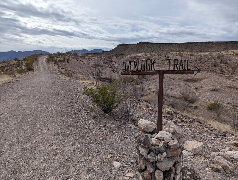
Part of what makes the Hoodoos Trail feel layered beyond its short distance is the history embedded in the ground beneath your feet. The upper section of the loop follows an old pack trail once known locally as Muerte Delburo, which translates roughly to death of the donkey.
That name alone tells you something about how demanding this route used to be.
Before FM 170 was completed and became the paved River Road that travelers use today, this rugged path was one of the main routes through the area. Pack animals hauled supplies along it, navigating the same rocky terrain that hikers now cross in trail shoes.
The physical effort required then would have been significantly greater than what it takes to complete the loop today.
Between 1946 and 1952, the trail also served as a patrol route for Border Riders, who monitored the region during a major foot-and-mouth disease outbreak affecting livestock crossing from Mexico. That specific chapter of history adds a layer of purpose to the path that goes beyond scenic hiking.
Climbing the old road section toward the overlook, you start to appreciate why the terrain earned such a grim nickname. The ground is uneven, the exposed rock reflects heat, and there is very little shade.
The views from the top, though, make the climb feel completely worthwhile.
History does not always need a plaque to feel present. On this trail, it lives in the worn stones and the shape of the path itself, quiet but unmistakably there.
The Overlook That Rewards Every Step of the Climb
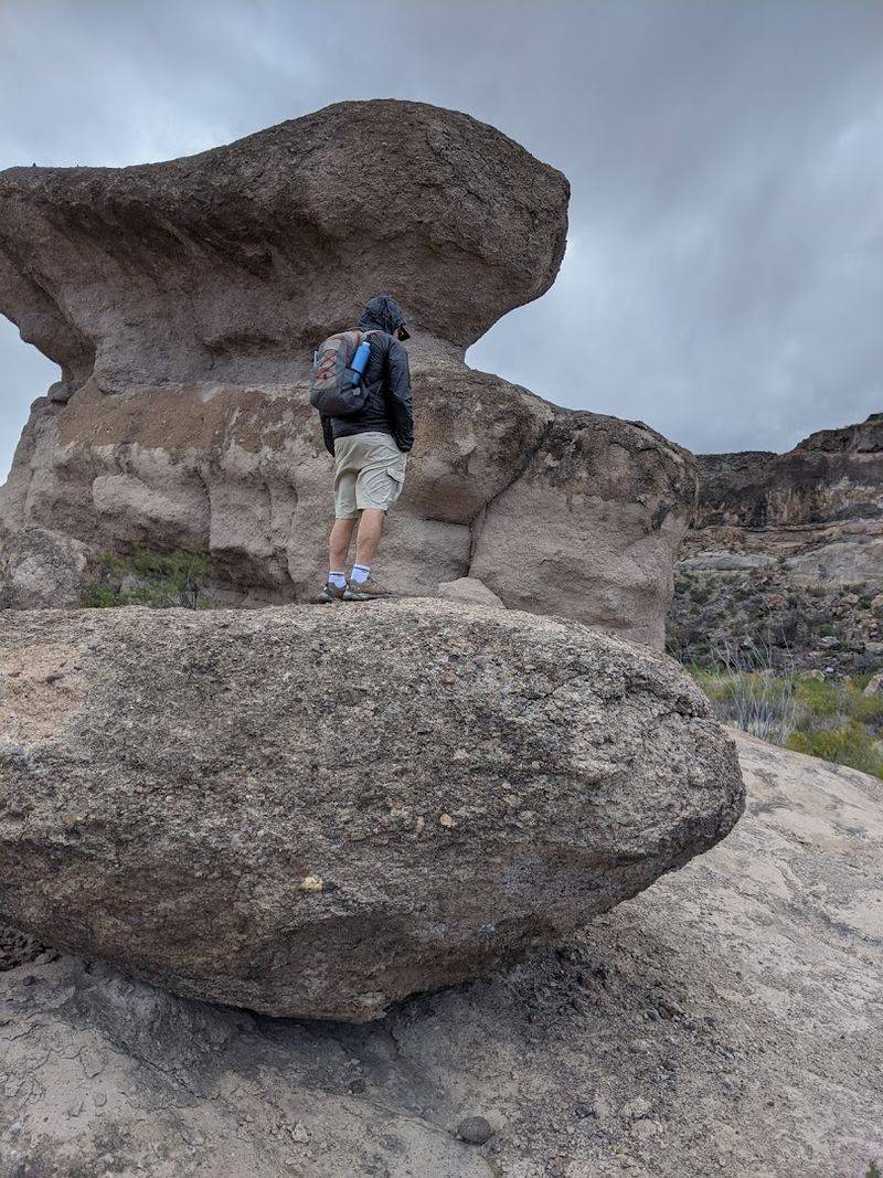
After winding through hoodoos and tracing the riverbank, the trail climbs to an overlook that puts the entire landscape in perspective. It is not a brutal ascent by any measure, but it does ask something of your legs, and the reward waiting at the top makes that ask feel very reasonable.
From the overlook, the Rio Grande stretches out below in a long, graceful curve. The Bofecillos Mountains frame the scene to one side, and on a clear day, the cliffs deep inside Mexico are visible in the distance.
The scale of what you are looking at takes a moment to fully register.
I sat up there for longer than I planned. There is a particular kind of quiet at high desert viewpoints that is hard to find elsewhere, where the wind moves through without carrying any sound except itself.
It felt like the landscape was breathing slowly, completely indifferent to the fact that I was watching.
The overlook is also one of the best photography spots on the trail. The elevation gives you a clean sight line over the river valley, and the surrounding terrain provides natural framing that makes wide shots feel cinematic without any effort.
Early morning visits reward you with softer light and longer shadows across the canyon below.
Bring water before you make the climb. The sun has full access to the overlook section, and even on a mild day, the exposed rock radiates heat in a way that reminds you exactly where you are geographically.
The view is worth every drop.
Desert Flora and Wildlife Along the Loop
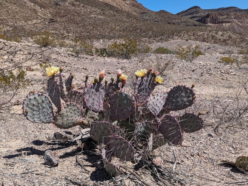
The Chihuahuan Desert does not look empty once you slow down enough to actually see it. The vegetation along the Hoodoos Trail is a masterclass in adaptation, with plants that have figured out how to survive conditions that would flatten most living things.
Cacti of several varieties line the path, some flowering in vivid pinks and yellows depending on the season.
Wildflowers appear in surprising bursts, especially after winter rains. They pop up between rocks and along the sandy sections of the trail in colors that feel almost defiant given how dry the surrounding environment looks.
Spring visits tend to offer the most dramatic floral displays, though fall can bring its own quiet beauty.
The trail supports a healthy variety of bird species, particularly near the Rio Grande corridor. Roadrunners occasionally dart across the path with that characteristic confident stride.
Lizards are almost constant companions on sunny days, darting between rocks so quickly you catch only the tail end of their movement.
Larger animals tend to stay out of sight during the heat of the day, but early morning hikers sometimes spot mule deer moving through the brush near the trailhead. The desert is more alive than it first appears, and the more time you spend on the trail, the more that becomes obvious.
Leashed dogs are welcome on the trail, which is a nice bonus for hikers who prefer four-legged company. The sandy and rocky terrain keeps things interesting underfoot, and most dogs seem genuinely entertained by the parade of desert smells along the route.
When to Go and How to Make the Most of the Visit
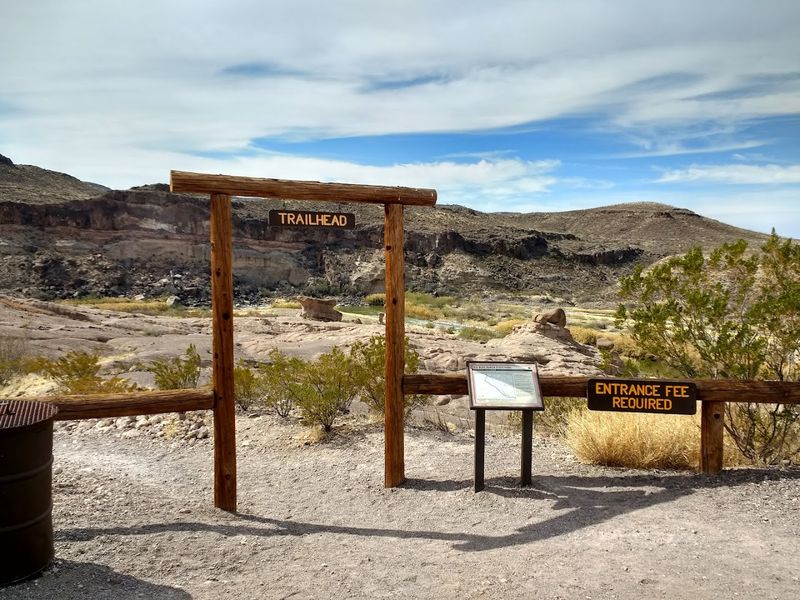
Timing matters a lot on a trail with limited shade in the middle of the Chihuahuan Desert. Spring and fall are the sweet spots, offering temperatures that make the 1.1-mile loop genuinely enjoyable rather than a test of endurance.
Summer visits are possible but demand an early start, ideally before 9 a.m., before the midday heat turns the exposed rock into a radiator.
Early mornings are worth the effort for reasons beyond just temperature. The light during the first hour after sunrise hits the hoodoos and balanced rocks at a low angle, creating textures and shadows that simply do not exist at midday.
It is the kind of light that makes even average photos look considered and intentional.
The trailhead sits along FM 170, approximately 26 miles west of the Barton Warnock Visitor Center. Parking is limited, so arriving early on weekends is a practical strategy rather than just a preference.
There are no restrooms at the trailhead, so plan accordingly before leaving the main road.
Rock cairns, rock baskets, and rock alignments mark the path throughout the loop. Navigation is generally straightforward, but paying attention to these markers helps especially in the sections where the sandy ground makes the trail less obvious.
Bring more water than you think you need. The dry desert air pulls moisture quickly, and the exposed sections of the trail amplify that effect.
A hat, sunscreen, and sturdy footwear round out the essentials for a comfortable and genuinely memorable visit to this underrated West Texas gem.
FM 170, the River Road That Sets the Scene Before the Trail Begins
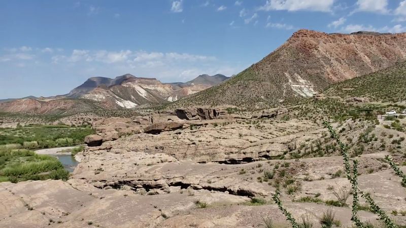
The drive to the trailhead is not just a means to an end. FM 170, known widely as the River Road, is regularly cited as one of the most scenic drives in the entire United States, and spending time on it before reaching the Hoodoos Trail adds a layer of anticipation that genuinely enhances the whole experience.
The road hugs the Rio Grande for long stretches, pulling tight against canyon walls and opening suddenly into wide desert vistas. Mountains rise on both sides of the border, and the river appears and disappears through gaps in the vegetation like it is playing a slow, patient game.
I drove it at a pace that made the person behind me mildly impatient, but some roads deserve that kind of attention.
The stretch between the Barton Warnock Visitor Center to the east and Fort Leaton State Historic Site to the west frames the trail perfectly within the broader landscape of Big Bend Ranch State Park.
Both stops are worth building into the day if time allows, as they add historical and geological context to everything you see on the hike itself.
The road surface is paved but narrow in sections, with limited pullouts. Driving it in good daylight is strongly recommended, especially for first-time visitors unfamiliar with the curves.
Cell service is sparse along most of the route, so downloading offline maps beforehand is a smart move.
FM 170 sets a mood before you ever lace up your hiking boots, and that mood carries through every step of the Hoodoos and Balanced Rocks Trail once you arrive.
Address: FM 170, Redford, TX 79846
