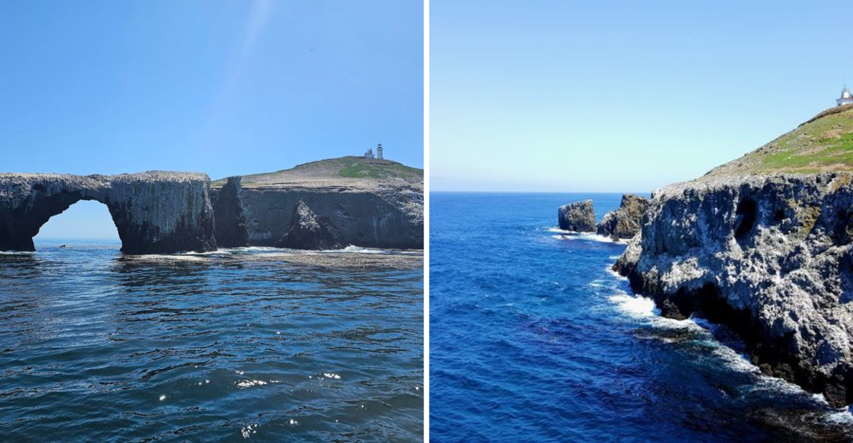
Cliffs rising straight out of the sea, pelicans gliding overhead, and the mainland blurring into the distance. That is what you see from this California island.
The Chumash people called it “Anyapakh,” meaning mirage or illusion. That word fits. I stood on the deck of the boat and watched the island take shape, something raw and windswept and wildly alive.
No beach bars, no resort pools, just open ocean and cliffs that seem to rise out of nowhere. Some places feel like they belong to another world.
This is one of them.
Arch Rock: The Iconic Gateway That Sets the Tone
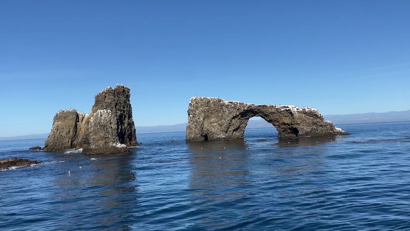
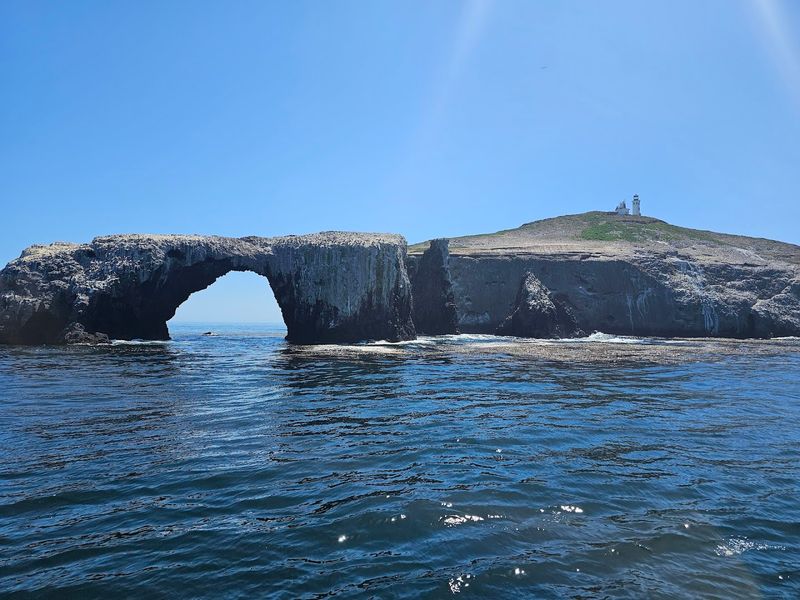
The first real sign that you have arrived somewhere extraordinary comes before you even step off the boat. Arch Rock appears on the eastern tip of Anacapa like a natural welcome gate, a 40-foot volcanic bridge carved by centuries of wind and wave erosion.
It is the official symbol of Channel Islands National Park, and once you see it, you understand why they chose it.
Formed from ancient lava flows that date back somewhere between 15 and 19 million years, this arch represents what happens when geology and patience work together over an almost unimaginable stretch of time. The rock frames a perfect circle of blue ocean behind it, and depending on the light, the colors shift from deep navy to a kind of glowing turquoise.
Photographers tend to linger here longer than anywhere else on the island.
Arch Rock is best viewed from the water, so keeping your eyes open during the boat approach pays off big. Some visitors catch it from the cliff trails above Landing Cove too, which offers a different and equally stunning perspective.
It is one of those landmarks that makes you stop mid-sentence and just stare.
Cliffs That Drop Straight Into the Pacific
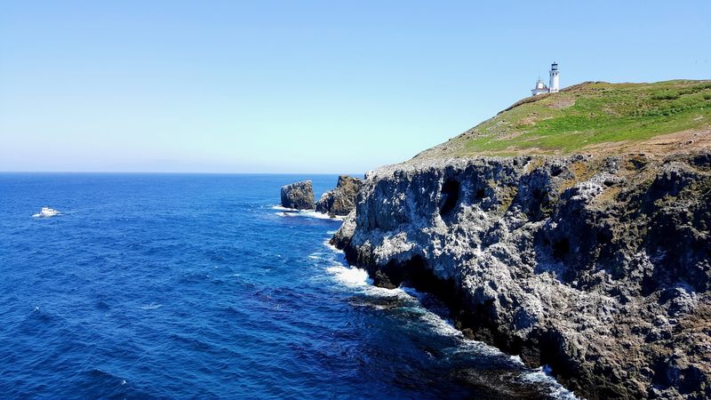
No gentle slopes lead you to the water on Anacapa. The cliffs here are serious, nearly vertical drops that plunge from the island’s plateau directly into the churning Pacific below.
They ring the entire island like a fortress wall, making the place feel both protected and exposed at the same time.
What makes these cliffs so striking is the texture. Layers of volcanic ash, breccia, and hardened lava create a kind of geological storybook that you can actually read if you know what to look for.
Wind and saltwater have spent millions of years sculpting blowholes, sea caves, and dramatic rock stacks along the base. On breezy days, the spray shoots upward through cracks in the rock with a sound that resembles a low, hollow drum.
The trails along the cliff edges stay relatively flat and easy to walk, but the views they offer are anything but ordinary. Looking down from 200 feet above the ocean while sea lions bark somewhere far below is the kind of moment that recalibrates your sense of scale.
The mainland feels genuinely far away up here, not just in miles but in mood. Bring a hat because the wind up on those edges has real opinions about loose gear.
A Wildlife Scene Unlike Anything on the Mainland
Anacapa Island is not a place you visit and then forget. The wildlife alone guarantees that.
The island hosts the largest breeding colony of California brown pelicans in the entire United States, and that fact becomes very real the moment you see them gathered along the western cliffs in enormous, almost theatrical numbers.
Western gulls have claimed every available surface on East Anacapa, especially during nesting season from late spring through summer. There are thousands of them, maybe tens of thousands, calling, squabbling, and watching you with what feels like mild suspicion.
If you visit during hatching season, fluffy gray chicks appear between the rocks like little puffballs with attitude. It is genuinely funny and surprisingly moving at the same time.
Harbor seals and California sea lions haul out on the rocky shores below, their barking carrying upward through the cliffs in waves. The surrounding kelp forests shelter bright orange garibaldi fish, lingcod, and various rays that snorkelers and divers love to find.
Scripps’s murrelets and ashy storm-petrels also nest here, making Anacapa a serious destination for birdwatchers. The island essentially operates as a wildlife preserve first and a hiking destination second, and that priority shows in the best possible way.
Inspiration Point and the Views That Earn Their Name
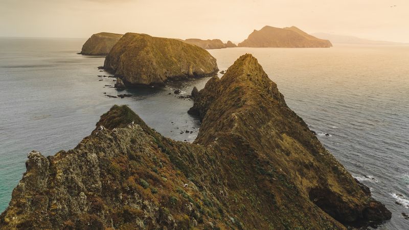
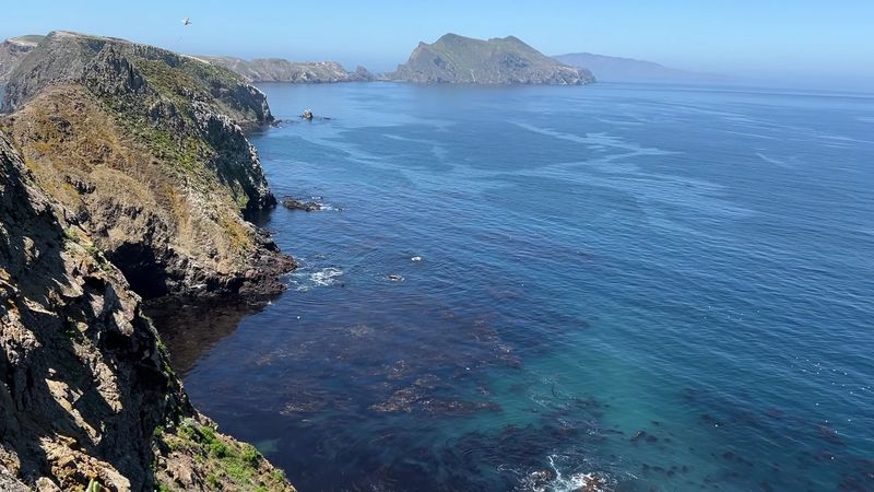
There is a reason the rangers always mention Inspiration Point first when you ask where to go. The viewpoint sits near the western end of the East Anacapa trail and opens up into one of the most expansive ocean panoramas you can reach without a helicopter.
Middle and West Anacapa stretch out below like stepping stones, and on clear days, Santa Cruz Island rises in the distance with its ridgelines catching the light in long golden streaks.
The walk to get there takes maybe 30 to 45 minutes from the landing area, moving along a well-maintained path that winds past gull nesting zones and wildflower patches. Because the island has no trees, the sky feels enormous the entire way.
You are essentially walking across an elevated volcanic plateau with the ocean visible on nearly every side, which creates this pleasant, slightly disorienting sensation of being suspended between sky and sea.
Mornings tend to offer the clearest visibility before the marine layer rolls in. I found the light particularly good in the late morning, when the sun angles across the cliff faces and the water below shifts between shades of deep blue and green.
Binoculars make the experience even richer, especially for spotting sea lions on the rocks far below.
Wildflowers That Transform the Island Each Winter
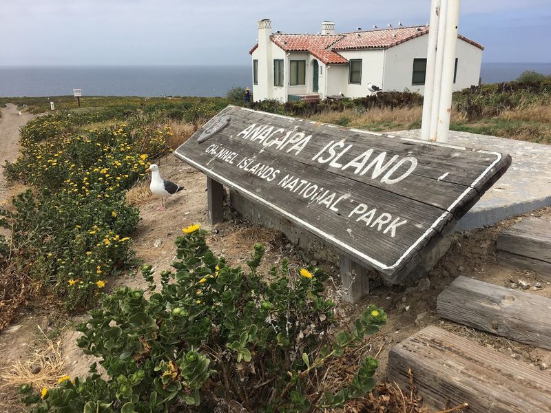
Most people picture Anacapa as a brown, sun-baked rock, and for part of the year, that image is not entirely wrong. But after the winter rains arrive, something remarkable happens.
The island shakes off its dry season look and erupts in color, led by giant coreopsis, a plant that grows nowhere else in the world quite like it does on the Channel Islands.
These plants can reach heights of up to eight feet, and when they bloom, the cliffs turn a vivid, almost electric yellow that photographs look almost too saturated to be real. Red paintbrush dots the spaces between them, island morning glory spills over rocky edges, and pale buckwheat adds softer tones to the mix.
The contrast between the dark volcanic rock and all that brightness is genuinely arresting.
Timing matters if wildflowers are your main goal. Late winter through early spring, roughly January through March, tends to bring the most spectacular displays.
The island supports around 150 native plant species, with 16 found only on the Channel Islands and two species unique to Anacapa itself. That level of botanical specificity makes the island interesting to botanists and casual hikers alike.
You do not need to be an expert to appreciate a cliff covered in yellow blooms above a turquoise sea.
The 1932 Lighthouse and the Island’s Quieter History
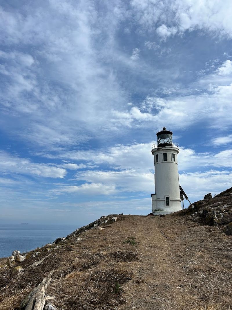
Perched on the eastern plateau of the island, the Anacapa lighthouse has been guiding ships along the Southern California coast since 1932. It is a compact, white cylindrical tower that looks almost modest against the scale of the cliffs around it, but its foghorn once served as the primary warning system for vessels navigating the Santa Barbara Channel in low visibility conditions.
The foghorn emitted a tone every 20 seconds, a rhythmic, droning sound that visitors still talk about in old accounts of the island. Modern navigation has made it largely ceremonial now, but the lighthouse remains one of the most photographed structures in Channel Islands National Park.
The small visitor center nearby offers exhibits on the island’s natural and cultural history, including information about the Chumash people who knew this place long before any lighthouse existed.
Spending time around the visitor center gives context that the trails alone cannot provide. You learn how the island was used as a fog signal station, how keepers lived in isolation for months at a time, and how the park service eventually took over management.
It is a quieter part of the Anacapa experience, a bit more reflective, and honestly a nice counterpoint to the noise and energy of the gull colonies just a short walk away.
Getting There and What to Bring for the Trip
Reaching Anacapa starts at Ventura Harbor, where Island Packers operates boat trips out to the island. The crossing takes roughly an hour each way, and the ride itself is part of the experience.
Dolphins frequently swim alongside the boat, pelicans cruise overhead, and on lucky days, a whale spout appears on the horizon. The return trip back through the Santa Barbara Channel, with the mainland skyline gradually reappearing, feels almost bittersweet.
Once you land, a metal staircase leads up from the dock at Landing Cove to the plateau above. The climb involves over 150 steps, so comfortable shoes with grip matter more than you might expect.
From the top, the trail network covers the entire accessible portion of East Anacapa, roughly 1.5 miles of path that most people complete in under two hours. Middle and West Anacapa remain closed to protect nesting habitats.
Packing well makes the difference between a great day and a rough one. There is no food, no water, and no shade on the island, so bringing more than you think you need is the right call.
Sunscreen, a hat, layers for the wind, and a solid lunch are all essential. Snorkeling gear is welcome at Landing Cove, and the kelp forest there is well worth exploring if the conditions cooperate.
Address: California 93001
