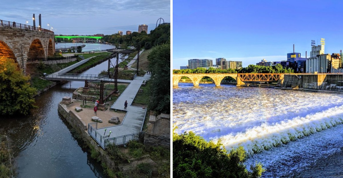
Ruins usually sit behind fences, admired from a distance and nothing more. This Minnesota park does the opposite, letting visitors walk and bike directly through what remains of history.
Crumbling walls once powered an industry that shaped the entire region, now standing quietly beside paved trails instead of humming with machinery. Joggers pass by remnants of foundations daily, some barely noticing what they’re actually running past.
Turning industrial ruins into recreational space this seamlessly takes real vision. Few parks blend history and everyday exercise quite this naturally, letting the past exist alongside modern routines without either one overshadowing the other.
Minnesota rarely showcases its industrial history this openly or this accessibly. Walking through it here feels less like a museum visit and more like stumbling onto something forgotten.
Limestone Foundations of a Flour Empire
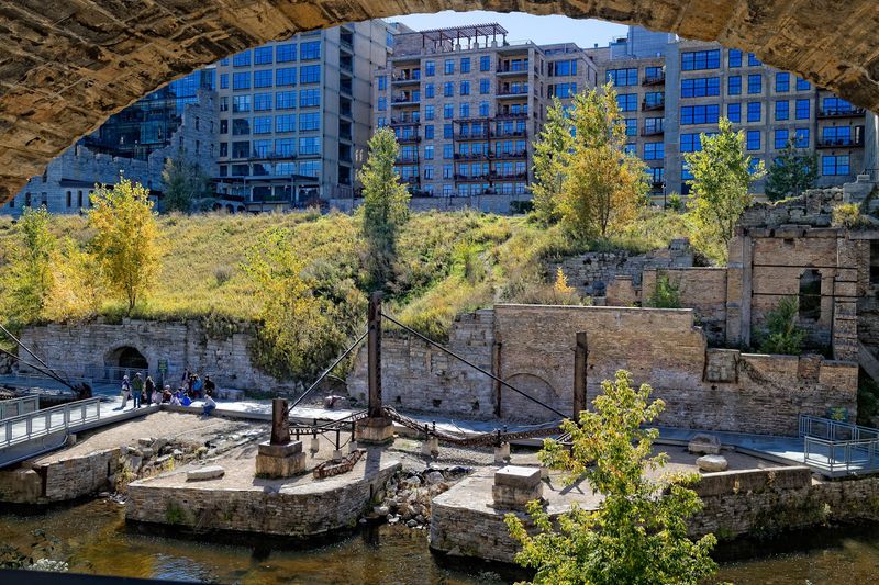
Massive limestone walls sit just below the sidewalk here, and that first glance down into them is genuinely startling. Water still trickles through channels carved for turbines that stopped spinning generations ago.
These are the foundations of the Washburn A Mill complex and its neighbors, the working heart of what was once called the Flour Milling Capital of the World. Panels along the route explain how wheat arrived by rail, got ground into flour, and shipped out under names like Gold Medal.
The lower level runs cooler and quieter than the street above, with brick, stone, and rusted iron framing every turn. Take the stairs at a careful pace, because the surfaces stay damp long after rain.
What sticks in memory is how honest the ruins look. Nothing has been smoothed into a theme park version of the past, and those rough edges do most of the storytelling.
Plan twenty minutes at minimum, closer to an hour for anyone who reads every sign. Sturdy shoes help more than any other bit of gear.
Crossing the Stone Arch Bridge on Foot
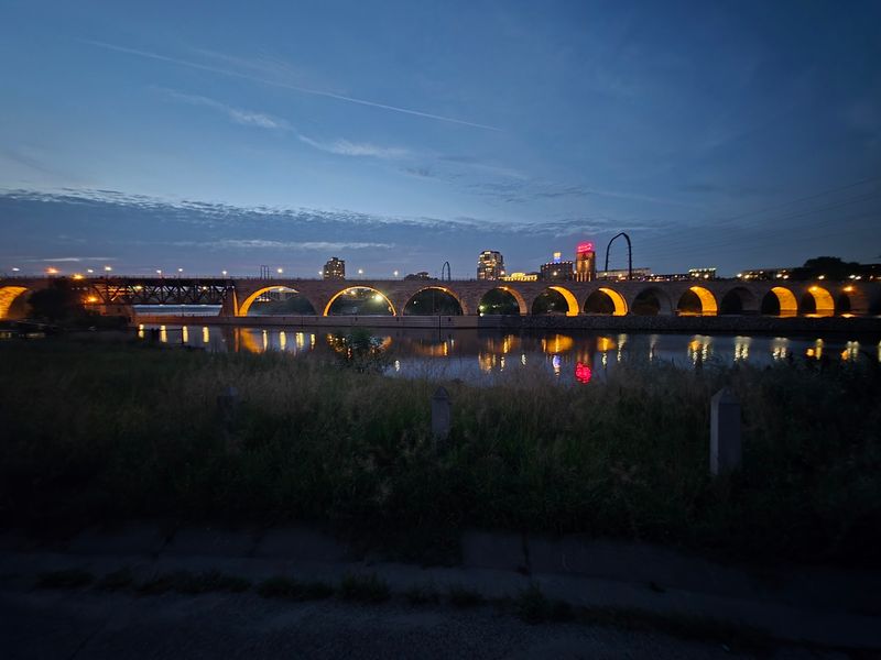
The Stone Arch Bridge curves across the Mississippi like something borrowed from an older continent, and it pulls attention from nearly every corner of the park.
Built for trains in the 1880s, it now carries only walkers, runners, and cyclists. The repeating arches create a rhythm that registers far better at a slow pace than a rushed one.
Halfway out, the view splits neatly in two. Downtown towers and the old mill district fill one side, while the river widens below the falls on the other. Wind picks up over open water, so a light jacket earns its place in the bag even during summer.
Parts of the bridge have gone through repair work in recent years and access can shift, so a quick look at the park website before arriving saves any letdown.
Late daylight turns the granite warm and gold, which explains the small crowd of photographers gathering each evening. Early mornings feel almost private, with river sounds louder than the city.
Crossing takes roughly fifteen minutes at an easy stroll, though stopping often is basically guaranteed.
Where St. Anthony Falls Powered Everything
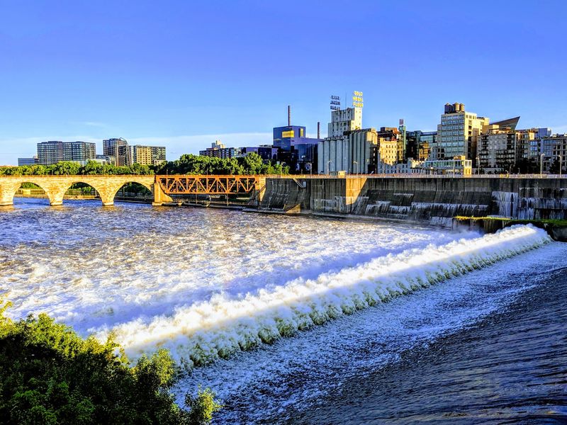
Water is the whole reason this district exists, and St. Anthony Falls makes that obvious within seconds of arriving. The rush of it carries across the park, sometimes a low hum and sometimes a roar depending on the season and recent rainfall. Spring runoff is the loudest show of the year.
Mills clustered along this stretch because the drop in the river gave them free, reliable power long before electricity was practical. Every canal, every tunnel, and every stone wall in the ruins traces back to that one natural advantage.
Overlooks near the lock and dam let visitors watch the churn up close, with mist drifting up on warm days. Railings keep things safe, but the rocks near the water edge shift underfoot and are best admired from a distance.
Geese patrol the grassy areas with real confidence, and giving them space is simply good manners. Winter brings ice formations along the concrete apron that look sculpted, which makes a cold-weather visit worth bundling up for. Bring a hat if the wind is up.
Reading the Story Told by Interpretive Signs
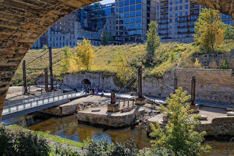
Something clicks when a black and white photograph on a sign lines up with the exact broken wall in front of you. Panels are scattered along the paths, showing the mill district packed with buildings, rail lines, grain elevators, and workers. Comparing then and now becomes a slow, satisfying game.
The signs cover more than the big names. Barrel makers, bag manufacturers, iron works, and rail crews all get mentioned, which fills in the human side of the industry.
General Mills traces its roots to a 1928 merger of milling firms here, and Pillsbury ran enormous operations just across the water. Reading that while standing in the leftover stonework hits differently than reading it in a book.
Kids tend to engage well with the old photos, especially the ones showing men balanced on scaffolding with no safety gear in sight. Allow extra time if history is the main draw, because the panels add up quickly.
A phone camera helps for photographing signs to read again later. Glare can be strong at midday, so angle carefully.
Biking the Riverfront Trails Without Traffic
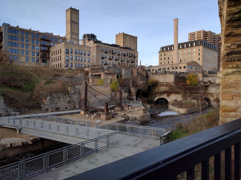
Cyclists have it good here. Paved trails run right through the ruins and then connect outward along the riverfront, so a short visit can stretch into a long ride without much planning.
Grades stay mild overall, with a couple of gentle climbs where the path rises from the lower level back up toward the street.
West River Parkway trails link this area with a much larger network, which means riders can roll toward other parks, bridges, and neighborhoods in either direction. Loops crossing the river on one bridge and returning on another are especially popular.
Weekends bring a friendly mix of families, commuters, and speedier riders, so a bell and a bit of patience go a long way. Occasional construction detours pop up, usually well marked.
Runners share the same pavement, and joggers seem to love this stretch at sunrise. The scenery does half the work of motivating a workout. Bike racks sit near the main entry points, handy for anyone wanting to lock up and explore the ruins on foot.
Down in the Canals Where Water Still Runs
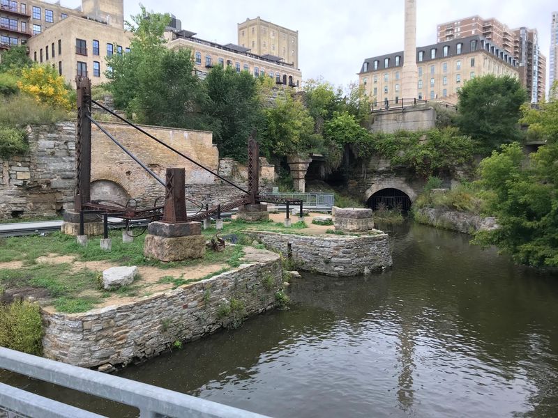
Descending into the excavated canals is the moment the park stops feeling like a normal city green space.
Stone walls rise on both sides, moss creeps along the joints, and clear water moves through channels that once fed waterwheels and turbines. Sound behaves oddly down there, muffled and echoing at the same time.
Small footbridges cross the water, giving a good view straight down into the current. Archaeologists uncovered much of this system after decades buried under parking lots, which makes the whole area feel like a rediscovery rather than a construction project.
Shade keeps things pleasant on hot afternoons, a detail worth remembering in July. Footing varies between smooth pavement, gravel, and older stone, so watch the transitions. Strollers manage most of it, though a few spots require a short detour.
Look for iron fittings still anchored in the masonry, evidence of machinery long since removed. Quiet weekday mornings are ideal for lingering here. Ten minutes of standing still and listening to the water is oddly restorative.
Mill City Museum Built Inside the Wreckage
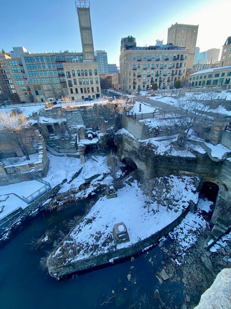
Right at the edge of the park stands a museum built inside the shell of a burned-out flour mill, and the design deserves applause. Glass and steel slot neatly between scarred brick walls, leaving the damage visible rather than hiding it. The contrast between old ruin and new construction is the point.
Even without going inside, the courtyard and exterior are worth circling. Charred window openings and towering walls give a real sense of the mill’s original scale.
The building explains the industry that shaped Minneapolis, from wheat farming to the shipping networks that carried flour worldwide. Pairing an hour indoors with an hour among the ruins makes the whole story land properly. Hours vary by season, so checking ahead prevents a wasted trip.
Restrooms are limited within the park itself, which is another practical reason the museum comes in handy. Families with restless kids will find the indoor exhibits a welcome change of pace. On rainy days, it turns a soggy walk into a solid afternoon.
Skyline and Theater Views Across the Water
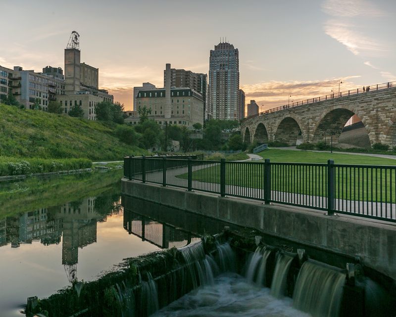
Look up from the stonework and the modern city announces itself in a hurry. The deep blue mass of the Guthrie Theater rises just beyond the mill district, and its cantilevered form makes a striking neighbor for century-old brick. Downtown towers stack up behind, catching light in the late afternoon.
Contrast is the whole appeal of this vantage point. Industrial ruin, contemporary architecture, and moving river all sit within a single frame. Evening brings warm window lights reflecting on the water, which turns an ordinary walk into something a little cinematic.
Benches and low walls give plenty of places to sit and take it in without hunting for a spot. Several nearby restaurants and cafes sit within a few blocks, so a walk here slides easily into dinner plans. The stadium and ballpark are both walkable too, useful on game days.
Winter strips the trees bare and opens up sightlines that summer leaves hide. Different season, different picture, same view worth stopping for.
A Photographer’s Playground in Every Season
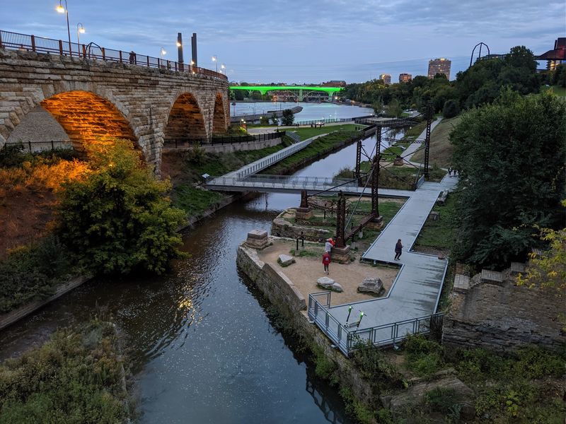
Cameras come out constantly here, and it takes about one minute to understand why.
Texture is everywhere: weathered limestone, rusted bolts, peeling paint, and flowing water, all backed by a skyline and a famous bridge. Portrait sessions and engagement shoots happen regularly, especially in the golden hour before sunset.
Morning light works beautifully on the ruins themselves, hitting the walls at low angles that reveal every chip and crack. Overcast days flatten harsh shadows and suit close-up detail shots.
Autumn adds color along the riverbanks, while winter delivers frost, ice, and a stark quiet that photographs remarkably well. Space is generous enough that a small group can set up without blocking the trail, though staying aware of cyclists is only fair.
Wide lenses handle the canal walls nicely, and a longer lens pulls the bridge arches into tighter compositions. Tripods are manageable on the paved sections. Anyone chasing reflections should aim for calm mornings when the water sits still.
Practical Notes for an Easy Visit
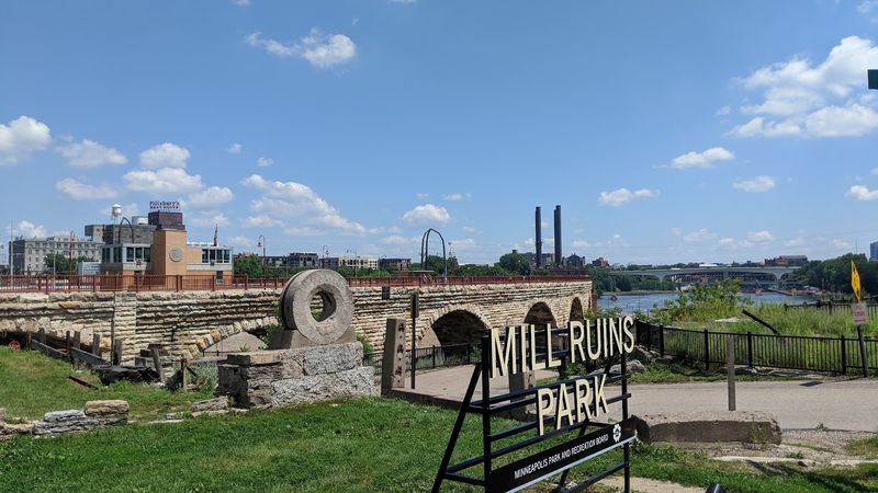
A little planning makes this outing smoother, starting with parking. Nearby lots and ramps fill up during events, and street options can be tight, so arriving earlier in the day or using transit avoids circling the block. Gates open at six in the morning and the park closes at ten at night, every day of the week.
Restrooms and drinking water are scarce inside the park, so filling a bottle beforehand is smart. Food trucks sometimes park nearby, and cafes sit within an easy walk. Dogs on leashes are welcome, and plenty of locals bring theirs along the trails.
Comfortable shoes matter because of stairs, ramps, and uneven historic surfaces. Accessible routes exist, though the lower canal areas involve more effort. Budget somewhere between forty minutes and a full afternoon depending on curiosity levels.
Find it at 102 Portland Ave S, Minneapolis, MN 55401, United States, tucked between downtown and the river and easier to reach than most first-time visitors expect.
