I drove out here expecting a lake. You know, water, boats, maybe some kids splashing around. That is not what I found. What I found was a ghost.
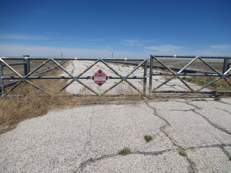
A planned paradise that never quite happened. The boat ramps lead to nothing.
The docks hang over dry grass. It is eerie and fascinating and honestly a little sad all at once.
But here is the thing. I could not look away. There is something strangely beautiful about the whole scene. The silence is loud.
The empty concrete ramps feel like abandoned movie sets. Oklahoma has plenty of gorgeous lakes. This is not one of them. But it might be the most interesting one I have ever visited.
The Grand Plan Behind Optima Lake
Back in the mid-20th century, the U.S. Army Corps of Engineers had big ambitions for the Oklahoma panhandle.
The plan was to dam the Beaver River and create Optima Lake, a sprawling reservoir that would serve multiple purposes at once.
Flood control, water supply, and recreation were all on the agenda. Oklahoma was growing, and federal planners believed a major lake in the western part of the state would be a regional asset for generations.
Construction on the dam began in the 1960s and stretched across more than a decade. By 1978, the dam was officially complete, representing a massive investment of federal dollars and engineering effort.
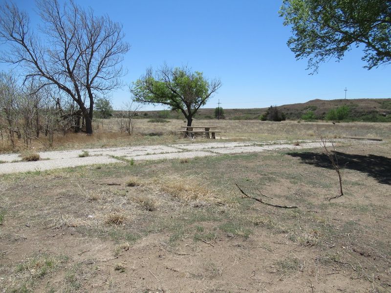
The surrounding area was mapped out for campgrounds, boat ramps, and picnic areas. Families across the Oklahoma panhandle and neighboring states were expected to flock here every summer season.
What nobody fully anticipated was how dramatically the Ogallala Aquifer, the underground water source feeding the Beaver River, would decline due to heavy agricultural pumping across the region. The river slowed to a trickle, and the dream reservoir never filled.
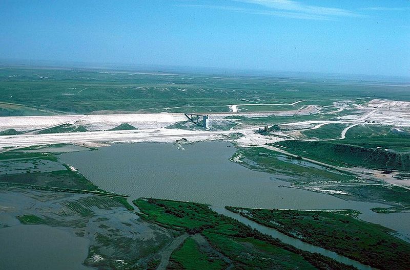
A Dam With No Water
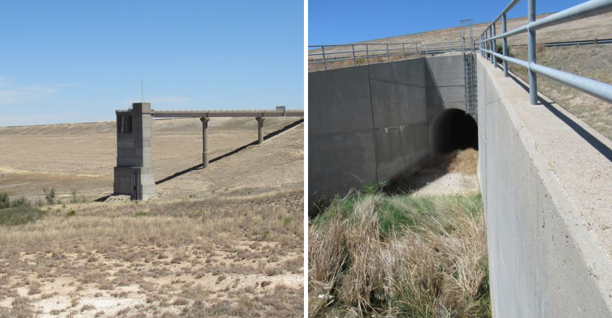
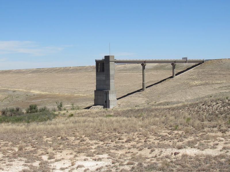
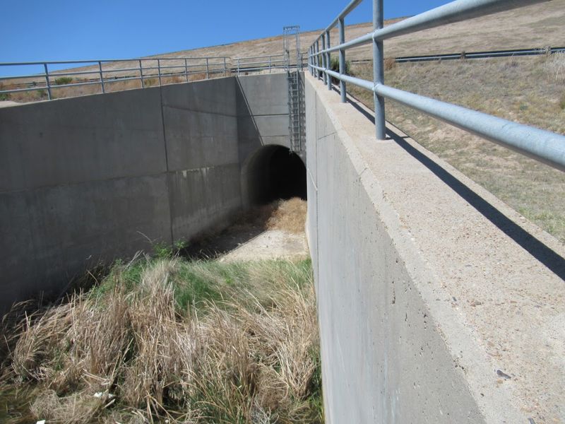
Standing at the base of the Optima Lake dam today is a genuinely strange experience. The concrete structure is solid, well-built, and unmistakably real, yet the reservoir it was designed to hold is almost entirely absent.
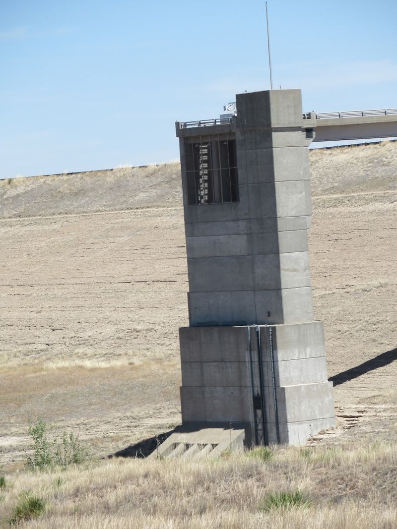
The Beaver River, which was supposed to fill this basin, now runs as a modest, shallow stream through what should have been a deep lake floor. Seeing a full-scale dam towering over a nearly dry streambed is the kind of sight that makes you stop and stare.
The dam itself is located near the small community of Hardesty in Texas County, Oklahoma, in the far western reaches of the state. The address associated with the site falls within Oklahoma 73944, placing it deep in panhandle territory.
Engineers built the structure to handle enormous volumes of water. The spillways, the embankments, and the control structures are all intact and functional in a technical sense.
The cruel irony is that the infrastructure works perfectly fine. There is simply not enough water in the Beaver River to put it to use.
Nature changed the equation, and the dam has been waiting ever since for a lake that may never come.
The Ogallala Aquifer and What Went Wrong
The real story behind Optima Lake is not just about a dam. It is about water, where it comes from, and what happens when it disappears faster than it can be replaced.
The Ogallala Aquifer sits beneath a huge swath of the Great Plains, stretching from South Dakota all the way down through the Oklahoma panhandle and into Texas. For decades, farmers across this region have pumped water from this underground source to irrigate crops.
Agricultural demand on the aquifer grew dramatically through the 20th century. By the time the Optima dam was complete, the Beaver River, which depends on aquifer discharge to maintain its flow, had already begun declining significantly.
Federal planners had modeled the project on historical river flow data that no longer reflected reality. The aquifer drawdown was faster and more severe than anyone had predicted when the dam was first proposed.
Oklahoma sits at the southern edge of this agricultural pumping crisis, and the Optima Lake situation is one of the clearest physical examples of what aquifer depletion looks like on the landscape. The empty basin is essentially a giant, concrete reminder of a water problem that has no easy fix.
Walking the Dry Lakebed
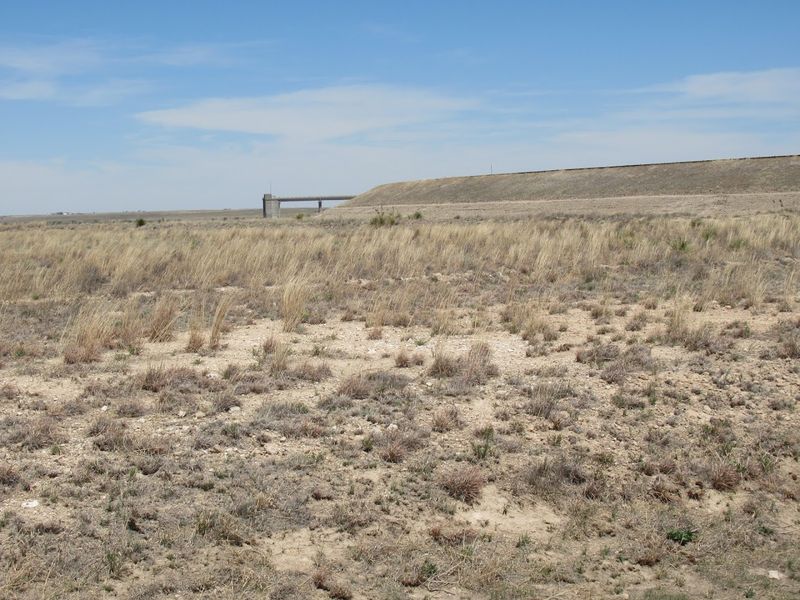
One of the most memorable parts of a visit to Optima Lake is actually stepping out onto the lakebed itself. Where water was supposed to be many feet deep, there is now open ground covered in grass, sand, and scrubby vegetation.
The flatness of the panhandle landscape makes the scene even more dramatic. You can walk for what feels like forever across terrain that should technically be underwater, and the horizon stretches out in every direction with almost no interruption.
Wild grasses have reclaimed much of the basin floor over the decades since the project was abandoned. In spring, patches of wildflowers push up through the sandy soil, adding unexpected color to the otherwise muted landscape.
The ground underfoot has an interesting texture. In some spots it is firm and compact, while in others it feels softer, a reminder that this area does receive occasional water from the Beaver River during wetter periods.
Exploring the lakebed on foot gives you a perspective that is hard to describe. You are standing inside a structure that was engineered to hold a massive body of water, surrounded by open sky and dry Oklahoma air, and the scale of the whole situation becomes very real very quickly.
Wildlife That Moved In Instead
Nature has a way of filling in wherever humans leave space, and Optima Lake is a perfect example of that. The dry basin and surrounding grasslands have become a surprisingly rich habitat for wildlife across the Oklahoma panhandle.
Wild turkeys are one of the most notable residents of the area. Large flocks roam the basin and the surrounding scrubland, and spotting a group of them moving through the dry grass is one of the more unexpected pleasures of a visit here.
Deer are also a common sight, particularly in the early morning and late evening hours when they move through the open terrain with little interference. The absence of heavy human activity has made this a comfortable range for them.
Shorebirds and wading birds occasionally appear along the shallow sections of the Beaver River that still flow through the basin. During seasonal migrations, the area can attract a surprising variety of bird species passing through western Oklahoma.
Coyotes, jackrabbits, and various prairie rodents round out the animal community here. The whole basin functions almost like an accidental wildlife refuge, a place where the ecosystem adapted to the reality on the ground rather than the one planners originally imagined.
The Atmosphere of Abandonment
There is a specific kind of quiet that settles over places like Optima Lake. It is not the peaceful quiet of a mountain forest or a beach at sunrise.
It is something more unsettling, the quiet of infrastructure that was built for crowds that never came.
The concrete is still there. The earthworks are still there.
The access roads, now cracked and edged with weeds, lead to boat ramps that have never launched a single boat into a full reservoir.
Standing near the dam and looking out over the empty basin, you get a strong sense of scale. The project was not small or modest.
This was meant to be a significant recreational destination for the entire region of western Oklahoma and beyond.
The sky above the panhandle is enormous, and on a clear day it presses down on the landscape with an almost theatrical intensity. Clouds move fast across the flat terrain, casting shifting shadows over the dry basin floor.
The overall atmosphere is one that photographers and filmmakers would find immediately compelling. The combination of human-built structures slowly being reclaimed by nature, set against the vast Oklahoma sky, creates a visual drama that is genuinely hard to replicate anywhere else.
The Human Cost of an Empty Promise
Beyond the physical landscape, there is a human dimension to the Optima Lake story that deserves attention. Communities across the western Oklahoma panhandle had real expectations tied to this project.
Local towns hoped the lake would bring tourism dollars, new residents, and economic activity to a region that has always struggled with isolation and limited resources. The promise of a major recreational lake felt like a genuine turning point for the area.
Landowners near the proposed reservoir made decisions based on the assumption that the lake would eventually fill. Some sold property to the federal government during the acquisition process, and the long-term value of surrounding land shifted based on the anticipated development.
When it became clear that the lake would not fill as planned, the sense of letdown across the region was significant. Oklahoma panhandle communities are resilient by nature, shaped by generations of adapting to drought, isolation, and economic hardship.
The Optima Lake situation added one more chapter to a long story of the panhandle making do with less than expected. The dam stands as a physical monument to good intentions, complex hydrology, and the gap between what planners promised and what the land could actually deliver.
What Optima Lake Teaches Us About Water
Optima Lake is more than a curiosity. It is a lesson written in concrete and dry earth about the relationship between water, land use, and long-term planning in the American West.
The Ogallala Aquifer that feeds the Beaver River is a finite resource. It accumulated over thousands of years and is being drawn down in a matter of decades.
Optima Lake makes that abstract fact suddenly very visible and very real.
Standing in the empty basin, it is easy to understand in a gut-level way what aquifer depletion actually means for a landscape. This is not a chart or a statistic.
It is a dry riverbed where a lake was supposed to be.
Oklahoma is not alone in facing these water pressures. Across the Great Plains, similar dynamics are playing out in agricultural communities that depend on groundwater for their survival and economic identity.
The Optima Lake story has become something of a reference point in conversations about water policy, infrastructure planning, and the limits of large-scale federal projects in arid environments.
A visit here leaves you thinking about water in ways that no textbook or documentary quite manages to achieve on its own.
Dear Reader: This page may contain affiliate links which may earn a commission if you click through and make a purchase. Our independent journalism is not influenced by any advertiser or commercial initiative unless it is clearly marked as sponsored content. As travel products change, please be sure to reconfirm all details and stay up to date with current events to ensure a safe and successful trip.