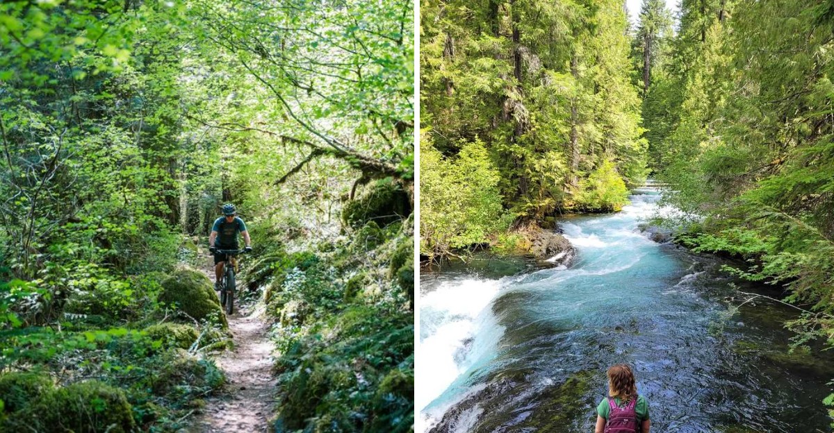
Fall foliage usually means driving hours toward somewhere crowded and photographed to death. This Oregon trail offers something better, color without the chaos most leaf peeping spots come with.
Leaves turn gradually along the path, reds and golds mixing with evergreens still holding their color from summer. Water runs alongside much of the route too, adding movement and sound that somehow makes the whole walk feel more alive than a typical fall hike.
Few trails hit peak color this reliably within such a specific late September window. Hikers who time it right often describe the timing as almost accidental luck, though longtime visitors know exactly when to show up.
Oregon’s fall color rarely gets discussed as much as its coastline or waterfalls. This particular stretch deserves equal attention, timed perfectly for anyone willing to plan around it.
Vine Maples Lighting Up The Understory
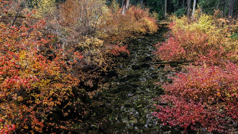
Red is the color that hits first out here, and it comes from vine maple growing low beneath the big conifers. Late September is when those leaves start shifting from green to orange to a deep scarlet.
Because Douglas firs stay dark and evergreen all year, the contrast becomes dramatic. The forest floor turns bright while the canopy stays shadowy and cool, and the effect looks almost staged.
Hikers who visited in early October have described the autumn color along the stretch from Ice Cap Creek toward Tamolitch as genuinely striking. Arriving a week or two earlier catches the first wave, with fewer leaves on the ground and more still glowing overhead.
Morning light works best for photos here. Sun slants sideways through the trunks and makes the maple leaves look lit from behind, like stained glass. Bring a jacket. The riverside air runs cool even on warm afternoons, and the shade holds that chill well past noon.
Sahalie And Koosah Falls, The Loop Worth Repeating
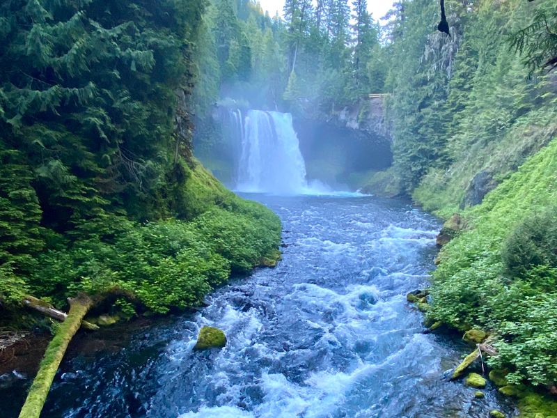
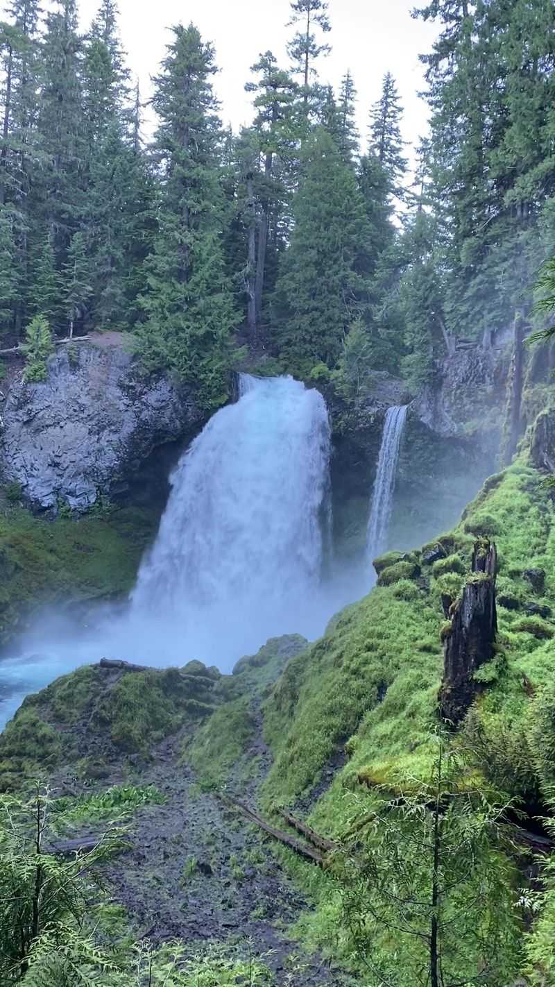
A short loop of roughly 2.5 miles connects two waterfalls, and it delivers more scenery per step than almost anything else in the Cascades. Sahalie drops first, then Koosah follows downstream.
The trail crosses the river and returns on the far bank, which means each fall gets viewed from several angles. Spray drifts across the path in places, so the rocks stay slick and the moss stays impossibly green.
Plan on two to three hours if stopping often, and stopping often is basically guaranteed. Rock and root trip hazards fill parts of the tread, so sturdy shoes matter more than speed.
Searching for Sahalie Falls or Koosah Falls tends to work better than the general trail name when navigating, since mapping apps sometimes point drivers to the wrong pullout.
Autumn adds gold and rust to the frame around all that white water. It is the same loop, and somehow it looks like a different place in September.
Tamolitch Blue Pool And Its Unreal Color
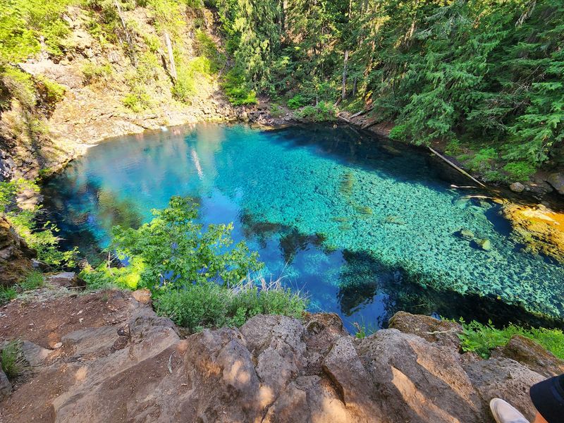
Nothing quite prepares a first-time visitor for the color of Tamolitch. The pool sits at the base of lava cliffs, fed by underground springs, and the water reads as an electric turquoise that photographs almost look edited.
Getting there involves a rolling forest walk that starts easy and turns rocky and winding around the halfway mark. The final scramble down to the water is genuinely steep.
Round trip distances vary depending on the trailhead chosen, with the Ice Cap Creek approach running close to 6.7 miles out and back. Water and decent traction are non-negotiable.
Late September helps in two ways. Cooler temperatures make the climb more comfortable, and the surrounding foliage frames that blue with warm color instead of flat summer green.
The pool stays frigid year-round because of its spring source. Looking is the safer plan, and honestly the view from the rim is the point anyway.
Riding The Full 26 Miles On Two Wheels
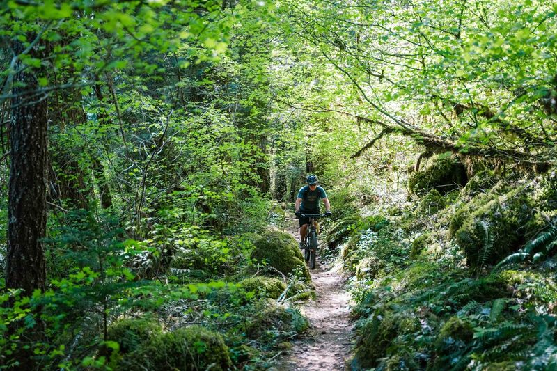
Mountain bikers treat this trail as a bucket-list ride, and the full route runs 26 miles of singletrack from the upper reaches down toward the lower forest. Riders who have done it in one push report finishing in about six hours with plenty of stops along the way.
The upper half leans intermediate to advanced, with lava rock gardens and exposed cliff sections that demand attention. The lower half sits closer to beginner and intermediate, though it includes a bit more climbing than expected.
Starting at the Blue Pool trailhead skips most of the technical lava and still delivers fast, flowing downhill through the woods. A bike bypass exists around the busiest pool viewpoint, which keeps foot traffic and wheels separated.
Autumn riding means wet leaves and slick roots, so braking early is wise. Rain does not ruin the tread here, but it does change the grip. Shuttling with a friend saves the long return pedal.
Old Growth Giants And Deep Green Moss
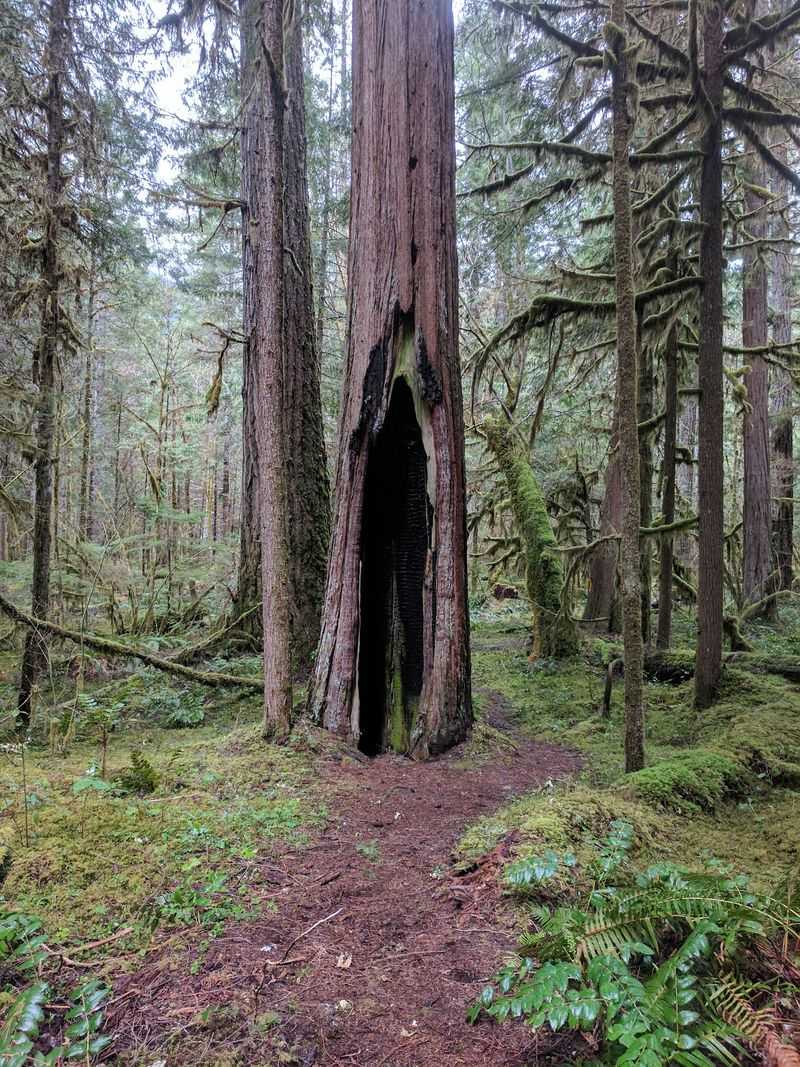
Some of the trees along this corridor have been growing for centuries, and standing beside a trunk that wide changes the sense of scale pretty quickly. Douglas firs dominate, joined by cedars and hemlocks in the damper hollows.
Moss covers nearly everything that holds still long enough. Fallen logs turn into nurse trees, sprouting seedlings straight from their decaying tops.
Visitors sometimes compare the grove to redwood forests. The trees here are not coastal redwood size, but the atmosphere hits a similar note, quiet and cathedral-like.
September light does something specific in old growth. Beams cut through gaps in the canopy at low angles and catch dust and moisture in the air, which makes the whole understory glow.
The forest above the Rainbow area remains especially lush, while sections below were affected by wildfire. Seeing both stretches back to back offers an honest look at how these woods recover over time.
Clear Lake, Where The Sunken Forest Waits Below
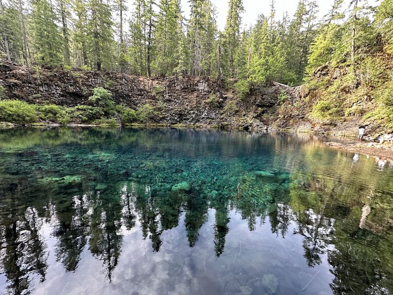
At the northern end of the trail system sits Clear Lake, and the name is not exaggeration. Spring-fed water lets visitors look straight down at tree trunks that were drowned when lava dammed the valley thousands of years ago.
Paddlers glide over that submerged forest on calm mornings. From the shoreline, the shapes below the surface look like shadows until the light angle shifts and they sharpen into actual trees.
The lake sits at higher elevation than the lower trail sections, which means autumn color arrives here a little earlier. Late September often catches the first real turn.
Trails wrap the shoreline and connect toward the falls downstream, making it easy to build a half-day outing without driving between spots.
Cold air settles over the water overnight and lifts as mist after sunrise. Getting there early is worth setting an alarm for, even if coffee has to happen in the car.
Lava Fields That Interrupt The Forest
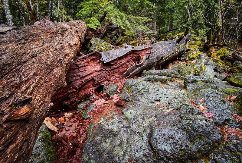
Just when the walking settles into a rhythm of soft dirt and needles, the trail spills onto black lava. Ancient flows from nearby volcanoes buried whole sections of this valley, and the rock never fully softened.
Footing gets awkward here. Sharp edges and loose chunks make each step deliberate, and cyclists often describe these stretches as the most technical part of the entire route.
What makes the lava fields memorable is the contrast. Dark stone, bright orange shrubs taking root in the cracks, and evergreen forest pressing in from both sides.
The river sometimes disappears underground beneath this porous rock, which explains why certain stretches run dry while springs erupt downstream. Geology does the strange work quietly.
Gloves are not a bad idea for anyone scrambling. A fall on lava leaves a mark that lasts longer than the hike. Sunlight heats the rock fast, so these open sections feel warmer than the shaded woods.
Picking The Right Trailhead For The Day
Access points are scattered along Highway 126, and choosing well makes a real difference. Mapping apps do not always land drivers in the right spot, so a little planning helps.
The lower trail near Jennie B. Harris Wayside runs flat but hugs the highway closely, and one stretch follows the road shoulder. Heading further east improves the scenery quickly.
A ranger station a couple of miles east of that wayside works well as a starting point, both for the trail itself and for current condition updates. Trail closures have appeared in past seasons, with signage on the ground but little warning online.
Parking areas tend to be small, especially at the popular waterfall and pool trailheads. Arriving before mid-morning solves most of that problem.
Bridges, Creeks And Quiet Riverside Pauses
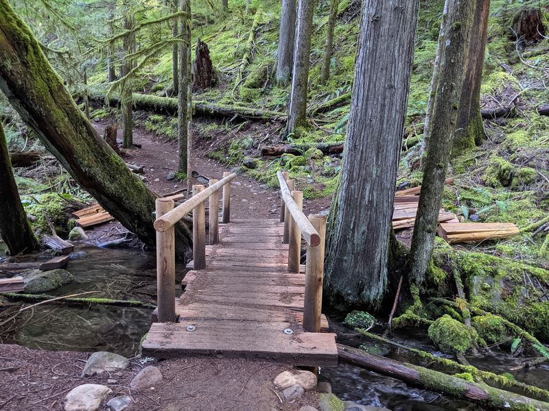
Counting the footbridges becomes a small game after a while. Dozens of creeks feed the McKenzie, and the trail crosses them on simple wooden spans that creak just enough to be charming.
Ferns crowd the banks. Water runs so clear that the stones on the bottom look magnified, and the sound follows hikers for miles.
Picnic areas dot the corridor with tables and fire rings, and some are tucked far enough off the highway to feel private. A short spur down to the water makes a fine lunch stop.
Rafters float past on the busier sections, and waving them along is a low-effort form of entertainment. Boat launches serve kayaks, canoes and paddleboards at a few points.
The current moves fast and cold, so wading calls for caution. Sitting on a warm rock and watching it go by works just as well. Dogs are welcome, and plenty of friendly ones pass by.
What To Pack For A Late September Visit
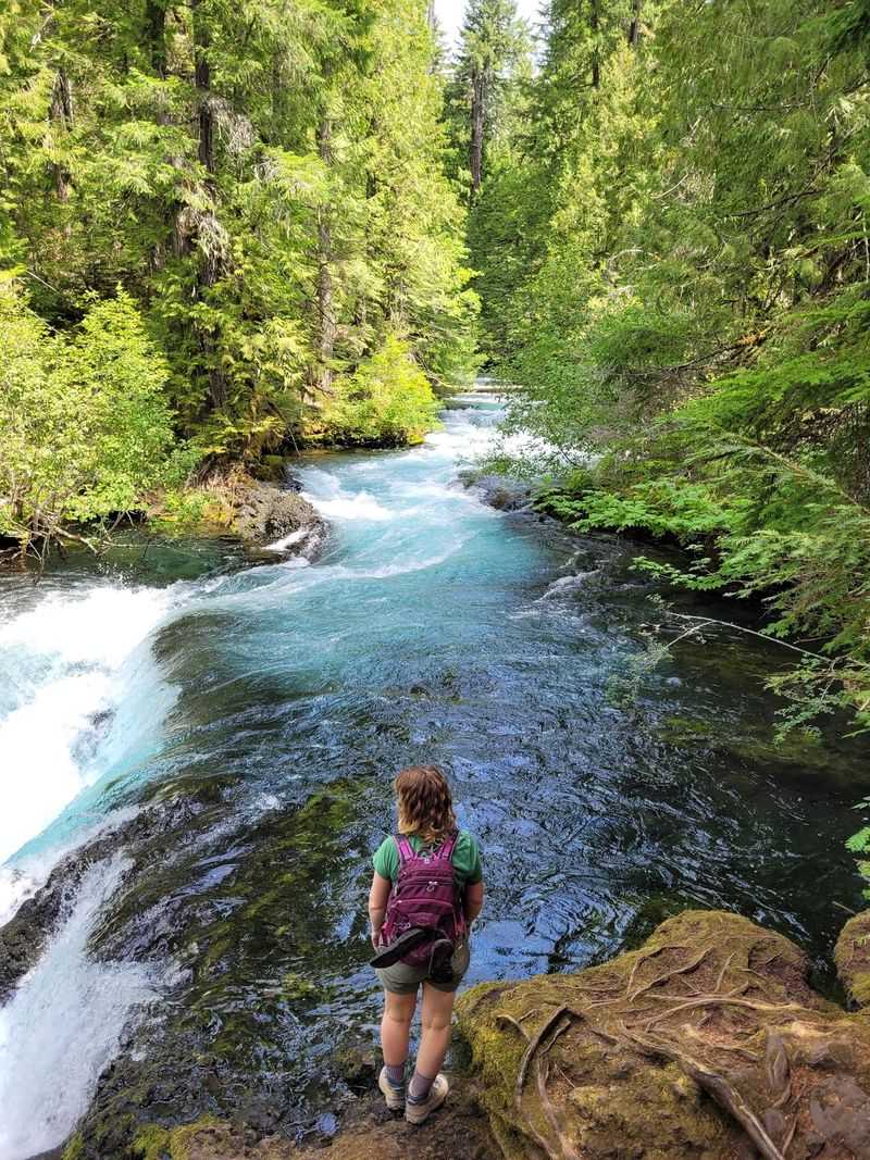
Packing for autumn in the Cascades means preparing for two seasons in one afternoon. Sunny pullouts feel mild while shaded riverside stretches hold a steady chill.
Layers solve most of it. A light rain shell earns its space even on clear forecasts, since weather rolls in over the ridges without much notice.
Water is essential because the trail runs long between services, and treating river water is not worth the gamble. Snacks help too, especially on the longer out-and-back routes.
Traction matters here more than on smoother paths. Roots, wet leaves and lava rock combine into a surface that punishes worn-out soles.
Riders who have pedaled the full route in steady rain reported the tread held up fine, which says something about how well the trail is maintained. Still, mudguards keep the day pleasant.
Pack out everything brought in. Leaving the moss and leaves undisturbed keeps this corner of Oregon looking the way it does in photographs.
