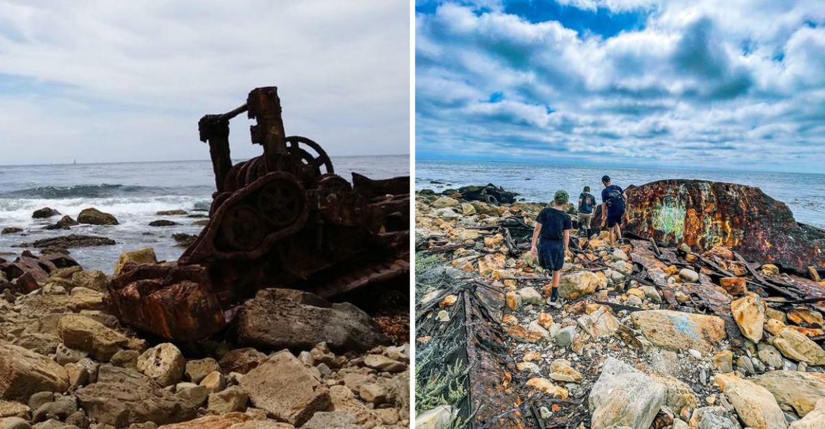
Massive cargo ship rusting into a California coastline, waves crashing around it like nothing unusual is happening. Wedged into a rocky reef since March of nineteen sixty one.
Dense fog and rough seas sent it grinding into the rocks. I had heard about it from a friend who described it as one of those places that feels hidden even though it sits in plain sight. Getting there is half the adventure, a boulder hopping trek with ocean spray in your face.
Once the rusted hull comes into view, it stops you in your tracks.
The Story Behind the SS Dominator
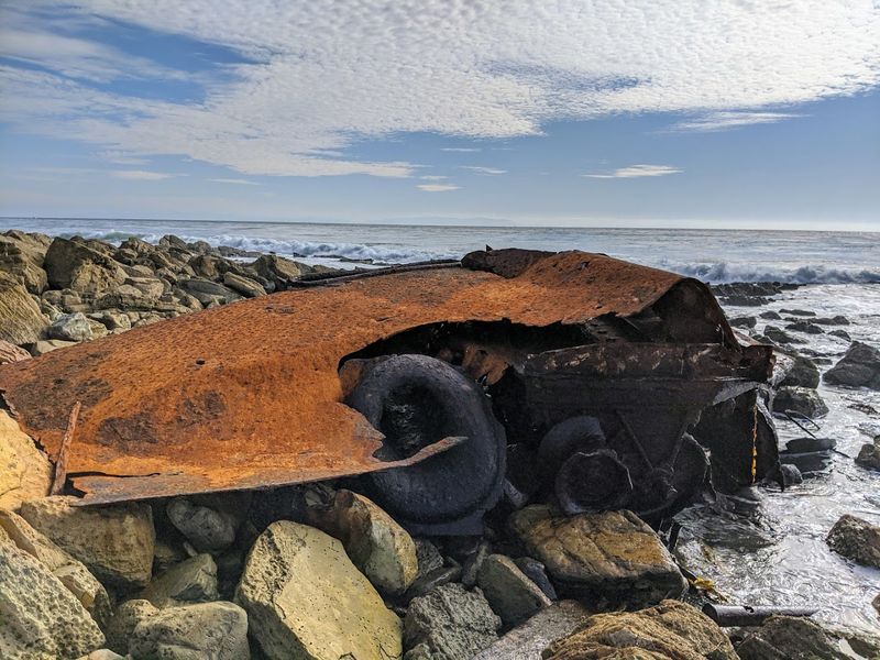
Long before it became a rusted landmark on the California’s Palos Verdes coastline, the SS Dominator had already lived several lives. Originally launched on March 31, 1944, as the Melville Jacoby, the vessel was a World War II American Liberty ship built to haul cargo across wartime waters.
After the war ended, it passed through commercial hands and collected new names along the way: SS Victoria, then SS North Queen, and finally SS Dominator.
By 1961, the ship was Greek-owned and loaded with over 10,000 tons of wheat and beef, bound from Portland, Oregon, toward Long Beach for refueling before continuing to Algiers. On the night of March 13, thick fog rolled across the water and a navigational error sent the ship straight into a rocky reef off Palos Verdes Point.
The Coast Guard and tugboats worked for two days trying to pull her free, but high winds and heavy seas kept pushing the hull deeper into the rocks.
Eventually, the crew abandoned ship. The rotting cargo drew flies, rats, and a smell that reportedly reached nearby neighborhoods.
The vessel was later auctioned, sparking disputes between buyers of the hull and buyers of the cargo. Nobody ever moved her.
What the Wreck Looks Like Today
Rust tells a story better than most museum placards ever could. What remains of the SS Dominator today is scattered across the rocky shoreline between Lunada Bay and Malaga Cove, a collection of twisted hull sections, metal decking, and mechanical components slowly being swallowed by the sea.
The wreckage is most visible at low tide, when the water pulls back and exposes more of the ship’s bones.
The bow, parts of the hull plating, and various structural pieces are still recognizable if you know what you are looking at. Decades of wave action have broken the original mass into fragments spread across a wide stretch of reef.
Each visit can look slightly different depending on recent swells and tide levels.
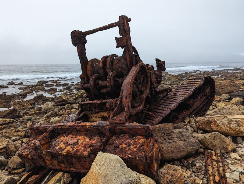
Perhaps the most unexpected detail is the rusted remains of a bulldozer sitting among the wreckage. It was brought in during early salvage and disposal efforts and never made it back out.
Seeing it there, half-submerged and oxidized beyond recognition, adds a strange layer to the whole scene. The wreck has shrunk considerably over the years, so catching it now while there is still something meaningful to see feels genuinely worthwhile.
Getting Down to the Shore
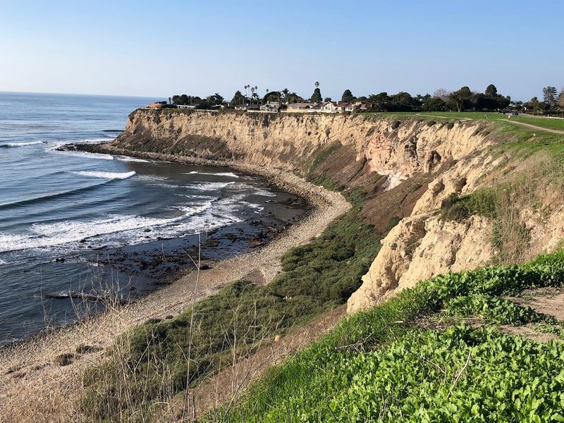
Reaching the SS Dominator is not a casual stroll, and that is honestly part of what makes it feel like a real find. There is no paved path, no ranger station, and no signage pointing the way.
Most visitors use the Drain Pipe Trail, named for the massive half-buried concrete drainage pipe that runs down the bluff face near Palos Verdes Drive West. It is steep and requires careful footing, but it cuts the overall distance to roughly 1.5 miles round trip.
Another option starts near Lunada Bay Canyon at coordinates that put you about half a mile south of the wreck. From there, you head north along the shoreline, boulder-hopping until the rusted hull comes into view around a rocky bend.
A third route follows the Palos Verdes Coastline Trail for a longer 4.6-mile round trip that is more gradual but adds significant time to the outing.
Whichever way you choose, expect the descent to feel a little sketchy and the beach walk to feel slow. The cobblestone shore shifts underfoot and demands full attention.
Bring water, wear sunscreen, and leave the flip-flops at home. This one rewards preparation.
Footwear and Gear That Actually Matter Here
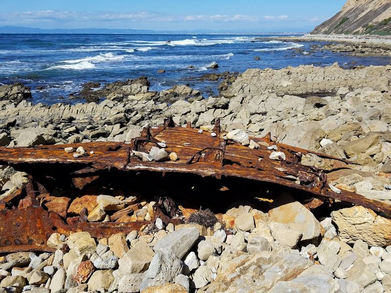
Almost every person who has made this trek mentions the same thing: your shoes will make or break the experience. The beach here is not sand.
It is entirely made up of large, rounded cobblestones and loose rock that shift and roll with every step. One wrong placement and a twisted ankle becomes very real, very fast.
Hiking boots with solid ankle support are genuinely the right call. Trail runners with good grip work too, but anything low-cut or soft-soled will leave you wobbling and second-guessing every move.
Water shoes with ankle support are worth considering if there is any chance of getting your feet wet near the wreck, which is likely at anything above the lowest tides.
Beyond footwear, bring a hat and sunglasses because there is zero shade along the entire route. A reusable water bottle is essential since there are no facilities, no bathrooms, and no vendors anywhere near the site.
A small first aid kit is not a bad idea either, given the rusted metal scattered across the reef. The wreck has sharp edges, and curiosity has a way of getting people closer than they planned.
Going prepared means going happy.
Timing Your Visit Around the Tides
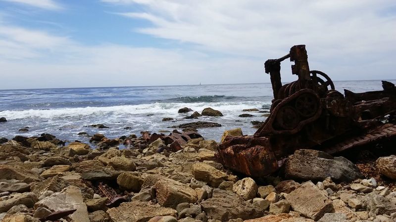
Tide timing is not optional here, it is the difference between a great visit and a genuinely risky one. At high tide, the narrow cobblestone shore shrinks dramatically, and in some sections it disappears entirely beneath the water.
There are very few places along the bluff base where you could safely climb up if the tide came in faster than expected.
Going at or just before low tide opens up the most shoreline and reveals the greatest amount of wreckage. It also makes the boulder-hopping section significantly easier since wet rocks are considerably more slippery than dry ones.
Checking a reliable tide chart before heading out is a simple step that removes most of the uncertainty from the trip.
Morning visits tend to work well for a few reasons. The light is softer and better for photos, the surfers who use the area early tend to be heading back up as casual visitors arrive, and parking along the street is easier to find before midday.
The site is technically open 24 hours, but navigating that rocky shore in low light adds unnecessary difficulty. A mid-morning arrival timed with a low tide is the sweet spot most experienced visitors recommend.
Tide Pools, Crabs, and the Wildlife Factor
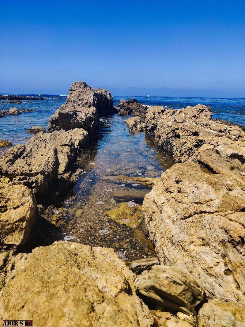
The shipwreck gets most of the attention, but the tide pools along this stretch of coast are genuinely worth slowing down for. The rocky reef that claimed the SS Dominator also happens to create excellent habitat for intertidal marine life.
Hermit crabs, small fish, sea anemones, and various crustaceans populate the pools that form between the boulders at low tide.
Kids especially tend to get completely absorbed by the tide pools, sometimes more so than the wreck itself. Crouching down near the water’s edge and watching a tiny crab navigate its rocky world has a way of making the whole outing feel richer.
The marine life here is protected, so looking is the move, not touching or collecting.
Seabirds work the shoreline regularly, and if you sit quietly near the water for a few minutes, the whole area starts to feel surprisingly alive. The combination of shipwreck history and active coastal ecosystem makes this more than just a novelty stop.
It is a genuinely layered experience that rewards the people who take their time rather than rush straight to the rusted metal and back. Bring binoculars if you have them.
Practical Tips Before You Go
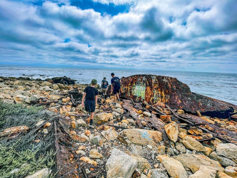
A few practical details can make a real difference between a smooth outing and a frustrating one. Street parking is available along Paseo Del Mar near the trail access points.
Two commonly referenced starting spots are near 2416 Paseo Del Mar and 1801 Paseo Del Mar, both of which put you within reach of trails leading down to the shoreline. Arriving before late morning generally makes parking easier to find.
There are no restrooms anywhere along the route, so plan accordingly before leaving the car. The trail down is steep and can have loose debris, so moving slowly and testing each foothold before committing is genuinely good advice rather than overthinking it.
Going with at least one other person is a smart call given the remote feel of the location once you are down on the beach.
Cell service can be spotty along the bluff base, so downloading an offline map beforehand removes a potential headache. The site is listed on Atlas Obscura and has a Google Maps pin that helps with navigation to the general area.
Once you are down on the rocks and the rusted hull comes into view, all the planning pays off immediately. Address: Palos Verdes Estates, California 90274.
