You are walking along a trail in North Dakota. Nothing special.
Grass. Prairie.
The usual. Then someone tells you the name and everything changes.
The trail is named after a coal fire that started when a lightning bolt struck the ground in the 1950s. That fire burned underground for nearly thirty years.
Smoldering beneath the surface, heating the soil, killing trees from the roots up. Locals could see smoke rising from cracks in the earth for decades. A thunderbolt started it.
Time and geology kept it going. The fire finally died out in the 1980s, but the name stuck.
Now people hike across ground that once cooked from the inside out. North Dakota has some strange history.
This might be the strangest.
The Lightning Strike That Started It All
Most trails get their names from a river, a mountain, or a famous explorer. The Coal Vein Trail earned its name from a single bolt of lightning that hit the ground in 1951 and accidentally started one of the most unusual geological events in North Dakota history.
That strike ignited an exposed coal seam buried beneath the badlands near Medora. The coal caught fire underground and kept burning, slowly and steadily, for 26 consecutive years.
Nobody put it out. Nobody really could.
The fire smoldered until 1977, quietly transforming everything around it. You might think a fire that lasted nearly three decades would be headline news, but out here in the remote badlands, it just burned in silence while the world moved on above it.
What makes this story so fascinating is how ordinary the starting point was. Thunderstorms roll through the Great Plains constantly.
Lightning hits the ground all the time. But this particular strike found exactly the right spot at exactly the right moment, and the result shaped this trail forever.
Visiting the Coal Vein Trail today means walking through the physical evidence of that one electric moment in 1951. The land still tells the story clearly.
Coal Beneath the Badlands: A Hidden Resource
Before the fire, before the trail, there was simply coal. The badlands of western North Dakota sit on top of enormous deposits of lignite coal, formed millions of years ago from ancient swamps and forests that slowly compressed under layers of sediment.
Lignite is a softer, younger type of coal compared to the harder varieties mined elsewhere. It burns at lower temperatures but can still sustain a fire for an incredibly long time when the conditions are right, as this trail proves beyond any doubt.
Erosion in the badlands constantly exposes new coal seams at the surface. Wind and water carve away the softer surrounding rock, leaving dark coal veins visible in the hillsides like dark ribbons running through the colorful layers of tan, gray, and rust-colored earth.
That natural exposure is exactly what made the 1951 lightning strike so consequential. The coal was already sitting right at the surface, ready to catch.
All it needed was a spark, and the storm provided one.
Walking along the trail today, you can still spot coal fragments and dark sediment mixed into the soil. It is a small detail, but it makes the whole story feel real and grounded in a way that no sign or pamphlet fully captures.
Clinker and Scoria: Fire Turned to Rock
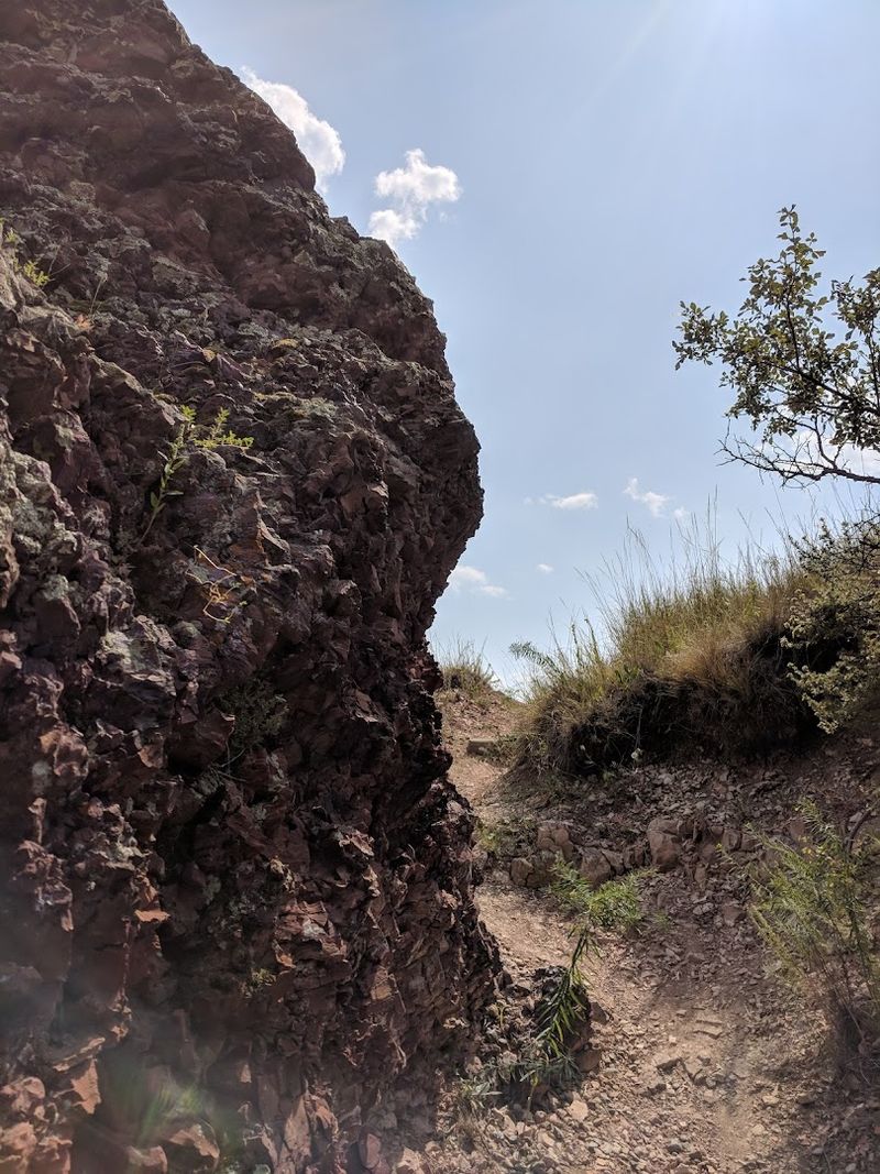
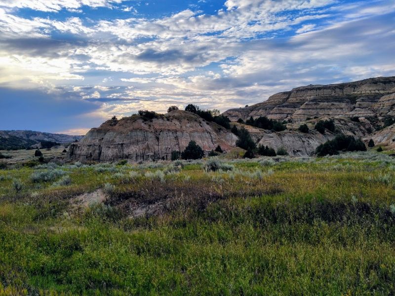
One of the first things you notice on the Coal Vein Trail is the color. The ground shifts from ordinary tan and gray badlands earth into vivid shades of red, orange, and deep rust.
That color is not paint. It is the result of underground fire.
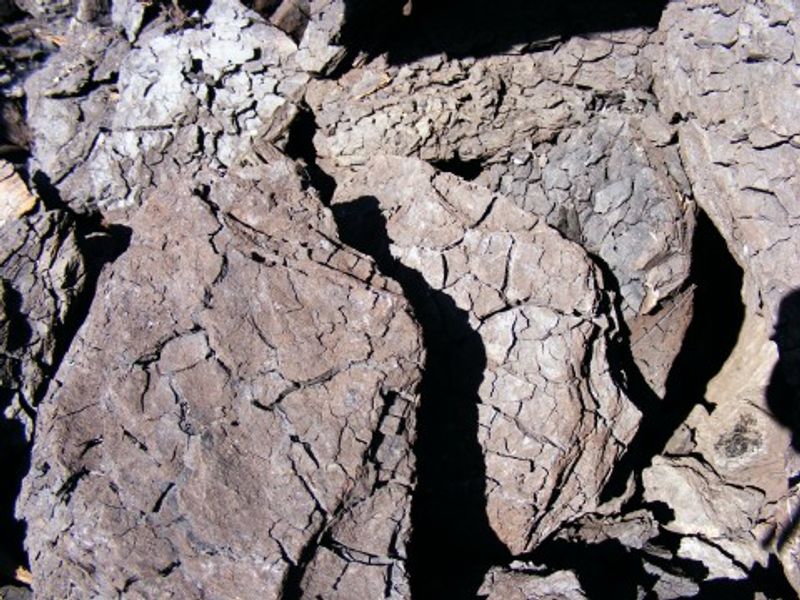
When coal burns beneath clay and shale for years, the intense heat bakes the surrounding rock into a hard, brick-like material called clinker, sometimes also called scoria. It looks almost industrial, like something you would find in a kiln, but it was made entirely by nature.
The texture is rough and porous, and the color ranges from pale pink to deep burgundy depending on how close the rock sat to the burning coal. Some pieces are almost glassy.
Others crumble easily in your hand if you pick them up from the ground.
Clinker actually plays an important ecological role in the badlands. Because it is harder than the surrounding rock, it resists erosion and forms ridges and caps that protect softer material underneath.
Many of the dramatic formations you see throughout the park owe their shapes to clinker.
Seeing it up close on this trail, knowing exactly how it formed, gives it a completely different meaning than just admiring colorful rocks from a distance.
The Trail Itself: Short, Easy, and Surprisingly Powerful
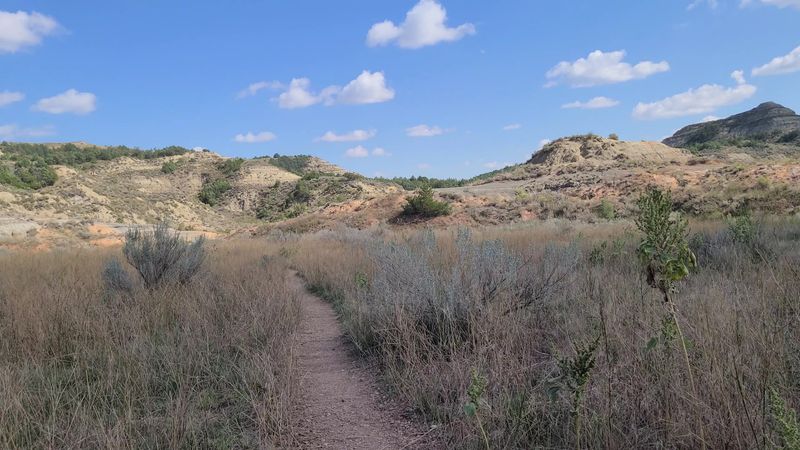
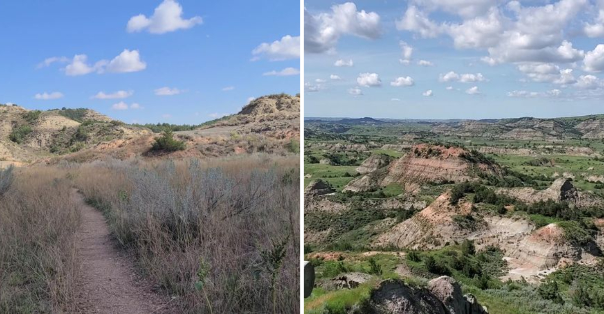
At roughly 0.8 miles long, the Coal Vein Trail is one of the shortest loops in Theodore Roosevelt National Park. You can complete it comfortably in about 30 to 45 minutes, making it an ideal stop even if you are just passing through the South Unit on a road trip.
Do not let the short distance fool you into thinking there is nothing to see. The trail packs an impressive amount of geological variety into less than a mile.
Red clinker fields, exposed coal fragments, prairie grasses reclaiming scorched ground, and sweeping badlands views all appear within a short walk of each other.
The path is well-marked and easy to follow, with interpretive signs along the way explaining the fire, the geology, and the slow ecological recovery of the area. Those signs are genuinely informative without being overwhelming.
Families with young kids will find this trail very manageable. The terrain is relatively flat with only gentle elevation changes, and there is enough visual interest at every turn to keep curious minds engaged throughout the whole loop.
I found myself stopping constantly, not because I was tired, but because every few steps offered something new worth looking at closely. That rhythm of discovery is what makes this short trail feel much bigger than its mileage suggests.
Gateway to the Maah Daah Hey: A Bigger Adventure Begins Here
The Coal Vein Trail does double duty as both a self-contained nature walk and the southern starting point for one of North Dakota’s most celebrated long-distance routes, the Maah Daah Hey Trail.
Stretching roughly 144 miles through the badlands, the Maah Daah Hey connects the South Unit of Theodore Roosevelt National Park to the North Unit, passing through the Little Missouri National Grassland along the way. It is a serious trail used by hikers, mountain bikers, and equestrians alike.
The name comes from the Mandan language and roughly translates to something that has been around for a long time or will be around for a long time. That meaning feels especially fitting given that it begins at a trail shaped by a fire that burned for nearly three decades.
Starting the Maah Daah Hey from the Coal Vein trailhead gives the journey a dramatic, almost mythological opening chapter. You leave behind red clinker fields and ancient coal seams and head north into the wide, wild badlands that Theodore Roosevelt himself once described as hauntingly beautiful.
Even if you have no intention of hiking all 144 miles, knowing the trail starts here adds a sense of epic scale to what is otherwise a quiet, easy loop in the park.
Theodore Roosevelt National Park: The Bigger Picture
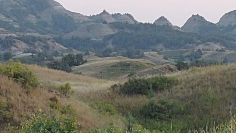
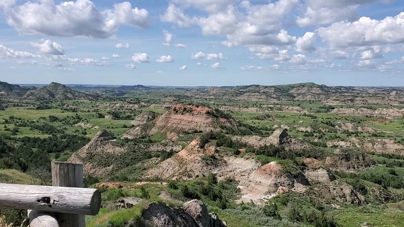
The Coal Vein Trail sits within the South Unit of Theodore Roosevelt National Park, a place that deserves far more attention than it typically gets compared to bigger-name parks like Yellowstone or the Grand Canyon.
The South Unit entrance is located just outside Medora, a small historic town that serves as the main gateway to the park. Medora itself is worth at least an afternoon, with its Old West character and proximity to the park entrance making it a natural base camp for exploring the area.
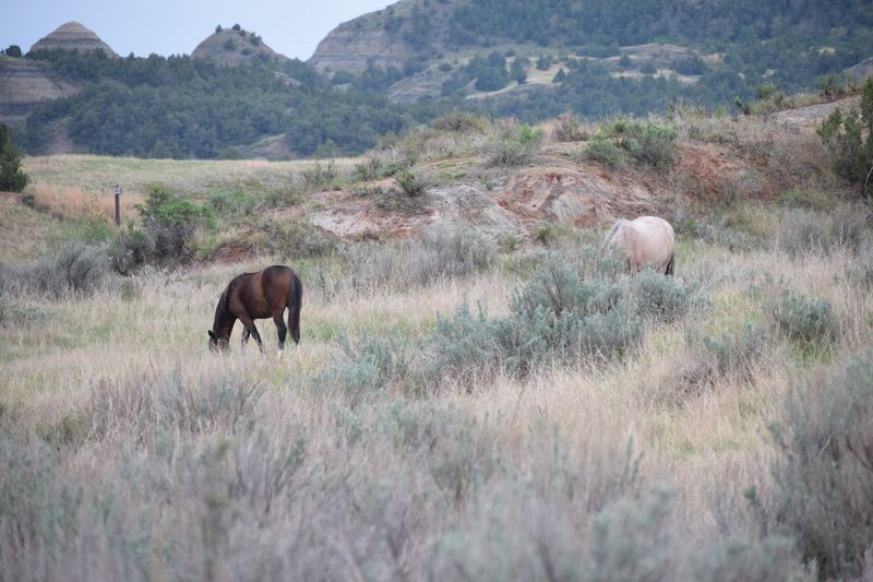
Inside the park, the 36-mile scenic loop drive connects most of the major viewpoints and trailheads, making it easy to pair the Coal Vein Trail with other stops like the Painted Canyon Overlook or the Ridgeline Trail. Wildlife sightings are common throughout, with bison, wild horses, prairie dogs, and pronghorn all calling this landscape home.
Theodore Roosevelt himself ranched in this region during the 1880s, and the park was established in his honor partly because of the profound influence the badlands had on his conservation values. That history gives the whole park an added layer of meaning beyond its obvious natural beauty.
Visiting feels like stepping into a landscape that genuinely shaped American history, not just a pretty backdrop for Instagram photos.
Planning Your Visit: What to Know Before You Go
Getting to the Coal Vein Trail is straightforward once you know where to look. The trailhead is located within the South Unit of Theodore Roosevelt National Park, accessible from Interstate 94 at the Medora exit.
The park entrance is well-signed and easy to find even on a first visit.
The trail is open year-round, though summer mornings offer the most comfortable temperatures for walking. Afternoon heat in July and August can be intense on exposed badlands terrain, so carrying water is always a smart move regardless of how short the loop is.
Spring and fall bring milder weather and often better wildlife activity near the trail. Autumn light on the red clinker formations is particularly striking, with the warm tones of the rock complementing the golden grasses and turning leaves throughout the park.
There is a small parking area at the trailhead with room for several vehicles. The spot fills up during peak summer weekends, so arriving early in the morning gives you the trail mostly to yourself, which makes the whole experience feel more personal and reflective.
The park charges an entrance fee, so checking the National Park Service website before your trip for current rates and any seasonal closures is always a good idea. Address: South Unit Entrance, 315 2nd Ave, Medora, North Dakota.
Dear Reader: This page may contain affiliate links which may earn a commission if you click through and make a purchase. Our independent journalism is not influenced by any advertiser or commercial initiative unless it is clearly marked as sponsored content. As travel products change, please be sure to reconfirm all details and stay up to date with current events to ensure a safe and successful trip.