Colorado’s majestic winter landscape transforms its mountain passes into some of the most challenging driving conditions in America. Out-of-state visitors often arrive unprepared for the combination of steep grades, hairpin turns, and unpredictable weather that define Colorado’s notorious winter routes. Before you head to the Centennial State during snow season, familiarize yourself with these deceptively dangerous roads that even experienced locals approach with caution.
1. Wolf Creek Pass’s Surprise Blizzards
Crossing the Continental Divide at 10,857 feet, Wolf Creek Pass receives more snow than anywhere else in Colorado – averaging a staggering 430 inches annually. The eastern approach features an intimidating 7% grade that becomes a slippery slope of doom during winter storms.
What makes this pass particularly treacherous is how quickly conditions deteriorate. Blue skies can transform into whiteout conditions within minutes, catching tourists completely off-guard.
The infamous “Big Curve” near the summit has claimed numerous vehicles whose drivers couldn’t navigate its ice-slicked surface while descending. Even with chains or snow tires, this pass demands absolute focus and respect.
2. Loveland Pass’s Avalanche Alley
Towering at 11,990 feet, Loveland Pass offers a shortcut around the Eisenhower Tunnel – but at considerable risk. This exposed mountain route becomes particularly hazardous when heavy snowfall increases avalanche danger along its upper sections.
Tourists rarely understand they’re driving through designated avalanche zones where massive snow slides have buried vehicles entirely. The combination of altitude sickness, oxygen-starved engines, and relentless winter winds creates a triple threat for unprepared drivers.
Unlike many mountain roads, Loveland stays open year-round because hazardous materials aren’t permitted through Eisenhower Tunnel, forcing commercial trucks onto this precarious alternative regardless of conditions.
3. Independence Pass’s Narrow Nightmare
Though officially closed in winter, Independence Pass reopens each spring while still blanketed in snow and ice. Rising to 12,095 feet between Aspen and Twin Lakes, this historic route features sections barely wide enough for two cars to pass – with no guardrails separating vehicles from certain doom.
GPS navigation systems frequently misdirect tourists here without warning about the road’s extreme conditions. Melting snow creates deceptive soft shoulders that have swallowed countless rental cars whose drivers strayed too close to the edge.
Sudden snowstorms can trap unprepared travelers at elevations where hypothermia sets in rapidly. The pass’s seasonal closure exists for good reason, yet every year, rescue teams respond to stranded motorists who ignored closure signs.
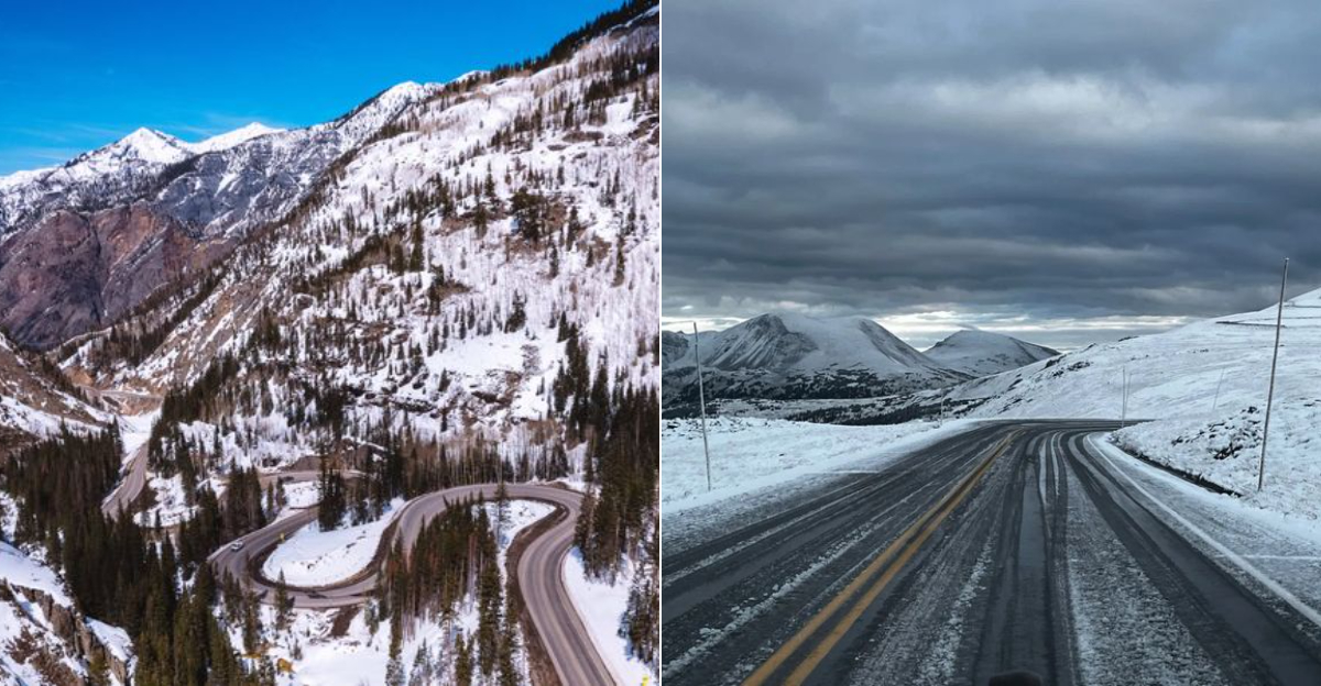
4. Million Dollar Highway’s Deadly Drop-offs
The stretch of US-550 between Ouray and Silverton earns its nickname with jaw-dropping views—and stomach-dropping cliffs. Winter transforms this already narrow mountain pass into an icy gauntlet with minimal guardrails protecting you from sheer drop-offs exceeding 1,000 feet.
Snowstorms can reduce visibility to near-zero while covering the road’s notorious hairpin turns in treacherous ice. Most tourists don’t realize the highway was originally built as a toll road for mining operations, not modern vehicles.
Locals know to avoid this 25-mile stretch during active storms, but visitors often press ahead, unaware that recovery vehicles struggle to reach stranded motorists in these extreme conditions.
5. Monarch Pass’s Whiteout Wilderness
Cutting through the heart of the Rockies at 11,312 feet, Monarch Pass blindsides tourists with its remote location and extreme weather shifts. When storms roll in, visibility can drop to mere feet while temperatures plummet to dangerous levels.
The pass features a particularly treacherous eastern descent with a sustained 7% grade that becomes a bobsled run in icy conditions. Vehicles with overheated brakes have careened off the mountain after drivers underestimated the technical demands of the downhill journey.
Cell service disappears across much of this isolated stretch, meaning breakdowns or accidents may leave travelers stranded for hours before help arrives. Winter survival gear isn’t optional here – it’s essential.
6. I-70 Glenwood Canyon’s Freeze-Thaw Danger
The engineering marvel of I-70 through Glenwood Canyon becomes a winter hazard zone when moisture seeps from its towering rock walls and freezes across the roadway. This 12-mile stretch experiences a unique microclimate where sunshine barely penetrates the deep canyon, keeping ice intact for days after storms.
Rockfalls increase dramatically during freeze-thaw cycles, sending deadly projectiles onto traffic without warning. Tourists fixate on the breathtaking scenery instead of watching for black ice patches that form even on seemingly dry pavement.
The canyon’s tight curves and limited escape routes mean multi-car pileups occur with frightening regularity during winter months. Emergency response times lengthen significantly when accidents block this crucial but vulnerable corridor.
7. Trail Ridge Road’s High-Altitude Hazards
As America’s highest continuous paved road, Trail Ridge climbs to a breathtaking 12,183 feet through Rocky Mountain National Park. Though officially closed in winter, spring travelers encounter arctic conditions with snowdrifts towering over 20 feet tall along cleared sections.
Above treeline, hurricane-force winds can literally push vehicles across ice-slicked pavement. Tourists from lower elevations frequently experience altitude sickness while driving, creating dangerous situations when decision-making becomes impaired.
Temperature drops of 40 degrees can occur within minutes when storms approach, freezing wet roads instantly. The road’s extreme elevation means snow can fall any month of the year, surprising summer visitors with July blizzards and treacherous driving conditions when least expected.
8. Berthoud Pass’s Brake-Burning Descent
Connecting Winter Park to the Front Range, Berthoud Pass lures tourists with its accessibility – then punishes the unprepared with technical challenges. The western approach features a relentless 6.5% downgrade that has cooked countless brake systems on rental cars whose drivers didn’t downshift properly.
Notorious for rapid weather changes, the pass can be sunny at the base and experiencing a full whiteout at the 11,307-foot summit. The road’s multiple switchbacks become particularly treacherous when hidden beneath fresh powder.
Despite being relatively close to Denver, Berthoud claims a disproportionate number of winter accidents. Its popularity as a ski access route means inexperienced mountain drivers often attempt it in completely inadequate vehicles during the worst possible conditions.
9. Cottonwood Pass’s Unpaved Peril
The partially paved Cottonwood Pass between Buena Vista and Gunnison becomes a muddy, rutted nightmare during shoulder seasons. Unlike more famous routes, this pass lacks consistent maintenance, creating deep potholes that hide beneath innocent-looking puddles.
Rental car agreements often specifically prohibit driving this route, yet GPS systems routinely direct tourists here as a “shortcut.” The western approach features loose gravel sections that become treacherously slippery when wet or icy.
Spring travelers frequently encounter impassable mud bogs where the road turns to soup during thaws. While officially closed in winter, the pass’s gates are occasionally found open, tempting unprepared drivers into a remote area where rescue can take many hours – if not overnight – to arrive.
10. Guanella Pass’s Deceptive Accessibility
Recently paved and seemingly tame, Guanella Pass lulls tourists into a false sense of security before revealing its true nature. The 11,670-foot pass between Georgetown and Grant experiences extreme wind events that create massive snowdrifts capable of stranding vehicles within minutes of a storm’s arrival.
The pass’s proximity to Denver makes it popular with day-trippers who often arrive without emergency supplies or appropriate vehicles. During winter, the road’s edges become dangerously soft as snow melts and refreezes, creating invisible traps that have pulled countless cars into ditches.
Wildlife encounters add another hazard as mountain goats, bighorn sheep, and even moose frequently cross the roadway, appearing suddenly around blind curves. The combination of wildlife, weather, and winding roads makes this accessible-seeming pass surprisingly dangerous.
Dear Reader: This page may contain affiliate links which may earn a commission if you click through and make a purchase. Our independent journalism is not influenced by any advertiser or commercial initiative unless it is clearly marked as sponsored content. As travel products change, please be sure to reconfirm all details and stay up to date with current events to ensure a safe and successful trip.