The Rocky Mountains are where rugged peaks meet winter magic, and nothing excites travelers more than that first snowfall of the season. For visitors, it’s not just about the flakes in the air; it’s about the moment the Rockies transform into a snowy playground.
This guide takes you through what influences when the snow shows up, from the average first flakes in mountain towns to those surprise early dustings high on the ridges. Geography, shifting climates, and a little bit of mountain unpredictability all shape the timing.
If you’re planning a trip, you’ll find tips on when to expect the first real snow and how to make the most of it. Whether you’re here to ski, hike in the crisp air, or simply watch the Rockies put on their winter coat, this is your traveler’s sneak peek into one of nature’s best shows.
1. Typical Timing & Averages
Colorado’s Front Range, including cities like Denver, typically sees its first measurable snow around October 18. The anticipation builds as the date nears, with locals marking their calendars. Meanwhile, Colorado Springs often experiences its first snow by October 19.
Pueblo, on the other hand, waits longer, with the average first snowfall around November 4. These dates highlight the varied climate across different elevations.
2. Early Snow in Mountain Zones
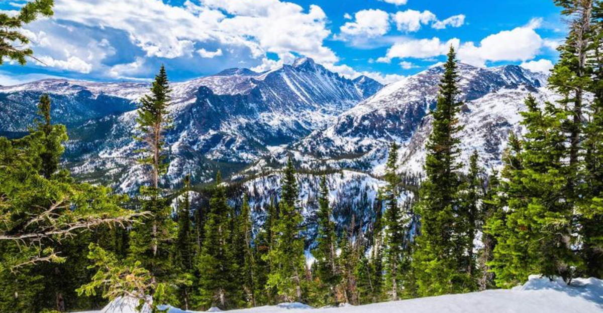
In the high mountain zones of the Rockies, snow can fall as early as late September. These early snows are often light and don’t stick around at lower elevations. However, the sight of snow-dusted peaks against a backdrop of autumn colors is an unforgettable experience.
High peaks, often kissed by frost throughout the year, transform into a spectacular winter wonderland. Ski resorts in Colorado, such as Arapahoe Basin and Loveland, often open by mid to late October thanks to these early mountain snowfalls combined with snowmaking.
3. Regional & Elevation Variation
The Rocky Mountains are a study in contrasts when it comes to snowfall. Lower elevation areas, such as the plains, experience snow later than their mountain counterparts. In southeastern Colorado, the first measurable snow often does not arrive until November, while higher terrain sees flakes much earlier.
Mountain weather stations frequently pick up trace amounts of snow well before nearby urban areas see their first storms. This elevation-driven difference is a defining feature of Colorado’s climate, shaping everything from travel to recreation.
4. Historical Extremes & Variability
Denver’s snowfall records are filled with surprises. The city’s earliest measurable snow on record fell on September 3, 1961, a date that still stands out in local climate history. On the other end of the spectrum, Denver has waited as late as November 21, 1934, for its first measurable snow.
This wide range underscores how unpredictable the city’s fall weather can be. Each year delivers its own twist, with the timing of the first snow keeping residents and forecasters alike on alert.
5. Snow Monitoring & Forecast Tools
Monitoring snow in the Rockies is both a science and an art. SNOTEL stations operated by the USDA track snowpack depth and water content across different elevations. Meteorologists also rely on advanced weather models and long-term climate data to anticipate the first significant snowfall. These tools provide valuable insights for communities, recreation areas, and travelers.
Forecasts are especially important for planning mountain activities and ensuring safety on the roads, as conditions can change rapidly. With ongoing climate variability, accurate monitoring has become more essential than ever.
Dear Reader: This page may contain affiliate links which may earn a commission if you click through and make a purchase. Our independent journalism is not influenced by any advertiser or commercial initiative unless it is clearly marked as sponsored content. As travel products change, please be sure to reconfirm all details and stay up to date with current events to ensure a safe and successful trip.