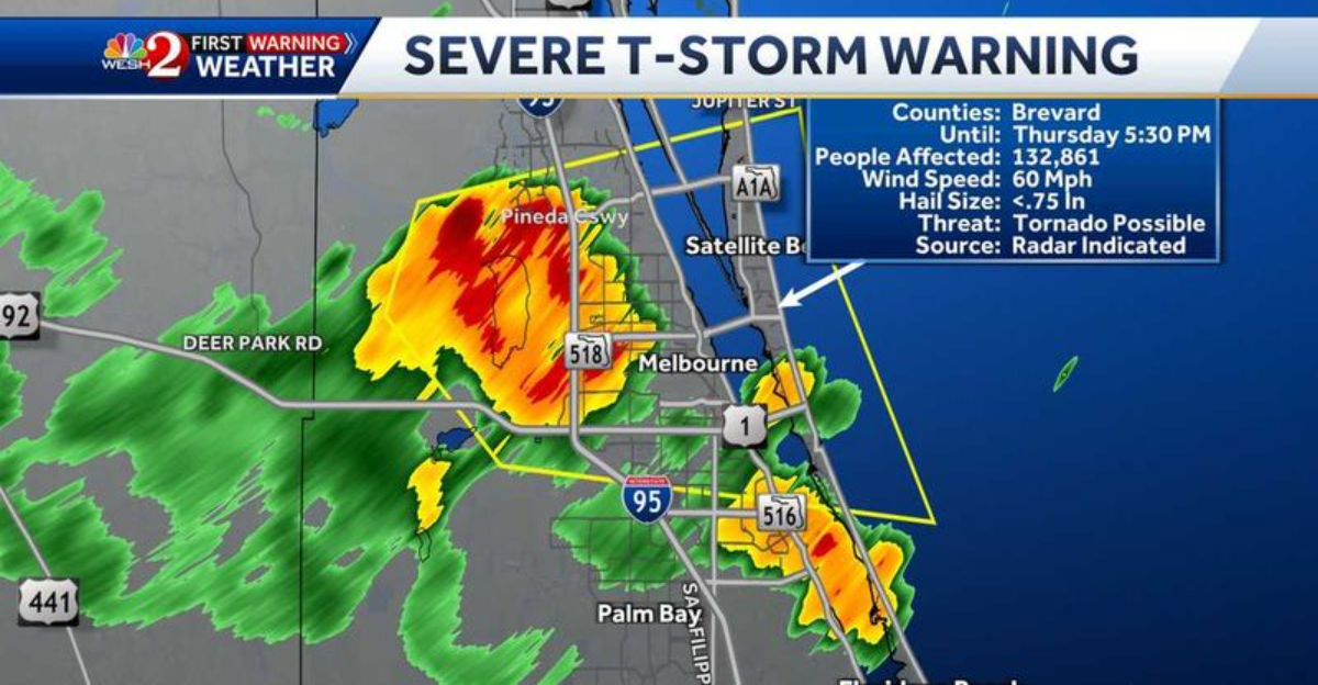
Florida residents should brace for dangerous weather conditions as severe storms approach the state. Meteorologists are tracking a powerful weather system expected to bring large hail, damaging winds, and potential flash flooding across multiple regions starting today, September 29, 2025. Tropical Depression Nine, likely to strengthen into Tropical Storm Imelda, is intensifying offshore and contributing to the deteriorating conditions that threaten coastal and inland areas alike.
Tropical Depression Nine Intensifying Rapidly
Currently churning offshore, Tropical Depression Nine has meteorologists concerned as barometric pressure continues dropping faster than initially forecast. The system is expected to strengthen into Tropical Storm Imelda within hours, bringing additional moisture and instability to Florida’s already volatile atmosphere.
Storm surge warnings have been issued for coastal communities from Tampa Bay northward, with 3-5 feet of inundation possible in low-lying areas. Maritime conditions are deteriorating rapidly with wave heights already reaching 12-15 feet offshore.
The combined effects of the approaching tropical system and the existing frontal boundary create what meteorologists call a “perfect storm” scenario for widespread severe weather. Satellite imagery shows the distinctive eye-like feature beginning to form, indicating rapid intensification that could bring hurricane-force winds to portions of Florida’s Gulf Coast.
Authorities are urging residents in vulnerable coastal areas to finalize evacuation plans immediately and secure property. Emergency shelters are being readied, and local officials emphasize the importance of monitoring official advisories via the National Hurricane Center and local media. With conditions capable of deteriorating rapidly, preparedness and timely action are essential to minimize risks to life and property.
Imminent Threat: Hail and Wind Damage Expected
Baseball-sized hail has already been reported in neighboring states as this storm system barrels toward Florida. Weather radar shows intense thunderstorm cells developing rapidly, with some containing rotation that could spawn isolated tornadoes in addition to the primary threats.
Wind gusts up to 70 mph may occur in the strongest storm cells, potentially downing trees and power lines across wide areas. The Florida Panhandle and North-Central regions face the highest risk today, with the threat shifting southward overnight.
The unusual intensity of this September storm system has prompted the National Weather Service to issue rare PDS (Particularly Dangerous Situation) warnings for multiple counties. Emergency management officials urge residents to move vehicles under cover and stay away from windows when storms approach your area.
Residents are also advised to prepare emergency kits, including flashlights, batteries, bottled water, and essential medications, in case power outages occur. Local authorities are monitoring conditions closely and coordinating with utility companies to respond quickly to downed power lines or blocked roads, emphasizing the importance of staying indoors and following official updates until the storm passes.
Emergency Preparations and Safety Measures
Governor Santos has activated the Florida National Guard and placed emergency response teams on high alert across all 67 counties. Shelters are opening in vulnerable coastal areas, particularly in regions where older housing may not withstand the forecast wind speeds.
Residents should prepare emergency kits immediately, including three days of water (one gallon per person per day), non-perishable food, medications, flashlights, and battery-powered radios. Charge all electronic devices now while power remains stable.
The Florida Division of Emergency Management has established a dedicated hotline (1-800-342-3557) for this severe weather event. Families should develop and review evacuation plans, especially those in mobile homes or flood-prone areas. Remember: when thunder roars, go indoors – and stay away from windows during periods of large hail and damaging winds.Local officials are also coordinating with utility companies to pre-position crews for rapid response to downed power lines and flooding.
Residents are advised to avoid driving through flooded roads and to monitor official updates via radio, television, and trusted online sources. Staying informed and following evacuation orders can make the difference between safety and danger as the storm approaches.
Dear Reader: This page may contain affiliate links which may earn a commission if you click through and make a purchase. Our independent journalism is not influenced by any advertiser or commercial initiative unless it is clearly marked as sponsored content. As travel products change, please be sure to reconfirm all details and stay up to date with current events to ensure a safe and successful trip.