Planning a weekend getaway to the Sunshine State? While Florida typically offers beautiful weather, Mother Nature occasionally throws a curveball that can impact your travel plans. Knowing what potential weather warnings to watch for can help you prepare and adjust your itinerary if needed. Here’s what to keep an eye on for the upcoming weekend of September 20-21, 2025.
1. Heat Advisory for South Florida
Miami and surrounding areas face a heat advisory with temperatures climbing to 88°F but feeling much hotter due to oppressive humidity. The heat index could reach a dangerous 100-105°F during peak afternoon hours.
Heat exhaustion symptoms include dizziness, headache, and excessive sweating. These conditions are particularly hazardous for elderly travelers, children, and those with health conditions.
Adjust outdoor plans to early morning or evening, stay hydrated with water (not just alcohol), and take frequent breaks in air-conditioned spaces when exploring South Florida this weekend.
2. Rip Current Risk Along Atlantic Beaches
Strong easterly winds are expected to create dangerous rip currents along Florida’s Atlantic coastline from Jacksonville down to Miami this weekend. These powerful, narrow channels of water flowing away from shore can pull even strong swimmers out to sea unexpectedly.
Beach warning flags will likely be yellow or red in many locations. Pay close attention to these signals before entering the water.
When swimming, stay near lifeguard stations and remember the escape strategy: swim parallel to shore until you’re out of the current before heading back to beach.
3. Fog Delays for Morning Flights
Early morning travelers should prepare for potential flight delays at Jacksonville International Airport due to forecast ground fog. Saturday morning visibility could drop below half a mile, impacting takeoffs and landings between 5-9 AM.
This weather pattern forms when cool overnight air meets warm ground surfaces, creating a blanket of low-lying clouds. The fog typically burns off by mid-morning as temperatures rise.
If you’re catching an early flight, check with your airline before heading to the airport and consider building extra time into your travel schedule.
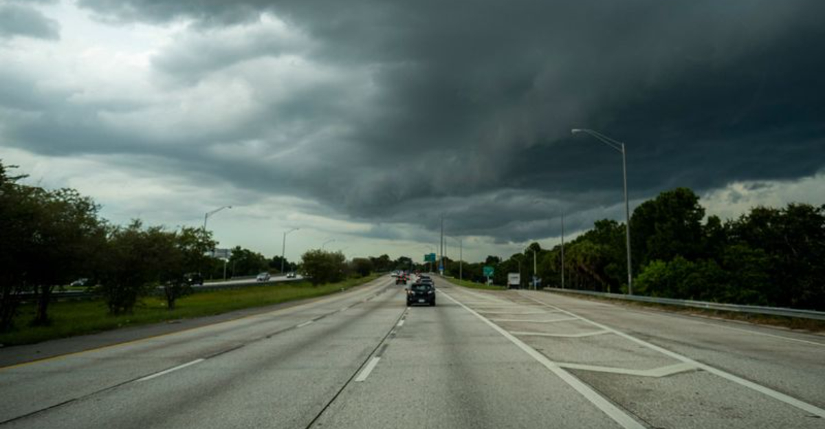
4. Afternoon Thunderstorms Across Central Florida
The classic Florida afternoon thunderstorm pattern will be in full effect this weekend, particularly around Orlando and Tampa. These sudden downpours typically develop between 2-5 PM when the sea breeze collides with heated inland air.
Visibility on highways can drop to near zero within seconds, creating hazardous driving conditions. Lightning strikes pose additional dangers for outdoor activities.
Consider scheduling important travel and outdoor activities for morning hours when conditions are generally clearer and more predictable.
5. Tropical Storm Gabrielle’s Outer Bands
While Tropical Storm Gabrielle remains far offshore in the Atlantic, its outer rain bands may bring gusty conditions to Florida’s northeastern coast. Wind gusts of 25-35 mph could affect coastal areas from St. Augustine to Jacksonville.
Beach erosion is possible along vulnerable shorelines. Outdoor furniture and loose items should be secured if staying in beachfront accommodations.
Boating enthusiasts should exercise caution as nearshore waters will be choppy with waves 3-5 feet high. Small craft advisories are likely to be issued for the weekend.
6. Flash Flood Risk in the Everglades Region
A slow-moving weather system could dump 2-3 inches of rain on parts of southwestern Florida, particularly affecting the Everglades region and roads around Naples and Fort Myers. Low-lying areas may experience rapid water accumulation.
Wildlife viewing tours and airboat rides might face cancellations. The saturated ground can also attract alligators and snakes to higher ground, including trails and roadways.
Travelers planning to explore Everglades National Park should check park alerts before heading out and avoid unpaved roads which can quickly become impassable.
7. Strong UV Index Across the State
An extremely high UV index of 9-10 is forecast statewide, creating sunburn risks in as little as 15 minutes of unprotected exposure. This invisible threat catches many visitors off guard, especially when clouds partially block the sun, creating a false sense of protection.
Sunscreen application should be frequent and generous. Even waterproof formulas need reapplication after swimming or excessive sweating.
Consider UV-protective clothing for extended outdoor activities and remember that UV rays can penetrate car windows during long drives, potentially causing unexpected sunburn.
Dear Reader: This page may contain affiliate links which may earn a commission if you click through and make a purchase. Our independent journalism is not influenced by any advertiser or commercial initiative unless it is clearly marked as sponsored content. As travel products change, please be sure to reconfirm all details and stay up to date with current events to ensure a safe and successful trip.