Winter’s magical touch is just around the corner for Oregon, bringing the year’s first blanket of snow to our beautiful state. From the majestic Cascades to the eastern plains, snowfall transforms Oregon’s landscape into a winter wonderland that affects everything from ski resorts to road conditions. Let’s explore what meteorologists are forecasting for Oregon’s first snowfall this season and how it might impact our communities.
1. Early Mountain Dustings Expected by Late October
The highest peaks of the Cascade Range typically receive their first snowflakes while fall colors still paint the valleys below. According to National Weather Service data, Mount Hood and Bachelor could see dustings as early as mid-to-late October this year, with accumulating snow likely by Halloween.
Weather patterns suggest slightly earlier-than-average arrival times for mountain snow, with the first significant accumulation (over 6 inches) possible before November 10th. This early timeline has ski resorts preparing for potential pre-Thanksgiving openings if conditions cooperate.
Historical records show the average first measurable mountain snow occurs around October 23rd for elevations above 5,000 feet. The early forecast is particularly exciting for winter sports enthusiasts who’ve been eagerly waxing skis and snowboards since summer’s end.
2. La Niña Influence Promises Heavier Precipitation
Meteorologists are monitoring a developing La Niña pattern in the Pacific that typically brings cooler, wetter conditions to the Pacific Northwest. For Oregon, this weather phenomenon signals potentially above-average snowfall totals across the state’s mountainous regions.
The Cascades could receive 15-20% more snow than in typical years if current predictions hold true. Historical data shows that La Niña winters have delivered some of Oregon’s most memorable powder seasons, with snowpack sometimes reaching 125% of normal levels.
Valley locations like Eugene and Portland might see their first flakes earlier too, possibly by late November rather than the usual mid-December timeframe. The Climate Prediction Center’s three-month outlook supports these projections, showing higher probabilities for precipitation throughout winter.
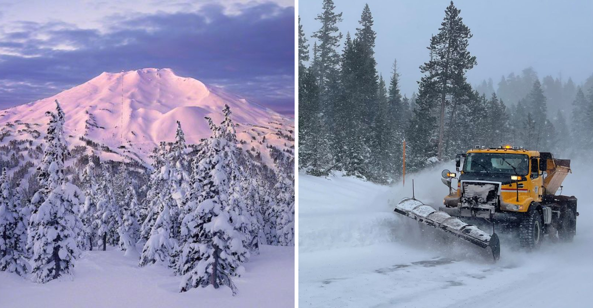
3. Eastern Oregon Prepares for Mid-November Arrival
While western Oregon waits, communities in the Blue Mountains and Wallowa range are gearing up for snow’s arrival by mid-November. Baker City, La Grande, and Enterprise typically see their first measurable snow around November 12-18, but this year’s forecast suggests it could arrive a few days earlier.
Road crews are already checking equipment and stockpiling materials. The Oregon Department of Transportation has positioned additional snowplows in strategic eastern locations, anticipating potentially heavy early storms along I-84 and Highway 82.
Ranchers in the region are preparing livestock for the season’s change, with many moving herds to lower elevations earlier than usual. Local meteorologists note that when eastern Oregon receives early snow, it often indicates a consistent winter pattern rather than isolated storms.
4. Central Oregon’s High Desert: December’s Winter Transition
The high desert regions around Bend, Redmond, and Prineville typically experience their first meaningful snowfall in early December. This year’s forecast suggests a similar timeline, with the first inch or two expected between December 1-10.
Meteorological models show storm systems tracking slightly further south than usual, which could bring more moisture to these normally drier areas. Residents of central Oregon’s high desert communities are familiar with the quick transition from fall to winter that often happens overnight.
Local businesses dependent on winter tourism are cautiously optimistic about the season ahead. Smith Rock and the Newberry National Volcanic Monument transform dramatically with even light snowfall, creating stunning winter landscapes that draw photographers and outdoor enthusiasts from across the region.
5. Valley Floor Snow: Will Portland See a White Christmas?
The million-dollar question for Willamette Valley residents: will cities like Portland, Salem and Eugene see snow before year’s end? Current long-range models suggest a 30-40% chance of at least one snow event before December 31st, slightly higher than the historical average of 25%.
Portland typically receives its first measurable snow around December 19th, though in most years it’s just a trace. The forecast this year hints at a possible mid-December cold snap that could bring valley snow if precipitation timing aligns with freezing temperatures.
School districts are reviewing their snow day protocols, especially with recent changes to remote learning capabilities. Transportation officials remind valley residents that even light snow can significantly impact commutes across the region’s bridges and overpasses, which freeze before road surfaces.
Dear Reader: This page may contain affiliate links which may earn a commission if you click through and make a purchase. Our independent journalism is not influenced by any advertiser or commercial initiative unless it is clearly marked as sponsored content. As travel products change, please be sure to reconfirm all details and stay up to date with current events to ensure a safe and successful trip.