Winter approaches Montana with the magic of the first snowfall just around the corner. The initial dustings transform the landscape into a wonderland, signaling the start of Montana’s most defining season. For residents and visitors alike, knowing where snow will first appear helps with planning everything from travel to winter recreation activities. Let’s explore the areas of Big Sky Country that typically see those first exciting snowflakes.
1. High Mountain Peaks Get Dusted First
The majestic peaks above 9,000 feet elevation rarely disappoint when it comes to early snow. Granite Peak in the Beartooth Range and mountains throughout Glacier National Park often receive their first white coating by mid-September, sometimes even in late August during cooler years.
National Weather Service meteorologists have noted these high-elevation zones can see accumulation while valleys remain completely dry and warm. The stark temperature differences between mountain peaks and valleys create perfect conditions for isolated snowfall.
Hikers exploring these areas should always prepare for sudden weather changes, even in early autumn. Rangers recommend carrying extra layers and checking mountain forecasts specifically, as valley predictions won’t reflect conditions at higher elevations.
2. Western Montana’s Mountain Passes
Mountain passes connecting western Montana communities become winter’s early targets. According to NOAA data, Lookout Pass along I-90 and Lolo Pass on Highway 12 typically see their first measurable snow by early October, creating challenging driving conditions while surrounding areas remain snow-free.
These crucial transportation corridors sit at elevations between 5,000-6,000 feet, making them susceptible to early season storms that sweep eastward from the Pacific. The Montana Department of Transportation often conducts readiness drills in September, positioning plows and sand trucks strategically near these vulnerable areas.
Travelers should monitor pass conditions before journeys starting in late September. Local weather apps with elevation-specific forecasts provide the most accurate predictions for these transitional zones where autumn and winter first collide.
3. Northeastern Plains: Surprise Early Blasts
While mountains typically see snow first, northeastern Montana’s plains sometimes experience surprising early blizzards. Cold Canadian air masses can sweep down across the border with little mountain interference, bringing October snow to communities like Glasgow and Wolf Point.
Historical weather data shows this region has experienced significant October snow events in recent years. The flat terrain allows Arctic air to rush southward unimpeded, creating conditions for rapid temperature drops and moisture conversion to snow.
Farmers in this region watch early forecasts carefully, as unexpected snow can impact harvest operations. Agricultural extension offices recommend having contingency plans ready by mid-September, especially during La Niña years when northern storm tracks become more common and early cold air outbreaks increase in probability.
4. Yellowstone Plateau’s Early Winter
The Yellowstone Plateau experiences some of Montana’s earliest consistent snowfall. This high-elevation region spanning the Montana-Wyoming border typically sees accumulating snow by late September, with the park’s western entrance near West Yellowstone often recording measurable amounts while Bozeman remains snow-free.
Park rangers note that overnight temperatures in this region regularly dip below freezing by mid-September. The combination of elevation (averaging 8,000 feet) and geographic position creates ideal conditions for early-season storms to deliver significant accumulation.
Wildlife responds quickly to these early snows, with elk and bison beginning migrations to lower elevations. Visitors planning autumn trips to Yellowstone should pack winter gear regardless of valley forecasts, as the plateau’s weather operates on its own seasonal schedule nearly a month ahead of surrounding areas.
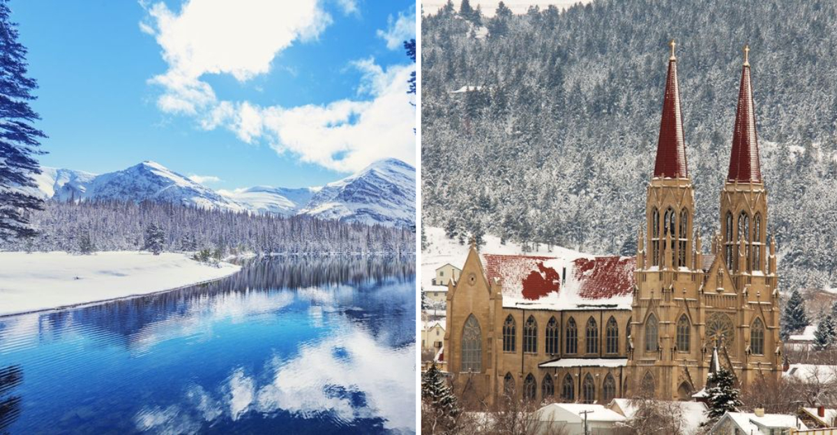
5. Helena and Central Mountain Valleys
Helena and surrounding central mountain valleys typically experience their first meaningful snow by mid-to-late October. This timing creates a fascinating transition period where residents might wake to snow-dusted mountains visible from their still-green yards.
The capital city’s position in a valley surrounded by the Continental Divide and other mountain ranges creates interesting weather patterns. Cold air can pool in these valleys while moisture wraps around mountains, delivering snow that sometimes melts upon contact with the still-warm valley floors.
Local meteorologists track the formation of temperature inversions carefully during this period. The National Weather Service office in Great Falls notes that these valleys often experience several “false start” snow events before winter fully establishes itself, with brief dustings that quickly melt, testing residents’ readiness for the season ahead.
Dear Reader: This page may contain affiliate links which may earn a commission if you click through and make a purchase. Our independent journalism is not influenced by any advertiser or commercial initiative unless it is clearly marked as sponsored content. As travel products change, please be sure to reconfirm all details and stay up to date with current events to ensure a safe and successful trip.