I keep hearing the same question on the trailhead: how do people still end up beyond the closure sign. The answer is messy, human, and very fixable. Real incidents in Colorado show how confusion, tech gaps, and risky choices mix with fast-changing hazards. If you love canyons like I do, this guide will help you stay curious, safe, and on the right side of the rope while exploring Colorado.
1. Outdated maps steer hikers wrong
Outdated maps or apps can send you straight into a closure without meaning to. I have watched people follow a pretty blue line on their screen while ignoring a bright sign at the junction. Some third-party maps lag behind official updates, especially after storms or fire damage.
In Colorado, land managers often post changes first on agency sites and at kiosks, not inside every app. I now cross-check closures with the U.S. Forest Service and Colorado Parks and Wildlife before I drive. I also read recent trip reports from local hiking forums where volunteers flag fresh washouts.
When I download offline maps, I add agency PDFs as a backup. If I reach a barrier, I stop and reroute even if the app shows a through trail. Tech helps me plan, but the trailhead board keeps me honest. That simple habit keeps me off closed canyon routes and saves me a headache.
2. Chasing secret viewpoints
The desire for unique or off-beat views pulls people into places that look quiet and special. I get the lure. A side path promises a better photo, a moment without crowds, and a story to tell later. In Colorado, that urge often meets real hazards like loose talus or unexpected drop-offs.
I remind myself that closures exist because rock and water move in ways we cannot predict. I look for sanctioned overlooks or photography pullouts listed by the local ranger district. Many parks and open spaces share scenic alternatives when they close a canyon section.
I also plan sunrise or weekday visits to open trails so I find space without crossing a line. If a barrier blocks the “secret” angle, I accept the view I can reach. My pictures look better when I feel calm and legal, and the canyon stays safer for everyone.
3. Underestimating canyon hazards
Closures often follow rockfall, unstable slopes, or flash-flood risk. I used to believe I could pick my way through. Then I stood beneath a wall that ticked like a cooling engine and watched pebbles fall without warning. In Colorado, storms travel fast over high ground and unload hard.
A dry wash can fill in minutes. Agencies close routes to buy time for slopes to settle or crews to inspect anchors and drains. I now check weather, recent burn scars, and flood advisories before I start.
If I enter a canyon with a history of slides, I move early in the day, keep my breaks short in narrow sections, and carry a map with escape routes. If a gate blocks the path, I do not step around it. The sign reflects a risk I cannot see from the ground. Turning back keeps me on tomorrow’s trail.
4. Ambiguous boundaries and split management
Trails often cross lands managed by a city, county, state, or the Forest Service. Boundaries weave through canyons, and signs do not always match at every turn. I have reached a fence that said closed while an app showed a legal route. In Colorado, mixed jurisdictions can slow updates and leave gaps.
I treat the strictest sign as the rule until I confirm. At the kiosk, I snap photos of maps and take notes on which segments close seasonally or after storms. If I cannot reconcile a conflict, I pick a different open trail nearby. That choice avoids a citation and respects the folks who maintain these places.
I also email a photo of confusing signs to the listed ranger contact. Clear communication improves the next visitor’s day. Boundaries get easier when we help tidy the puzzle.
5. The Agnes Vaille aftershock
The Agnes Vaille Falls trail closed after a 2013 rock slide that killed hikers. The terrain remains unstable even years later. I still hear travelers say they can slip in for a quick look. That choice ignores the reason for the closure and the risk that persists in steep couloirs.
When I visit the area, I read current alerts from the Forest Service and talk with locals who know recent slope behavior. Colorado canyon country looks solid from a distance, but freeze-thaw cycles pry open cracks each season. I pay my respects at the trailhead and move on to the many open routes nearby.
The memory of that day guides me. A closed sign at Agnes Vaille is not a suggestion. It is a hard lesson written in stone and loss, and it deserves my full attention every time.
6. Queen’s Canyon and long-term fire scars
Queen’s Canyon near Colorado Springs shut after damage from the Waldo Canyon Fire. Authorities kept it closed for many years to reduce flash-flood danger downstream. I sometimes meet visitors who think long closures mean forgotten gates. In Colorado, burn scars change how rain moves across soil for a long time.
Water runs faster, picks up debris, and funnels into narrow cuts. That is why you still see strict warnings and barriers here. I respect the closure and plan my day around open alternatives like nearby city open spaces. I also track updates from local managers who study runoff and repair culverts.
This canyon will open only when the risk drops. Until then, I hike where the land and the people who care for it say yes. Patience serves both the trail and everyone below it.
7. Crowding pressure and social nudges
When trailheads fill, people look for space anywhere. I have felt that push on busy weekends. A blocked side path can start to look like a shortcut. In Colorado, high visitation concentrates people at the same few canyons. If I feel squeezed, I shift my timing or choose a lesser-known open route.
I also set a group plan before we start. If we meet a closure, we do not debate it at the gate. We pivot quickly to a backup that I marked in my notes. That small script breaks the social pull that leads someone to step over a rope while others follow.
I would rather earn quiet with a longer drive than a fine or a rescue. Crowding fades when I stay flexible and generous with my plans.
8. Gaps in enforcement on remote miles
Remote canyons rarely see a ranger. That reality tempts some people to treat closures as optional. I travel a lot in the shoulder seasons and notice how easy it feels to slip past a faded sign. In Colorado, distance does not remove risk or consequences.
If something goes wrong, rescue teams face longer response times and tougher access. Citations can follow after the fact when photos or reports surface. I plan as if a ranger stands at every junction. That mindset simplifies choices and keeps me focused on the day, not the loopholes.
I also carry a satellite communicator and share my route on open trails. The point is not to get away with something. The point is to go home content, with a clean story and a clear conscience.
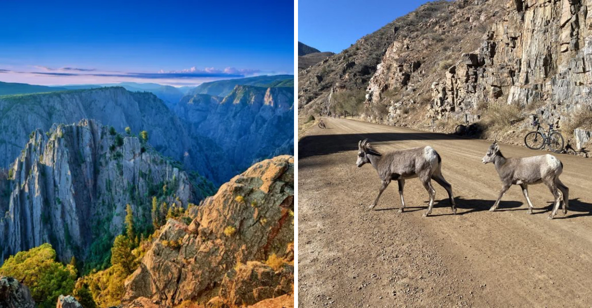
9. Misreading closures after wildlife encounters
Wildlife issues can trigger temporary closures that feel confusing. At places like Waterton Canyon, visitors have pushed too close to animals for photos, which led to safety shutdowns. I have seen people assume the rule targets others, not them. In Colorado, managers close sections to protect both animals and visitors.
I stay back, use a zoom lens, and give wildlife the road. If a canyon closes for activity, I change plans without complaint. That small choice keeps animals from stress and prevents risky behavior that invites stricter rules later.
I also scan agency feeds for wildlife alerts before I head out. When in doubt, I ask at the trailhead. A respectful pause today supports better access later in the season.
10. Lessons from trespass cases beyond the border
Outside Colorado, cases show how curiosity can slide into trespass and real harm. Two people from Durango faced charges after entering a fenced historic area at Canyonlands National Park and taking artifacts. They ignored clear no trespassing signs.
That story sticks with me when I hike fragile canyon sites across Colorado. Closed areas often protect cultural resources and ongoing research. I treat fences and ribbons as bright lines. I also learn basic Leave No Trace guidance for cultural sites and skip sharing precise locations online.
The law does not bend for a quick peek or a souvenir. I would rather bring home a memory and a photo taken from a legal spot. Respect on one trip keeps doors open for the next.
Dear Reader: This page may contain affiliate links which may earn a commission if you click through and make a purchase. Our independent journalism is not influenced by any advertiser or commercial initiative unless it is clearly marked as sponsored content. As travel products change, please be sure to reconfirm all details and stay up to date with current events to ensure a safe and successful trip.